Zuidhorn
| Zuidhorn | |||
|---|---|---|---|
| Municipality | |||
|
Former courthouse in Zuidhorn | |||
| |||
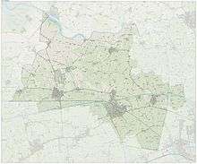
.svg.png) Location in Groningen | |||
| Coordinates: 53°15′N 6°24′E / 53.250°N 6.400°ECoordinates: 53°15′N 6°24′E / 53.250°N 6.400°E | |||
| Country | Netherlands | ||
| Province | Groningen | ||
| Government[1] | |||
| • Body | Municipal council | ||
| • Mayor | Bert Swart (CDA) | ||
| Area[2] | |||
| • Total | 128.37 km2 (49.56 sq mi) | ||
| • Land | 125.56 km2 (48.48 sq mi) | ||
| • Water | 2.81 km2 (1.08 sq mi) | ||
| Elevation[3] | 4 m (13 ft) | ||
| Population (May 2014)[4] | |||
| • Total | 18,756 | ||
| • Density | 149/km2 (390/sq mi) | ||
| Time zone | CET (UTC+1) | ||
| • Summer (DST) | CEST (UTC+2) | ||
| Postcode | Parts of 9800 range | ||
| Area code | 0594 | ||
| Website |
www | ||


Zuidhorn (Dutch pronunciation: [ˈzœytɦɔrn]) is a municipality and a town in the northeastern Netherlands. Due to a municipal reoganisation in 1990, Zuidhorn was extended when it merged with, though not physically connected to Oldehove, Grijpskerk and Aduard. It is a pleasant town, which depends largely on the city of Groningen. A railway line, operated by Arriva, connects the town with Leeuwarden in Friesland and Groningen.
Transport
Zuidhorn has two train stations: Zuidhorn and Grijpskerk. At least once an hour a train runs between Groningen and Leeuwarden. On weekdays, trains stop twice an hour in Zuidhorn. Until 1991 there used to be a third station on this line, Visvliet.
Nature
In the center of Zuidhorn, lies a large, partly wooded park called "Johan Smit Park". It offers a wide variety of recreation, open to the public, based on trails. The "Quick Silver S" is the main sport hall, hosting many activities such as a running clubs, and other sports. Nearby, the park has numerous soccer fields and a playground. For most of the year, docile highland cattle roam the park.
Wierden
There is a dense concentration of terps, better known as wierden, artificial dwelling hills, in the area Middag-Humsterland. In 1995, this collection of wierden was submitted to UNESCO's list of World Heritage Sites. The property is currently on the tentative list.[5][6]
Population centres
Aalsum, Aduard, Balmahuizen, Barnwerd, Briltil, De Kampen, De Poffert, De Ruigewaard, Den Ham, Den Horn, Diepswal, Electra, Englum, Fransum, Frytum, Gaaikemadijk, Gaaikemaweer, Gaarkeuken, Grijpskerk, Heereburen, Hoekje, Hoogemeeden, Humsterland, Ikum, Kenwerd, Kommerzijl, Korhorn, Lagemeeden, Lammerburen, Lauwerzijl, Niehove, Nieuwklap, Niezijl, Noorderburen, Noordhorn, Noordhornerga, Noordhornertolhek, Okswerd, Oldehove, Pama, Pieterzijl, Ruigezand, Saaksum, Selwerd, Spanjaardsdijk, Steentil, Visvliet, Wierumerschouw and Zuidhorn.
References
- ↑ "Burgemeester de heer L.K. (Bert) Swart" [Mayor Mr. L.K. (Bert) Swart] (in Dutch). Gemeente Zuidhorn. Retrieved 13 February 2014.
- ↑ "Kerncijfers wijken en buurten" [Key figures for neighbourhoods]. CBS Statline (in Dutch). CBS. 2 July 2013. Retrieved 12 March 2014.
- ↑ "Postcodetool for 9801AJ". Actueel Hoogtebestand Nederland (in Dutch). Het Waterschapshuis. Retrieved 10 February 2014.
- ↑ "Bevolkingsontwikkeling; regio per maand" [Population growth; regions per month]. CBS Statline (in Dutch). CBS. 26 June 2014. Retrieved 24 July 2014.
- ↑ Tentative List for the Netherlands. The World Heritage Platform. Retrieved on 2009-07-23.
- ↑ Middag and Humsterland. UNESCO World Heritage Centre. Retrieved on 2009-07-23.
External links
 Media related to Zuidhorn at Wikimedia Commons
- Official website
 |
De Marne Reitdiep |
Winsum | | |
| Kollumerland c.a. (FR) | |
Groningen | ||
| ||||
| | ||||
| Grootegast | Leek |
Municipalities of Groningen | ||
|---|---|---|
 | ||
| ||