Çobanlar
| Çobanlar | |
|---|---|
 Çobanlar | |
| Coordinates: TR 38°42′N 30°47′E / 38.700°N 30.783°ECoordinates: TR 38°42′N 30°47′E / 38.700°N 30.783°E | |
| Country |
|
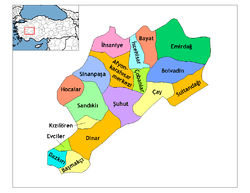
| Province | Afyonkarahisar |
| Area[1] | |
| • District | 392.99 km2 (151.73 sq mi) |
| Population (2012)[2] | |
| • Urban | 8,981 |
| • District | 13,701 |
| • District density | 35/km2 (90/sq mi) |
| Climate | Csb |
Çobanlar (Ancient Greek: Αναβωρα, Anabora or Anabura) is a town and district of Afyonkarahisar Province in the Aegean region of Turkey, a plain 25 km east of the city of Afyon. It covers an area of 422 km², and the population (2010) is 13,364, of which 8,757 live in the town of Çobanlar. The town lines in the 38’ N, 30’ E. Çobanlar has population 13.283. Çobanlar is 990 m high sea level. İn the South Çobanlar’s Bey Mountain, in the west Çobanlar’s Sultan Mountains. The mayor is Salih Alaka (AKP).
Bronze Age burial mounds have been found near the river, and in antiquity the town of Anabura was here, there are remains in the village of Feleli and a statue of Artemis from the site is on display in the museum in Afyon. The undergrand city revealed in year 2003 shows that there was life even before B.C. 400.
In the town there are a number of classic Ottoman Empire period houses with courtyards.
Today the area is a rural district, the major production is sugar beet. In the countryside the people drive home-made vehicles (half-trailer, half pick-up truck) called pat-pat.
Settlements
References
- ↑ "Area of regions (including lakes), km²". Regional Statistics Database. Turkish Statistical Institute. 2002. Retrieved 2013-03-05.
- ↑ "Population of province/district centers and towns/villages by districts - 2012". Address Based Population Registration System (ABPRS) Database. Turkish Statistical Institute. Retrieved 2013-02-27.
External links
- District governor's official website (Turkish)