Karabük Province
| Karabük Province Karabük ili | |
|---|---|
| Province of Turkey | |
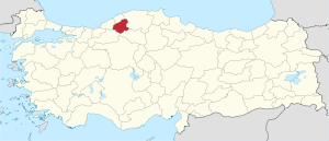 Location of Karabük Province in Turkey | |
| Country | Turkey |
| Region | West Black Sea |
| Subregion | Zonguldak |
| Government | |
| • Electoral district | Karabük |
| Area | |
| • Total | 4,109 km2 (1,586 sq mi) |
| Population (2010-12-31)[1] | |
| • Total | 227,610 |
| • Density | 55/km2 (140/sq mi) |
| Area code(s) | 0370 |
| Vehicle registration | 78 |
| Website | http://www.karabuk.gov.tr |
Karabük Province (Turkish: Karabük ili ) is a landlocked province in the northern part of Anatolia (northern central Turkey), located about 200 km (124 mi) north of Ankara, 115 km (71 mi) away from Zonguldak and 113 km (70 mi) away from Kastamonu. In 2010 it had a population of 227,610. The main city is Karabük which is located about 100 km (62 mi) south of the Black Sea coast.
Karabük Province is one of the newest provinces of Turkey. Until 1995 it was a district of Zonguldak, when it became an il (provincial center) in its own right. Established in 1995, it comprises Karabük, Eflani, Safranbolu and Yenice districts which were formerly part of Zonguldak Province and Eskipazar and Ovacık districts which were previously part of Çankırı Province.
Karabük is located on the highway between Bartın and Ankara, which was in ancient times an important route between Amasra on the coast and central Anatolia. The railway between Ankara and Zonguldak passes through Karabük.
Safranbolu, a historically important city, which is listed in the UNESCO World Heritage List, is located in Karabük Province.
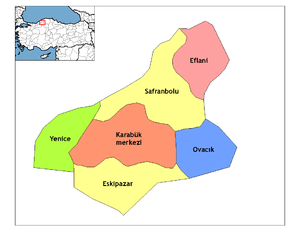
Districts
Karabük province is divided into 6 districts (capital district in bold):
History
Karabük receive its name from its geography. Its name occurred from combine of “Kara” , black in English, and “Bük”, shrubbery in English.
In Prehistoric Age
Although there are many tumuli and hill towns which give information of history of the region before the invention of writing, due to absence of scientific analysis, we do not have sufficient information. However, as to archeological researches which were done around Eskipazar and Ovacık, the earliest site in this region is “Yazıboy”, which is a village of Eskipazar nowadays. Researches think that one of humulus in this village reach today from b.c. 2500.
Gallery
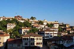 Traditional houses of Safranbolu
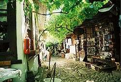 Historical shoe-maker shops in Safranbolu
 Bostancı Pond in Eflani
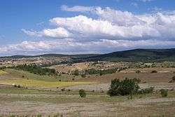 Eflani countryside
See also
References
- ↑ Turkish Statistical Institute, MS Excel document – Population of province/district centers and towns/villages and population growth rate by provinces
External links
| Wikimedia Commons has media related to Karabük Province. |
- (Turkish) Karabük governor's official website
- (Turkish) Karabük municipality's official website
- (English) Karabük weather forecast information
- Karabük Guide
- (Turkish) Eflani News
- (Turkish) Karabük News Website
| ||
Metropolitan municipalities are bolded. | ||
Coordinates: 41°13′25″N 32°38′25″E / 41.22361°N 32.64028°E