Île de la Visitation
| L'Île-de-la-Visitation Nature Park Parc-nature de l'Île-de-la-Visitation | |
|---|---|
 | |
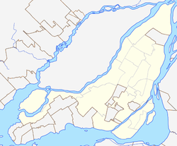
 Location of Île de la Visitation in Montreal | |
| Location | Ahuntsic-Cartierville/Montréal-Nord, Montreal, Quebec, Canada |
| Coordinates | 45°34′32″N 73°39′48″W / 45.575558°N 73.663381°WCoordinates: 45°34′32″N 73°39′48″W / 45.575558°N 73.663381°W |
| Area | 34 hectares (84 acres) |
| Operated by | City of Montreal |
| Open | 1984 |
Île de la Visitation is a small island in the Rivière des Prairies, part of the Hochelaga Archipelago, and part of the city of Montreal in Quebec, Canada.
Located within the boroughs of Ahuntsic-Cartierville and Montréal-Nord, the island is the site of a 34 hectares (84 acres) nature park, as well as the remaining buildings of the historic Sault-au-Récollet district.
The island also includes the former hydraulic installations, l'île du Cheval-de-Terre, which is connected to Laval by the Rivière des Prairies generating station, as well as a wooded area left intact along the Rivière des Prairies.
L'Île-de-la-Visitation Nature Park
The nature park, located on Île de la Visitation, was established in 1984 during the renovation of the Rivière des Prairies generating station. It has an area of 34 hectares.
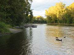
The footpaths along the shore allow for walking and offer views of the Rivière des Prairies. The paths that once allowed biking now have 'no-biking' signs and warn of a $40 ticket. Biking is allowed on a small part of the western end of the island. Various historical monuments (Milling site, Maison du Pressoir, Maison du Meunier) and picnic tables are located along the trail.
In winter, cross-country skiing trails are offered. There is also a small hill that is used for tobogganing by children.
The current of the Rivière des Prairies is calm around the island.
History
Known as Branchereau Island until 1750, Île de la Visitation borrows its name from the parish of the Visitation of the Blessed Virgin-Mary which was founded in 1736. In order to control the force of the current, the Sulpician landlords connected the island to the shore by a causeway. Between 1724 and 1726, Simon Sicar, engineer, built the dam and a sawmill near the island. He built a stone mill to grind corn, another for carding wool.
In 1785, the island was surveyed and subdivided.[1]
Mills
Over time, the mills have had several owners.
- 1726-1837: Séminaire de Montréal
- 1837-1867: Pascal Persillier-Lachapelle & Succession
- 1867-1872: Basile Piché
- 1872-1878: M. Ouimet
- 1878-1883: Wail McGauvran & Tucken
- 1883-1890: R. Gagnon père et fils
- 1890-1906: Dominion Leather Board Company
- 1906-1950: Back River Power Co
- 1950-1980: Milmont Fibreboards Co
There have been a few kinds of mills over the years.
- 1833-1879: Nail mill
- 1873-1890: Sawmill and paper mill
- 1890-1977: Paper mill
Maison du Pressoir
The Maison du Pressoir was built in 1806 by Didier Joubert who used it to press apples into cider. It then became a house.
The remains of the stone foundation which served as base for the machine still exist.
References
- ↑ Gordon Lefebbre, Montréal-Nord, d'hier à aujourd'hui, Comité d'histoire de Montréal-Nord, 2000, p. 10