Aglandjia
| Aglandjia Aglantzia | ||
|---|---|---|
 | ||
| ||
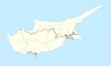 Aglandjia Location in Cyprus | ||
| Coordinates: 35°08′45″N 33°23′25″E / 35.14592°N 33.390169°ECoordinates: 35°08′45″N 33°23′25″E / 35.14592°N 33.390169°E | ||
| Country | Cyprus | |
| District | Nicosia District | |
| Government | ||
| • Type | Municipality | |
| Population (2011)[1] | ||
| • Total | 20,783 | |
| Time zone | EET (UTC+2) | |
| • Summer (DST) | EEST (UTC+3) | |
| Postal code | 4700 | |
| Website | http://www.aglantzia.org.cy | |

Aglandjia (Greek: Αγλαντζιά [locally [aɣlaˈnd͡ʒa]]; Turkish: Eğlence) is a suburb and a municipality of Nicosia, Cyprus. The municipality has a population of 20,783 (2011) and is contiguous with Nicosia Municipality.
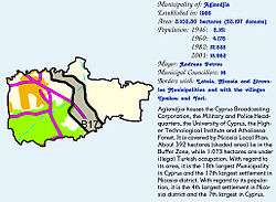
Aglandjia is near the buffer zone. It has an area of about 31 square kilometers (km²), of which 14 km² are agricultural land occupied by the Turkish army since 1974. Of the remaining 17 km², 9 km² are national forest parks (Athalassa park [8.6 km²] and Pedagogical Academy park [0.4 km²]).
Name
The word Aglandjia is of Turkish origin, deriving from eğlence, meaning "entertainment". Its pronunciation in Cypriot Greek is [aɣlaˈnd͡ʒa].
Geography
Aglandjia is Nicosia's highest suburb, since its largest part is built either on hills or on hillsides or at tableland level. Aglandjia was built in mediaeval times, before Ottoman rule, on an important site for defensive purposes, the existence of natural resources and its healthy climate.
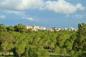
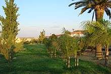
The natural environment of Aglandjia is unique, being not only endowed with the big lung of Nicosia, Athalassa Forest, but also with Ayios Yeoryios park, Aglandjia Municipal park, as well as 45 small parks and green spaces. Aglandjia is built along the road, which led from Nicosia to Larnaca before the invasion. Two trapezoid hills overlook the site on both sides. The hill on the left is Arona hill, which is now under Turkish occupation. The trapezoid hill on the right of the road is called Aronas of Athalassa or Mount Lion or Liontarovounos, on which the remains of the medieval La Cava castle stand.
History and demography
The history of Aglandjia goes back as far as 3888 BC, since several tombs dating to the Bronze Age were found on the trapezoid Arona hill (Mount Lion or Liontarovounos). Around the hill there was an ancient settlement, from which the city of Ledra may have originated. The Kafizin (in the buffer zone) or Small Aronas, a historic site with a cave dedicated to the worship of a Nymph, where important archaeological works of art and inscriptions in the cypriot syllabary were found, also stands within the area of Aglandjia.
In the Middle Ages, the Lefkomiatis settlement was in the area of Aglandjia. The area seems to have been inhabited towards the end of the Frankish rule, under the reign of Jacques II (1468–1473) and its name is believed to come from the surname of the Frankish family de Aglande who was the owner of the area.
After the conquest of Cyprus by the Ottomans, the Aglandjia settlement declined. It starts to form a self-sufficient rural settlement around the end of the 18th century. Its inhabitants are busy with farming, stockbreeding and quarrying. Around the end of the 18th century, dragoman Hadjigeorgakis Kornesios erected Ayios Yeoryios church on the site of the cemetery and Ayios Yeoryios church in Athalassa.
During the EOKA struggle, Aglandjia was present with organised groups and the sacrifice of Kyriakos Karaolis, whereas in the 1964 events, volunteers were incorporated in different companies. Andreas Nikolaou Koutsou fell in battle. During the Turkish invasion, Aglandjia was not only bombed mercilessly but the war took a heavy toll of the city and persons went missing. The Turkish invasion army occupies 45% of its territory.
Aglandjia has a population of 22,000 inhabitants, of whom 7,500 are refugees. Aglandjia combines the old and the new. It maintains a nucleus with traditional bricked houses with yards; its narrow streets refresh you with their human breath, whereas more recent large houses surround it, a few blocks of flats and refugees housings. Aglandjia is one of the excellent built-up areas of broader Nicosia. Aglandjia is characterized by Athalassa forests, the hypsometrical differences of the land, its neighboring with and easy access to the centre of Nicosia, the harmonious linking of the traditional and the new, and the tens of development works the Local Authority has to present.
Administration

Aglandjia was declared a Municipality by a referendum in May 1986. The Municipal Council is made up of the Mayor and sixteen Municipal Councilors. The current Mayor is Costas Kortas. All the Municipal Councils have worked in a spirit of comprehension and cooperation, having as a main and unique aim the progress and development of the Municipality. Based on the development Programmes, the Municipal Councils have created tens of infrastructure development works, which have marked the progress and development of our town.
Aglandjia Municipality gives a special impulse to Cultural development, the protection and improvement of the Environment and Social Policy. Aglandjia Municipality employs 24 permanent employees and 30 workers (permanent and casual) who staff the services below, which have their seat in the Town Hall:
- Secretariat
- Technical services
- Financial services
- Greenery and Environment services
- Hygiene services
- Cultural services
Culture
Two television broadcasting stations, the state station CyBC, chose Aglandjia to establish their central offices. Many government services function in our community, since the Police Headquarters and the Agriculture Research Institute have their centre here, the Veterinary Clinic offers its services, the International Conference Centre functions, the Higher Technological Institute and the Higher Hotel Institute are located here. The Pedagogical Academy functioned for many years in Aglandjia and gave teachers to Cyprus, whereas the University of Cyprus functions now in the same building; its new buildings and the University Campus are being erected in Aglandjia. The famous Costakis Zoiros live in Aglandjia.
The inhabitants of Aglandjia have left the marks of their religiousness in the churches and chapels since remote times. The big Ayios Yeoryios church stands in the heart of Aglandjia, and further up there are Apostle Andreas church, built on the initiative of refugees, Ayios Nektarios church, Ayios Yeorgios Athalassa chapel, the country churches of Panayia, Ayios Yeorgios and Ayia Mavri. The younger scions of Aglandjia Municipality are educated in six elementary schools and three secondary schools.
The Municipality, proud of its cultural tradition, mentions with boast the Elias Aletras Popular Theatre, which honors Aglandjia with its contribution.
Sites of interest
Skali Cultural Centre is the most dynamic work of the Municipality, which constitutes the basic infrastructure for Aglandjia cultural upgrading. It is the pride of the Municipality and constitutes the cultural identity of Aglandjia and a reference for all Cyprus. It succeeded in its aim and mission, which it the qualitative cultural offer to the citizens, the revival of old Aglandjia and the communication with the broader society.
The history of Aglandjia dates back as far as 3888 BC, since several tombs from the Bronze Age were found on the Arona trapezoid hill (Leontari Hill or Leondarovounos). The first archaeological finds were discovered in the last decades of the previous century, period to which the oldest excavations in Cyprus in general date back. The centre of the first excavations in the area, both by the Germans and the British, was the imposing trapezoid hill, which is known under the names Leontari Hill or Aronas.
The prehistoric settlement on Leantari Hill, strategically located for the defence of the area, had most certainly the character of a military deployment during the first phase of its history. The medieval La Cava castle, built on the same site, more or less in the middle of the flat summit of Leondarovounos around 1385 by king Jacques I, was also used as an observatory for the control of access and the road leading from Larnaca to Nicosia.
However, the destruction that hit the monument started very early, the first in 1426 already by the Mameluks. The Venetians blasted it later, during the third decade of the 16th century, whereas the Ottomans used the bigger of the two towers as a powder magazine. The demolishing of the castle walls in 1878 and the use of its stones as building material for the erection of Faneromeni Church in Nicosia completed the wear of dereliction during the previous century.
La Cava Castle was built by James I of Lusignan,it took its name from the large rock cistern which still survives today, In 1888 the area was excavated by a Mr M R James he dug up to 49 feet without reaching the bottom. Up until 1870 a considerable amount of the Castle was still standing including the vaulted hall, the curtain walls and two towers. However the majority of the Castle was pulled down in that year to build the Church of Phaneromeni.The Castle was proclaimed an ancient moment in 1915.[2] Today a portion of the Great Tower and Second Tower exists together with the Cistern.[3]
The Kafizin or small Aronas is a historic site with a cave dedicated to the worship of a Nymph, where important archaeological works of art and inscriptions in Cyprosyllabic writing were found. Potteries with votive inscriptions constitute nearly the whole of the offerings found in Kafizin cave. On the other inscriptions, the alphabetic writing has been used to express the common Greek language. The offerings to the Kafizin Nymph, potteries and utensils, whether they bear inscriptions or not, represent a unique in its kind series of representative ceramic types of local manufacture and specific chronology. There is a big variety of vessels and some of them are unique, we have bowls of different variations, two-handled vessels, cup-bearers, feeding bottles, mud-lighters, jars, cooking utensils, frying pans, wash basins, jugs, combined pots, urns, amphorae, rythons, large jars and jar lids, objects testifying to the practice of waving etc.It is worth mentioning that the area is full of potsherds.
On the basis of dates which are mentioned on some inscriptions, the use of the Numph worship place dates back to the Hellenistic period and more precisely between 225 and 218 BC, that is to say from the twenty-third year of the reign of Ptolemy the Benefactor until the fourth year of Ptolemy Philopatoras. The Lefkomiatis settlement was in Aglandjia area during the Middle Ages. Only a few remains are saved from the Byzantine period and the Middle Ages, during which there was a settlement in Aglandjia. After the conquest of Cyprus by the Ottomans, the Aglandjia settlement declines. It starts setting up a self-sufficient rural settlement at the end of the 18th century. Its inhabitants are busy with farming, stockbreeding and quarrying.
Aglandjia has also a large, traditional and old quarter where many local restaurants and taverna are located.
The Melkonian Educational Institute also operated in Aglandjian between 1926-2005.
International relations
Twin towns — Sister cities
Aglandjia is twinned with:
References
- ↑ "C1. POPULATION ENUMERATED BY SEX, AGE, DISTRICT, MUNICIPALITY/COMMUNITY AND QUARTER (1.10.2011)", Population - Place of Residence, 2011, Statistical Service of the Republic of Cyprus, 2014-04-17, retrieved 2014-04-20
- ↑ Rupert Gunnis, Historic Cyprus, 1936
- ↑ Touring Guide of Nicosia 1994
External links

| Nicosia District | |
|---|---|
| Limassol District | |
| Larnaca District | |
| Famagusta District | |
| Paphos District | |
| Kyrenia District | |