Ahwahnee, California
| Ahwahnee | |
|---|---|
| census-designated place | |
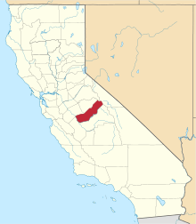
 Ahwahnee Location in California | |
| Coordinates: 37°21′56″N 119°43′35″W / 37.36556°N 119.72639°WCoordinates: 37°21′56″N 119°43′35″W / 37.36556°N 119.72639°W | |
| Country |
|
| State |
|
| County | Madera County |
| Area[1] | |
| • Total | 10.024 sq mi (25.961 km2) |
| • Land | 10.024 sq mi (25.961 km2) |
| • Water | 0 sq mi (0 km2) 0% |
| Elevation[2] | 2,326 ft (709 m) |
| Population (2010) | |
| • Total | 2,246 |
| • Density | 220/sq mi (87/km2) |
| Time zone | Pacific (PST) (UTC-8) |
| • Summer (DST) | PDT (UTC-7) |
| ZIP Code | 93601 |
| Area code(s) | 559 |
| GNIS feature IDs | 256142; 2628702 |
| U.S. Geological Survey Geographic Names Information System: Ahwahnee, California; U.S. Geological Survey Geographic Names Information System: Ahwahnee, California | |
Ahwahnee is a census-designated place[3] in Madera County, California.[2] It is located 5.25 miles (8.4 km) west of Yosemite Forks,[4] at an elevation of 2326 feet (709 m).[2] The population was 2,246 at the 2010 census.
Ahwahnee is hilly and located in the Sierra Nevada mountains. The ZIP Code is 93601. The community is inside area code 559. It is part of the Madera–Chowchilla Metropolitan Statistical Area.
History
The Ahwahnee post office opened in 1893 to 1896.[4] The name, Ahwahnee, is derived from the Southern Sierra Miwok word awwo which, in English, means "mouth."[5] The Gertrude post office was transferred to and renamed to Ahwahnee in 1900, closed in 1907, and re-opened in 1917.[4]
Demographics
2010
The 2010 United States Census[6] reported that Ahwahnee had a population of 2,246. The population density was 224.1 people per square mile (86.5/km²). The racial makeup of Ahwahnee was 2,064 (91.9%) White, 6 (0.3%) African American, 30 (1.3%) Native American, 16 (0.7%) Asian, 0 (0.0%) Pacific Islander, 38 (1.7%) from other races, and 92 (4.1%) from two or more races. Hispanic or Latino of any race were 196 persons (8.7%).
The Census reported that 2,240 people (99.7% of the population) lived in households, 0 (0%) lived in non-institutionalized group quarters, and 6 (0.3%) were institutionalized.
There were 898 households, out of which 218 (24.3%) had children under the age of 18 living in them, 541 (60.2%) were opposite-sex married couples living together, 87 (9.7%) had a female householder with no husband present, 46 (5.1%) had a male householder with no wife present. There were 45 (5.0%) unmarried opposite-sex partnerships, and 21 (2.3%) same-sex married couples or partnerships. 170 households (18.9%) were made up of individuals and 105 (11.7%) had someone living alone who was 65 years of age or older. The average household size was 2.49. There were 674 families (75.1% of all households); the average family size was 2.81.
The population was spread out with 421 people (18.7%) under the age of 18, 166 people (7.4%) aged 18 to 24, 396 people (17.6%) aged 25 to 44, 705 people (31.4%) aged 45 to 64, and 558 people (24.8%) who were 65 years of age or older. The median age was 49.4 years. For every 100 females there were 93.8 males. For every 100 females age 18 and over, there were 92.7 males.
There were 1,030 housing units at an average density of 102.8 per square mile (39.7/km²), of which 711 (79.2%) were owner-occupied, and 187 (20.8%) were occupied by renters. The homeowner vacancy rate was 4.2%; the rental vacancy rate was 6.9%. 1,737 people (77.3% of the population) lived in owner-occupied housing units and 503 people (22.4%) lived in rental housing units.
References
- ↑ U.S. Census Archived 2012-01-24 at WebCite
- 1 2 3 U.S. Geological Survey Geographic Names Information System: Ahwahnee, California
- ↑ U.S. Geological Survey Geographic Names Information System: Ahwahnee, California
- 1 2 3 Durham, David L. (1998). California's Geographic Names: A Gazetteer of Historic and Modern Names of the State. Clovis, Calif.: Word Dancer Press. p. 739. ISBN 1-884995-14-4.
- ↑ William Bright; Erwin Gustav Gudde (30 November 1998). 1500 California place names: their origin and meaning. University of California Press. p. 11. ISBN 978-0-520-21271-8. Retrieved 20 January 2012.
- ↑ "2010 Census Interactive Population Search: CA - Ahwahnee CDP". U.S. Census Bureau. Retrieved July 12, 2014.