Yosemite Forks, California
| Yosemite Forks | |
|---|---|
| Unincorporated community | |
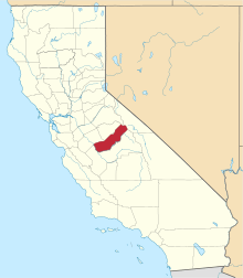
 Yosemite Forks  Yosemite Forks Location in California | |
| Coordinates: 37°22′02″N 119°37′55″W / 37.36722°N 119.63194°WCoordinates: 37°22′02″N 119°37′55″W / 37.36722°N 119.63194°W | |
| Country | United States |
| State | California |
| County | Madera County |
| Elevation[1] | 2,907 ft (886 m) |
Yosemite Forks is an unincorporated community in Madera County, California.[1] It is located 18 miles (29 km) northeast of Raymond,[2] at an elevation of 2907 feet (886 m).[1] The road forks at the place: one continues to Yosemite Valley, the other to Bass Lake.[2]
References
This article is issued from Wikipedia - version of the 7/5/2016. The text is available under the Creative Commons Attribution/Share Alike but additional terms may apply for the media files.