Al-Sinnabra
| Sinn en-Nabra | |
.JPG) | |
 Shown within Israel | |
| Alternate name | Sennabris, Sinnabris |
|---|---|
| Location |
|
| Coordinates | 32°43′05″N 35°34′19″E / 32.717958°N 35.571864°E |
| History | |
| Periods | Hellenistic - Crusader period |
| Site notes | |
| Archaeologists | Na'im Makhouly, Benjamin Mazar, Michael Avi-Yonah, Moshe Sheteklis, Emanuel Dunayevsky, Pesach Bar-Adon, P.L.O. Guy, Ruth Amiran, Rafi Greenberg |
Al-Sinnabra or Sinn en-Nabra, is the Arabic place name for a historic site on the southern shore of the Sea of Galilee in modern-day Israel.[1] The tell upon which al-Sinnabra was situated, Khirbet Kerak or Bet Yerah, is one of the largest in the Levant, spanning an area of over 50 acres.[2][3][4] Bet Yerah was the Hellenistic era twin city of Sennabris (Hebrew: צינבריי, סנבראי),[5][6] as al-Sinnabra was known in Classical antiquity, and its remains are located at the same tell.[7][8]
The city or village was inhabited in the Hellenistic, Roman-Byzantine, and early Islamic periods. An Arab Islamic palatial complex or qasr located there was also known as al-Sinnabra and served as a winter resort to caliphs in Umayyad-era Palestine (c. 650-704 AD).[9][10][11] By the Crusader period, the qasr of al-Sinnabra was in ruins. Though the date of destruction for the village itself is unknown, by the Ayyubid period descriptions of the area mention only the "Crusader Bridge of Sennabris", constructed over the Jordan river which at the time ran to the immediate north of the village.
For decades, part of the palatial complex of al-Sinnabra was misidentified as a Byzantine era (c. 330-620 CE) synagogue because of a column base engraved with a seven-branched candelabrum.[12][13] This thesis was questioned by Ronny Reich in 1993.[14] Donald Whitcomb suggested the complex was the qasr of al-Sinnabra in 2002,[10][15][16] and excavations carried out in 2010 showed his analysis to be correct.[11][12][17] Constructed in the 7th century by Mu'awiya and one of his successors, Abdel Malik, who also commissioned the building of the Dome of the Rock in the Old City of Jerusalem, it likely represents the earliest Umayyad complex of this type yet to be discovered.[13][18][19]
Name and location
The name al-Sinnabra or Sinn-en-Nabra is Arabic.[20][21] In Greek sources the name is transcribed as Sennabris, while in the Aramaic used in Talmudic sources it is referred to as Sinnabri,[20][21] and is described as sitting alongside Bet Yerah.[22]
Though described in the writings of early Arab historians, the precise location of al-Sinnabra had long been unknown.[11] Josephus, the 1st-century Jewish historian, described Sennabris as the northernmost point of the Jordan valley, situating it some 30 stadia from Tiberias.[1][23] In Buldan, Yaqut al-Hamawi (1179–1229), the Syrian geographer, situated al-Sinnabra opposite 'aqabat Afiq (meaning "the Afeq pass"), 3 miles (4.8 km) from Tiberias.[21]
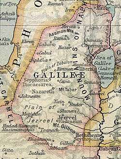
Josef Schwarz, a rabbi who came to reside in Jerusalem in the 19th century, transliterated its name as it appears in the Talmud as Senabrai, and citing Josephus for its location, he noted that "Even at the present day there are found in this vicinity traces of ruins called by the Arabs Sinabri."[24] A map of the area produced by the Palestine Exploration Fund around this time depicted Khirbet Sinn en-Nabrah to the immediate northwest of Khirbet Kerak, in an area occupied in the present day by the settlement of Kinneret.[25]
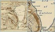
Al-Sinnabra's location is now confirmed to have been off the main Ramla-Beisan-Damascus highway about 6 kilometers (3.7 mi) south of Tabariyya (the Arabic name for Tiberias), a city that served as the capital of the el-Urdunn province under the Umayyad dynasty.[18] It is situated on the tell of Khirbet Kerak (Arabic: Khirbet al-Karak, "the ruins of the castle") or Beth Yerah (Hebrew: בית ירח , "House of the Moon (god)"), which lies where the Sea of Galilee empties into the Jordan river and rises 15 meters above sea level.[20][26] The Jordan river runs to the south, although it previously (until the medieval period at the earliest[27]) ran north and west of it.[1]
History
Hellenistic period
In Hellenistic times, the city was known as Sennabris.[20] Parts of the city walls from this period have been identified, and it is estimated that the wall (on the south and west of the tel) was at least 1600 meters long. The wall was built of piles of basalt, with bricks at the top and was strengthened by alternating rectangular and rounded towers with spiral staircases.[27][28] Similar towers from this period have been found at Tel Zeror.[28] A portion of the town discovered in the southern part of the mound included a street along which houses were built, one of which had a paved court around which were eleven rooms. Some of the houses facing the lake have survived to the height of the window sills.[29]
Roman-Byzantine period
According to Josephus, Vespasian encamped with three Roman legions in Sennabris.[30][31][32] He describes it as a "village," but given the size of the Roman force stationed there, this seems to be an understatement.[23] A fort was constructed at this time, probably by the builders of the Sixth Legion,[33] as well as a road connecting Tiberias to Sennabris, via Bethsaida and Hippos.[34]
A large Byzantine era church was constructed in the village in 450 CE and underwent several renovations, the last of these dated to 529 CE.[2] The church shows signs of renewed habitation in the early Islamic period, when it possibly served as a dar, or manor house.[35]
Early Islamic period
The village gained importance under the rule of the Umayyad empire,[36] A qasr (Arab Islamic palatial complex) located in al-Sinnabra and known by the same name, served as a winter resort to Mu'awiya, Marwan I, and other caliphs in Umayyad-era Palestine (c. 650-704 AD).[9][10][11] Mu'awiya (602-680), the first caliph, settled in al-Sinnabra, dividing his time in Palestine between his residence there and Jerusalem.[37][38] Innovations he introduced to the palace structure at al-Sinnabra include the maqṣura, "a columned bay ... enclosed by a railing or screen" against which the caliph would lean to hear petitions from his subjects, and a mihrab associated with the apsidal form.[35]
According to Whitcomb, the qasr is likely the earliest Umayyad complex of this type yet to be discovered.[18] It differs from other qusur (p. of qasr) in that there are no buyūt ("houses") arranged around a central courtyard, suggesting either a more urban design, such as that found at 'Anjar, or a more palatial one, like that at Qasr ibn Wardan.[16] It is similar to other qusur in that it exhibits characteristics associated with the pre-Islamic building techniques used by Arab chieftains of the Byzantine era.[39]
Later caliphs also came to al-Sinnabra.[37] Abdel Malik, the fifth Caliph, who emulated many of Mu'awiya's practices, resided part of the year in Damascus and Baalbek, and would spend the winter season in al-Sinnabra and in al-Jabiya in the Golan, making it one of the four Marwanid capitals of the Umayyad dynasty.[35][40] He died in al-Sinnabra in 705.[40]
In 744, an army headed by Suleiman ibn Hisham, a general of the Umayyad caliphate sent by the new caliph Yazid III to quell resistance to his rule, reached al-Sinnabra, where the tribes of Urdunn came to pledge their loyalty to the caliph before him.[41]
The site was apparently still in use in the 10th century; in 979 a meeting between Abu Taghlib (Fadlallah b. al-Hasan) of the Hamdanid dynasty, and Fadl, son of Salih, a Jew who headed the Fatimid forces took place there.[42]
Crusader period
During the Crusades, the army of Baldwin I, one of the leaders of the First Crusade, was defeated there in the Battle of Al-Sannabra in 1113 by the armies of Mawdud, the atabeg of Mosul who had formed an alliance with forces from Damascus.[43] In the lead up to the Battle of Hittin in 1187, Saladin and his forces passed through and set up camp near the village, before moving on to command the roads around Kafr Sabt.[44] The Umayyad qasr was in ruins by this time.[45] In the dried out river bed where the river used to flow at this time, the remains of the "Crusader Bridge of Sennabris" were found.[2]
Ayyubid period
The exact date of the village's destruction is unknown, but it is thought that it did not survive beyond the period of Ayyubid rule (c. late 12th-early 13th centuries) as references to al-Sinnabra from this time mention only the bridge of the same name, without recalling the village.[46]
Excavations and identification
In 1946, in the northern quadrant of the tell, a fortified compound consisting of a series of large structures, including a bathhouse adjoined to large apsidal hall decorated with colorful mosaics, was discovered just above the granary (AKA the Circles Building), an Early Bronze Age structure uncovered in previous excavations.[18] [47]
Between 1950 and 1953,[48] [49] [50] P.L.O. Guy and Pesach Bar-Adon, two Israeli archaeologists excavated the compound, falsely identifying a building there as a 5th-6th century Palestinian synagogue, because of the presence of a column base engraved with a seven-branched candelabrum.[10][12][13][18] The "synagogue" was incorporated into the Beth Yerah National Park which served as a popular tourist destination during the 1950s and 1960s, but has since been closed.[12]
Excavations by the Oriental Institute of the University of Chicago in 1960 uncovered the Byzantine church (to the north of the compound).[35] Questions were repeatedly raised about the identification of the structure to the south as a synagogue within a Roman era fort with attached bathhouse.[12][35] Ronny Reich, a prominent Israeli archaeologist, disproved that thesis in 1993, without offering an alternate explanation as to its identity.[10][15][16]
The compound, until 2002 identified as "Roman-Byzantine", was hypothesized to be the palace of al-Sinnabra by Donald S. Whitcomb of the Oriental Institute at the University of Chicago, after re-examining the plan and architectural features provided in the descriptions made by Israeli excavators.[10][12][18] Noting the similarities between the features of the complex and those of Khirbat al-Mafjar, another Islamic era palace, he suggested the site was one of the so-called desert castles (p. qusur; s. qasr) of the early Islamic Levant.[10][18] By comparing this information against the descriptions provided in historical geography texts, Whitcomb determined that the complex at Khirbet Kerak was the Arab Islamic palace of al-Sinnabra.[10][11]
Whitcomb's thesis was confirmed following research conducted by Taufik De'adle of the Hebrew University and excavations undertaken by Israeli archaeologists headed by Raphael Greenberg from Tel Aviv University's Institute of Archaeology in 2010.[11][12][17] Coins found at the site and its foundations indicate that the central building was built no earlier than 650 CE and that the bathhouse attached to the outer wall dates to the end of the 7th century. The foundations of the compound are made up of thick wall-stubs over two meters deep and provide an idea of the layout of the palace, the bathhouse and the wall and towers that surrounded them. The remains of water conduits and ceramic pipes from the bathhouse attest to the existence of a sophisticated water-distribution system, fed by an aqueduct.[12]
Greenberg said that al-Sinnabra and other sites that are in the process of being similarly re-dated indicate an architectural continuity between the Roman and early Arab empires.[51]
See also
- Cities of the ancient Near East
- Desert castles
- Qasr al-Minya, the other Umayyad qasr on the Sea of Galilee, Israel
References
- 1 2 3 Josephus, Flavius; Mason, Steve (2003). Life of Josephus (Reprint, illustrated ed.). Brill. p. 193. ISBN 978-0-391-04205-6.
- 1 2 3 Geoffrey W. Bromiley (1982). Geoffrey W. Bromiley, ed. International Standard Bible Encyclopedia: E-J (Revised ed.). Wm. B. Eerdmans Publishing. ISBN 9780802837820.
- ↑ Ian Shaw; Robert Jameson (2002). Ian Shaw; Robert Jameson, eds. A dictionary of archaeology (6th, illustrated, reprint ed.). Wiley-Blackwell. p. 335. ISBN 978-0-631-23583-5.
- ↑ The Holy Land: An Archaeological Guide from Earliest Times to 1700, Jerome Murphy O'Connor, Oxford University Press, 1980, p.159
- ↑ Midrash HaGadol (Genesis Rabba 98:22)
- ↑ Jerusalem Talmud, Megillah 1:1 (2b)
- ↑ Ugarit-Forschungen, Volume 8. Verlag Butzon & Bercker. 1977. p. 179.
- ↑ Kenneth M. Setton; Marshall W. Baldwin (2006). Kenneth M. Setton; Marshall W. Baldwin, eds. A History of the Crusades: The First Hundred Years (2nd, illustrated, reprint ed.). University of Wisconsin Press. p. 658. ISBN 978-0-299-04834-1.
- 1 2 Whitcomb in Schuzman, 2009, p. 241.
- 1 2 3 4 5 6 7 8 "Individual Scholarship: 2001-2002 Annual Report - Donald S. Whitcomb". The Oriental Institute of the University of Chicago. July 30, 2007. Retrieved 2010-03-16.
- 1 2 3 4 5 6 "Ruins thought to be synagogue was Umayyad palace: 7th century Arab palace identified in Israel". Al-Arabiya. March 16, 2010. Archived from the original on 23 March 2010. Retrieved 2010-03-16.
- 1 2 3 4 5 6 7 8 "Israeli archaeologists identified Caliph Mu'awiya's Lakeside Palace". Tel Aviv University: Division for Press Relations, Spokesperson & Communication Guidelines. March 15, 2010. Retrieved 2010-03-18.
- 1 2 3 "Tibériade: identification des vestiges d'un palais omeyyade". RTBF.be. March 16, 2010. Retrieved 2010-03-16.
- ↑ Ronny Reich (1993). "The Bet Yerah Synagogue Reconsidered". Atiqot: 139–144.
- 1 2 Chancey, Mark A. (2005). Greco-Roman culture and the Galilee of Jesus (Illustrated ed.). Cambridge University Press. p. 110, footnote #74. ISBN 978-0-521-84647-9.
- 1 2 3 Whitcomb in Schuzman, 2009, p. 246.
- 1 2 Agence France Presse (March 16, 2010). "Ruins of 7th century Arab palace identified in Israel". Zimbio. Retrieved 2010-03-16.
- 1 2 3 4 5 6 7 "The Umayyad Qasr". Tel Bet Yerah Research and Excavation Project. Retrieved 2010-03-18.
- ↑ "Identifican el palacio de los primeros omeyas en el mar de Galilea". European Press Photo Agency. March 16, 2010. Retrieved 2010-03-16.
- 1 2 3 4 Milgrom, Jacob; Wright, David Pearson; Freedman, David Noel; Hurvitz, Avi (1995). Pomegranates and golden bells: studies in biblical, Jewish, and Near Eastern ritual, law, and literature in honor of Jacob Milgrom (Illustrated ed.). Eisenbrauns. p. 630, footnote #2. ISBN 978-0-931464-87-4.
- 1 2 3 Gil, 1997, p. 78, footnote #5.
- ↑ Lightfoot, John (2007). From the Talmud and Hebraica, Volume 1. Cosimo Inc. p. 142. ISBN 978-1-60206-406-5.
- 1 2 Stuart S. Miller (2006). Sages and commoners in late antique ʼEreẓ Israel: a philological inquiry into local traditions in Talmud Yerushalmi. Mohr Siebeck. ISBN 978-3-16-148567-1.
- ↑ Joseph Schwarz (1850). Issac Leeser, ed. A descriptive geography and brief historical sketch of Palestine. Oxford University.
- ↑ Douglas L. Esse (1991). Subsistence, trade, and social change in early Bronze Age Palestine (Illustrated ed.). Oriental Institute of the University of Chicago. p. 35. ISBN 978-0-918986-66-5.
- ↑ Eric M. Meyers, American Schools of Oriental Research (1997). The Oxford encyclopedia of archaeology in the Near East, Volume 1 (Illustrated ed.). Oxford University Press. p. 312.
- 1 2 Hestrin, Ruth (1992). E.Stern, ed. האנצקלופדיה החדשה לחפירות ארכיאולוגיות בארץ ישראל [The New Encyclopedia of Archaeological Excavations in the Holy Land] (in Hebrew). I. pp. 175–181.
- 1 2 Broshi, Magen (1990). Devorah Dimant; Lawrence H. Schiffman, eds. Time to prepare the way in the wilderness: papers on the Qumran scrolls. Hebrew University of Jerusalem. p. 19. ISBN 978-90-04-10225-5. Retrieved 2010-07-11.
- ↑ Negev, Avraham, ed. (2001). Beth Yerah. Archaeological encyclopedia of the Holy Land. pp. 88–89. ISBN 0-8264-1316-1.
- ↑ Miller, Stuart S. (2006). Sages and commoners in late antique ʼEreẓ Israel: a philological inquiry into local traditions in Talmud Yerushalmi. Mohr Siebeck. p. 149, footnote #8. ISBN 978-3-16-148567-1.
- ↑ "Beth Yerah". Encyclopædia Britannica. Retrieved 2010-01-27.
- ↑ Flavius, Josephus (1981-10-01). The Jewish War. p. 225. ISBN 978-0-14-044420-9.
- ↑ Chancey, 2005, p. 67.
- ↑ J.P. Brown; E.M. Meyers (1994). "Map 69 Damascus-Caesarea" (PDF). p. 1069.
- 1 2 3 4 5 Whitcomb in Schuzman, 2009, p. 245.
- ↑ University of London (1966). Bulletin of the School of Oriental and African Studies. School of Oriental and African Studies. p. 370.
- 1 2 Gil, 1997, p. 78.
- ↑ Noted by Yaqut al-Hamawi, see le Strange, 1890, p. 531
- ↑ Chase F. Robinson (2005). 'Abd al-Malik (Illustrated ed.). Oneworld. ISBN 978-1-85168-361-1.
- 1 2 Bacharach, Jere L. (1996). Gulru Necipogulu, ed. Muqarnas - An Annual on the Visual Culture of the Islamic World (Illustrated ed.). Brill. p. 38. ISBN 978-90-04-10633-8.
- ↑ Gil, 1997, p. 86.
- ↑ Gil, 1997, p. 355.
- ↑ Tyerman, Christopher (2006). God's war: a new history of the Crusades (Illustrated ed.). Harvard University Press. p. 203. ISBN 978-0-674-02387-1.
- ↑ Lane-Poole, Stanley (1985). Saladin and the Fall of the Kingdom of Jerusalem. The Other Press. p. 188. ISBN 978-983-9541-55-7.
- ↑ B. Z. Ḳedar, ed. (1992). The Horns of Ḥaṭṭīn (Illustrated ed.). Yad Izhak Ben-Zvi.
- ↑ Universiṭah ha-ʻIvrit bi-Yerushalayim (1968). Scripta Hierosolymitana, Volume 15. Magnes Press, Hebrew University. p. 31.
- ↑ Amihai Mazar. "al-Sinnabra Overview". The Shelby White-Leon Levy Program for Archaeological Excavations. Archived from the original on 10 February 2010. Retrieved 2010-03-16.
- ↑ P. Bar-Adon, Beth Yerah (News and Notes), IEJ, vol. 3, pp. 132, 1953
- ↑ P. Bar-Adon, Beth Yerah (News and Notes), IEJ, vol. 4, pp. 128-129, 1954
- ↑ P. Bar-Adon, Beth Yerah (News and Notes), IEJ, vol. 5, pp. 273, 1955
- ↑ Associated Press (March 17, 2010). "Ancient Muslim Ruins Found in Israel ... Again". Fox News. Retrieved 2011-08-17.
Bibliography
- Gil, Moshe (1997). A history of Palestine, 634-1099. Cambridge University Press. ISBN 978-0-521-59984-9.
- David Pearson Wright; David Noel Freedman; Avi Hurvitz (1995). Jacob Milgrom; David Pearson Wright; David Noel Freedman; Avi Hurvitz, eds. Pomegranates and golden bells: studies in biblical, Jewish, and Near Eastern ritual, law, and literature in honor of Jacob Milgrom (Illustrated ed.). Eisenbrauns. ISBN 978-0-931464-87-4.
- Peregrine, Peter N.; Ember, Melvin, eds. (2001). Encyclopedia of Prehistory. 8 : South and Southwest Asia. London: Human Relations Area Files Inc. ISBN 0-306-46262-1.
- Whitcomb, Donald (2009). "From Pastoral Peasantry to Tribal Urbanites: Arab Tribes and the Foundation of the Islamic State in Syria". In Jeffrey Szuchman. Nomads, Tribes and the State in the Ancient Near East (PDF). p. 241. ISBN 978-1-885923-61-5.
- Emanuel Eisenberg et al., Bet Yerah, the Early Bronze Age Mound: v. 1: Excavation Reports 1933-1986, Israel Antiquities Authority, 2006, ISBN 965-406-197-X
- le Strange, Guy (1890), Palestine Under the Moslems: A Description of Syria and the Holy Land from A.D. 650 to 1500, Committee of the Palestine Exploration Fund