Albin, Wyoming
| Albin, Wyoming | |
|---|---|
| Town | |
 Location in Laramie County and the state of Wyoming. | |
 Albin, Wyoming Location in the United States | |
| Coordinates: 41°25′1″N 104°6′1″W / 41.41694°N 104.10028°WCoordinates: 41°25′1″N 104°6′1″W / 41.41694°N 104.10028°W | |
| Country | United States |
| State | Wyoming |
| County | Laramie |
| Area[1] | |
| • Total | 0.15 sq mi (0.39 km2) |
| • Land | 0.15 sq mi (0.39 km2) |
| • Water | 0 sq mi (0 km2) |
| Elevation | 5,338 ft (1,627 m) |
| Population (2010)[2] | |
| • Total | 181 |
| • Estimate (2012[3]) | 185 |
| • Density | 1,206.7/sq mi (465.9/km2) |
| Time zone | Mountain (MST) (UTC-7) |
| • Summer (DST) | MDT (UTC-6) |
| ZIP code | 82050 |
| Area code(s) | 307 |
| FIPS code | 56-00825[4] |
| GNIS feature ID | 1584728[5] |
Albin is a town in Laramie County, Wyoming, United States. It is part of the Cheyenne, Wyoming Metropolitan Statistical Area. The population was 181 at the 2010 census.[6]
Geography
Albin is located about 55 miles (89 km) east-northeast of Cheyenne along Wyoming Highway 216.
According to the United States Census Bureau, the town has a total area of 0.15 square miles (0.39 km2), all of it land.[1]
Climate
| Climate data for Albin, Wyoming | |||||||||||||
|---|---|---|---|---|---|---|---|---|---|---|---|---|---|
| Month | Jan | Feb | Mar | Apr | May | Jun | Jul | Aug | Sep | Oct | Nov | Dec | Year |
| Average high °F (°C) | 38.7 (3.7) |
42.0 (5.6) |
48.3 (9.1) |
58.1 (14.5) |
68.1 (20.1) |
78.8 (26) |
86.4 (30.2) |
84.6 (29.2) |
75.7 (24.3) |
63.3 (17.4) |
47.8 (8.8) |
39.8 (4.3) |
60.97 (16.1) |
| Average low °F (°C) | 15.4 (−9.2) |
18.1 (−7.7) |
22.5 (−5.3) |
30.2 (−1) |
40.1 (4.5) |
49.0 (9.4) |
55.4 (13) |
53.9 (12.2) |
44.9 (7.2) |
34.4 (1.3) |
23.5 (−4.7) |
17.0 (−8.3) |
33.7 (0.95) |
| Average precipitation inches (mm) | 0.7 (18) |
0.6 (15) |
1.5 (38) |
1.9 (48) |
2.9 (74) |
2.6 (66) |
2.1 (53) |
1.7 (43) |
1.4 (36) |
1.1 (28) |
0.8 (20) |
0.7 (18) |
18.1 (460) |
| Source: Weatherbase [7] | |||||||||||||
Demographics
| Historical population | |||
|---|---|---|---|
| Census | Pop. | %± | |
| 1940 | 160 | — | |
| 1950 | 208 | 30.0% | |
| 1960 | 172 | −17.3% | |
| 1970 | 118 | −31.4% | |
| 1980 | 128 | 8.5% | |
| 1990 | 120 | −6.2% | |
| 2000 | 120 | 0.0% | |
| 2010 | 181 | 50.8% | |
| Est. 2015 | 190 | [8] | 5.0% |
2010 census
As of the census[2] of 2010, there were 181 people, 59 households, and 44 families residing in the town. The population density was 1,206.7 inhabitants per square mile (465.9/km2). There were 71 housing units at an average density of 473.3 per square mile (182.7/km2). The racial makeup of the town was 93.9% White, 0.6% Native American, 0.6% Asian, 4.4% from other races, and 0.6% from two or more races. Hispanic or Latino of any race were 34.3% of the population.
There were 59 households of which 42.4% had children under the age of 18 living with them, 50.8% were married couples living together, 10.2% had a female householder with no husband present, 13.6% had a male householder with no wife present, and 25.4% were non-families. 22.0% of all households were made up of individuals and 6.8% had someone living alone who was 65 years of age or older. The average household size was 3.07 and the average family size was 3.59.
The median age in the town was 28.1 years. 36.5% of residents were under the age of 18; 7.1% were between the ages of 18 and 24; 28.2% were from 25 to 44; 23.7% were from 45 to 64; and 4.4% were 65 years of age or older. The gender makeup of the town was 50.8% male and 49.2% female.
2000 census
As of the census[4] of 2000, there were 120 people, 54 households, and 32 families residing in the town. The population density was 850.6 people per square mile (330.9/km²). There were 70 housing units at an average density of 496.2 per square mile (193.1/km²). The racial makeup of the town was 95.83% White, 0.83% Native American, 0.83% Asian, 2.50% from other races. Hispanic or Latino of any race were 9.17% of the population.
There were 54 households out of which 24.1% had children under the age of 18 living with them, 51.9% were married couples living together, 3.7% had a female householder with no husband present, and 38.9% were non-families. 37.0% of all households were made up of individuals and 22.2% had someone living alone who was 65 years of age or older. The average household size was 2.22 and the average family size was 2.91.
In the town the population was spread out with 22.5% under the age of 18, 7.5% from 18 to 24, 20.0% from 25 to 44, 27.5% from 45 to 64, and 22.5% who were 65 years of age or older. The median age was 46 years. For every 100 females there were 87.5 males. For every 100 females age 18 and over, there were 89.8 males.
The median income for a household in the town was $25,625, and the median income for a family was $38,750. Males had a median income of $26,000 versus $18,750 for females. The per capita income for the town was $13,174. There were 6.7% of families and 12.5% of the population living below the poverty line, including 19.0% of under eighteens and 31.3% of those over 64.
Education
Public education in the town of Albin is provided by Laramie County School District #2. One of the district's campuses, Albin Elementary School, is located in the town and serves students in grades Kindergarten through six.
Albin made news in the regional media for a failed attempt to start a charter school in their town.
See also
References
- 1 2 "US Gazetteer files 2010". United States Census Bureau. Archived from the original on 2012-01-24. Retrieved 2012-12-14.
- 1 2 "American FactFinder". United States Census Bureau. Retrieved 2012-12-14.
- ↑ "Population Estimates". United States Census Bureau. Archived from the original on 2013-06-17. Retrieved 2013-06-01.
- 1 2 "American FactFinder". United States Census Bureau. Archived from the original on 2013-09-11. Retrieved 2008-01-31.
- ↑ "US Board on Geographic Names". United States Geological Survey. 2007-10-25. Retrieved 2008-01-31.
- ↑ "Profile of General Population and Housing Characteristics: 2010 Demographic Profile Data (DP-1): Albin town, Wyoming". U.S. Census Bureau, American Factfinder. Archived from the original on September 11, 2013. Retrieved April 2, 2012.
- ↑ "Weatherbase: Historical Weather for Albin, Wyoming". Weatherbase. 2011. Retrieved on November 24, 2011.
- ↑ "Annual Estimates of the Resident Population for Incorporated Places: April 1, 2010 to July 1, 2015". Retrieved July 2, 2016.
- ↑ "Census of Population and Housing". Census.gov. Archived from the original on May 11, 2015. Retrieved June 4, 2015.
Municipalities and communities of Laramie County, Wyoming, United States | ||
|---|---|---|
| City | 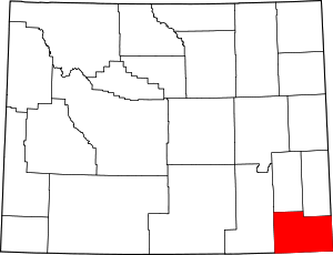 | |
| Towns | ||
| CDPs | ||
| Unincorporated communities | ||