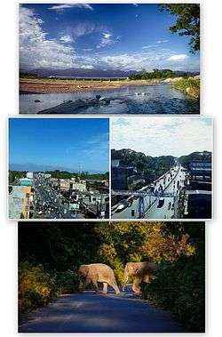
Alipurduar district
| Alipurduar District আলিপুরদুয়ার জেলা | |
|---|---|
| District of West Bengal | |
 | |
 Alipurduar District Location in West Bengal, India | |
| Coordinates: 26°29′N 89°34′E / 26.48°N 89.57°ECoordinates: 26°29′N 89°34′E / 26.48°N 89.57°E | |
| Country |
|
| State | West Bengal |
| Headquarters |
|
| Area | |
| • Total | 3,383 km2 (1,306 sq mi) |
| Population (census 2011 of India) | |
| • Total | Almost 17 lakh |
| Languages | |
| • Official | Bengali, English |
| Time zone | IST (UTC+5:30) |
| ISO 3166 code | ISO 3166-2:IN |
| Website | Official website |
Alipurduar District is the 20th district in the state of West Bengal, India.[1] It consists of Alipurduar municipality, Falakata municipality and six community development blocks: Madarihat–Birpara, Alipurduar–I, Alipurduar–II, Falakata, Kalchini and Kumargram. The six blocks contain 66 gram panchayats and nine census towns. The district has its headquarters at Alipurduar. It was made a district on 25 June 2014.[2]
Alipurduar, the second largest sub-division during British rule was created on 7 July 1876. The late Colonel Hedayet Ali Khan was the first assistant commissioner of Alipurduar and it was named after him.[3] In independent India, Alipurduar earned reputation as one of the largest sub-divisions of the country. Alipurduar was an outlying sub-division of Jalpaiguri district. However, since the sub-division was nearly 100 km from Jalpaiguri, the position of sub-divisional officer/sub-divisional magistrate gained prominence with the SDO office catering to the diverse needs of the people of the sub-division. Post independence, the first SDO of Alipurduar was GD Goswami. The sub-division became the first independent posting of many IAS officers of West Bengal Cadre.
The demand for separate district of Alipurduar arose from the feeling of alienation felt by the people of Alipurduar who felt that they were being neglected by the government and the district administration. The huge distance between many areas of Alipurduar and Jalpaiguri town, the district headquarters, had been a constant source of irritation, expense and inconvenience for the people of Alipurduar.[4] Alipurduar sub division was as large as the other two sub divisions of Jalpaiguri district (in geographical area and population)[5] which added fuel to the demand for separation of Alipurduar sub division from Jalpaiguri district.
Alipurduar was bifurcated from Jalpaiguri district and made a separate district on 25 June 2014.[2] On this day, Shri Nikhil Nirmal IAS became the last SDO and SDM of erstwhile Alipurduar sub division[6] while Alice Vaz R IAS became the first district magistrate of Alipurduar District.[7] Vaz had served as SDO Alipurudar in her first independent posting during 2007. The decision to make Alipurudar a separate district was welcomed from all corners since it would pave the way for better governance and inclusive growth.[4]
Area
Apart from the Alipurduar municipality, the district contains nine census towns and rural areas of 66 gram panchayats under six community development blocks: Madarihat–Birpara, Alipurduar–I, Alipurduar–II, Falakata, Kalchini and Kumargram.[8]
The nine census towns are Paschim Jitpur, Chechakhata, Alipurduar Railway Junction, Bholar Dabri, Sobhaganj, Falakata, Jaygaon and Uttar Latabari and Uttar Kamakhyaguri.[9]
Blocks
Madarihat–Birpara block
Rural area under Madarihat–Birpara block consists of ten gram panchayats, viz. Bandapani, Hantapara, Madarihat, Totopara Ballalguri, Birpara–I, Khayarbari, Rangalibajna, Birpara–II, Lankapara and Shishujhumra.[8] There is no urban area under this block.[9] Madarihat and Birpara police stations serve this block.[10] Headquarters of this block is in Madarihat.[11]
Alipurduar–I block
Rural area under Alipurduar–I block consists of 11 gram panchayats, viz. Banchukamari, Parorpar, Shalkumar–I, Vivekananda–I, Chakowakheti, Patlakhawa, Shalkumar–II, Vivekananda–II, Mathura, Purba Kanthalbari and Tapsikhata.[8] Urban area under this block consists of four census towns: Paschim Jitpur, Chechakhata, Alipurduar Railway Junction and Bholar Dabri.[9] Alipurduar police station serves this block.[10] Headquarters of this block is in Panchkalguri.[11]
Alipurduar–II block
Rural area under Alipurduar–II block consists of 11 gram panchayats, viz. Chaporer Par–I, Mahakalguri, Shamuktala, Turturi, Chaparerpar–II, Majherdabri, Tatpara–I, Bhatibari, Kohinoor, Parokata and Tatpara–II.[8] Urban area under this block consists of one census town: Sobhaganj.[9] Samuktala police station serves this block.[10] Headquarters of this block is in Josodanga.
Falakata block
Rural area under Falakata block consists of 12 gram panchayats, viz. Dalgaon, Dhanirampur–II, Guabarnagar, Mairadanga, Deogaon, Falakata–I, Jateswar–I, Parangerpar, Dhanirampur–I, Falakata–II, Jateswar–II and Shalkumar.[8] Urban area under this block consists of one municipality: Falakata.[9] Falakata police station serves this block.[10] Headquarters of this block is in Falakata.[11]
Kalchini block
Rural area under Kalchini block consists of 11 gram panchayats, viz. Jaigaon–I, Jaigaon–II, Dalshing Para, Malangi, Satali, Mendabari, Latabari, Chuapara, Kalchini, Garopara and Rajabhatkawa.[8] Urban area under this block consists of two census towns: Jaigaon and Uttar Latabari.[9] Jaigaon and Kalchini police stations serve this block.[10] Headquarters of this block is in Hamiltanganj.
Kumargram block
Rural area under Kumargram block consists of 11 gram panchayats, viz. Chengamari, Khoardanga–I, Newland Kumargram Sankos, Turturikhanda, Kamakhyaguri–I, Khoardanga–II, Valka Barabisa–I, Kamakhyaguri–II, Kumargram, Raidak, Valka Barabisa–II.[8] Urban area under this block consists of one census town: Uttar Kamakhyaguri.[9] Kumargram police station serves this block.[10] Headquarters of this block is in Kumargram.[11]
- Barobisha or Barabisa is a fast developing business and cultural hub which is located on the National Highway 31C, towards Assam and is 8 km away from Bengal-Assam border.
Railway network
Alipurduar railway division has at least 710 km of railway track. It is the largest division of the NFR zone. In Alipurduar district there are two major stations, Alipurduar junction(APDJ) and New Alipurduar(NOQ). There are other stations in the district.
Legislative segments
As per order of the Delimitation Commission in respect of the delimitation of constituencies in the West Bengal, the area under Kumargram block and seven gram panchayats under Alipurduar–II block, viz. Bhatibari, Kohinoor, Parokata, Mahakalguri, Shamuktala, Turturi and Tatpara–I will constitute the Kumargram assembly constituency of West Bengal. The Majherdabri gram panchayat under Alipurduar–II block and the area under Kalchini block will constitute the Kalchini assembly constituency. The Alipurduar municipality, the Alipurduar Railway Junction census town, and the gram panchayats of Chaporer Par–I, Chaporer Par–II and Tatpara–II under Alipurduar–II block and ten gram panchayats of Alipurduar–I block, viz. Banchukamari, Parorpar, Shalkumar–I, Vivekananda–I, Chakowakheti, Patlakhawa, Shalkumar–II, Vivekananda–II, Mathura and Tapsikhata will form the Alipurduars assembly constituency. The other gram panchayat of Alipurduar–I block, viz. Purba Kanthalbari will form the Falakata assembly constituency along with the area under Falakata block. Madarihat block will be part of Madarihat assembly constituency. Kumargram, Kalchini and Madarihat constituencies will be reserved for Scheduled tribes (ST) candidates. Falakata constituency will be reserved for Scheduled castes (SC) candidates. All these five assembly constituencies will be part of Alipurduars (Lok Sabha constituency), which will be reserved for ST candidates.[12]
Visitor attractions
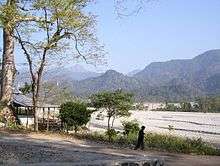

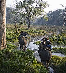

- Buxa Tiger Reserve, IUCN category II national park
- Jayanti Hills
- Buxa Fort, built by British Raj
- Jaldapara National Park
- Chilapata Forests
- Jaigaon, a small town of Alipurduar and near the Bhutan border
- Rajabhatkhawa Museum at Rajabhatkhawa
- Rai matang
- Santrabari
- Rovers point
- Roopang valley
- Lepchakhawa
- Chunabhati.
- Tea Gardens
External links
References
- ↑ http://timesofindia.indiatimes.com/city/kolkata/Alipurduar-a-new-district-on-June-25/articleshow/36916065.cms
- 1 2 http://www.business-standard.com/article/news-ians/alipurduar-becomes-bengal-s-20th-district-114062500725_1.html
- ↑ http://www.alipurduar.org/district-profile/
- 1 2 http://www.frontline.in/the-nation/district-no-20/article6189575.ece
- ↑ http://jalpaiguri.gov.in/html/disprof.html
- ↑ http://wbpar.gov.in/writereaddata/No%201517-PAR(IAS)%20issued%20on%2022.08.2013.pdf
- ↑ http://wbpar.gov.in/writereaddata/1151-PAR(IAS).pdf
- 1 2 3 4 5 6 7 "Directory of District, Sub division, Panchayat Samiti/ Block and Gram Panchayats in West Bengal, March 2008". West Bengal. National Informatics Centre, India. 19 March 2008. Archived from the original on 25 February 2009. Retrieved 21 December 2008.
- 1 2 3 4 5 6 7 "District Wise List of Statutory Towns (Municipal Corporation, Municipality,Notified Area and Cantonment Board), Census Towns and Outgrowths, West Bengal, 2001". Census of India, Directorate of Census Operations, West Bengal. Archived from the original on 21 July 2011. Retrieved 21 December 2008.
- 1 2 3 4 5 6 "List of Districts/C.D.Blocks/ Police Stations with Code No., Number of G.Ps and Number of Mouzas". Census of India, Directorate of Census Operations, West Bengal. Archived from the original on 13 February 2010. Retrieved 21 December 2008.
- 1 2 3 4 "Contact details of Block Development Officers". Jalpaiguri district. Panchayats and Rural Development Department, Government of West Bengal. Retrieved 26 December 2008.
- ↑ "Press Note, Delimitation Commission" (PDF). Assembly Constituencies in West Bengal. Delimitation Commission. pp. 4–5, 23. Retrieved 10 January 2009.
Cities, towns and locations in Alipurduar district | |||
|---|---|---|---|
| Cities, municipal and census towns |
| ||
| Locations other than cities and towns | |||
| Related Topics |
| ||
 |
|
| ||
| Jalpaiguri district | |
Kokrajhar district, Assam | ||
| ||||
| | ||||
| Cooch Behar district | Dhubri district, Assam |