Alto, Texas
| Alto, Texas | |
|---|---|
| Town | |
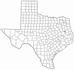 Location of Alto, Texas | |
 | |
| Coordinates: 31°39′0″N 95°4′26″W / 31.65000°N 95.07389°WCoordinates: 31°39′0″N 95°4′26″W / 31.65000°N 95.07389°W | |
| Country | United States |
| State | Texas |
| County | Cherokee |
| Area | |
| • Total | 1.7 sq mi (4.4 km2) |
| • Land | 1.7 sq mi (4.4 km2) |
| • Water | 0.0 sq mi (0.0 km2) |
| Elevation | 436 ft (133 m) |
| Population (2000) | |
| • Total | 1,190 |
| • Density | 707.1/sq mi (273.0/km2) |
| Time zone | Central (CST) (UTC-6) |
| • Summer (DST) | CDT (UTC-5) |
| ZIP code | 75925 |
| Area code(s) | 936 |
| FIPS code | 48-02188[1] |
| GNIS feature ID | 1372283[2] |
| Website | http://www.altotexas.org |
Alto is a town in Cherokee County, Texas, United States. The population was 1,225 at the 2010 census.
Alto is the closest municipality to the Caddo Mounds State Historic Site, an archaeological site dating back to 800 CE, featuring a prehistoric village and ceremonial center.
History
An early settler in the region was Martin Lacy, who built Lacy's Fort just to the west to the current site of Alto in around 1838. In 1838 and 1839, during the campaign to suppress the Córdova Rebellion, the fort served as an operations and supply base for the Third Militia brigade commanded by Maj. Gen. Thomas J. Rusk.[3]
The town of Alto was laid out in 1849 and named for the Spanish word meaning "high," on account of the site's elevation on a drainage divide between the Neches and Angelina Rivers.[4]
Geography
Alto is located at 31°39′0″N 95°4′26″W / 31.65000°N 95.07389°W (31.650131, -95.073810).[5]
According to the United States Census Bureau, the town has a total area of 1.7 square miles (4.4 km2), all land. Alto had a prisoner of war camp during World War II, which served the Cherokee County area.
Demographics
| Historical population | |||
|---|---|---|---|
| Census | Pop. | %± | |
| 1870 | 61 | — | |
| 1880 | 88 | 44.3% | |
| 1890 | 210 | 138.6% | |
| 1910 | 672 | — | |
| 1920 | 1,081 | 60.9% | |
| 1930 | 1,053 | −2.6% | |
| 1940 | 1,141 | 8.4% | |
| 1950 | 1,021 | −10.5% | |
| 1960 | 869 | −14.9% | |
| 1970 | 1,045 | 20.3% | |
| 1980 | 1,203 | 15.1% | |
| 1990 | 1,027 | −14.6% | |
| 2000 | 1,190 | 15.9% | |
| 2010 | 1,225 | 2.9% | |
| Est. 2015 | 1,223 | [6] | −0.2% |
As of the census[1] of 2000, there were 1,190 people, 452 households, and 282 families residing in the town. The population density was 707.1 people per square mile (273.5/km²). There were 534 housing units at an average density of 317.3 per square mile (122.7/km²). The racial makeup of the town was 65.55% White, 24.79% African American, 0.50% Native American, 0.17% Asian, 6.81% from other races, and 2.18% from two or more races. Hispanic or Latino of any race were 10.25% of the population.
There were 452 households out of which 29.4% had children under the age of 18 living with them, 42.0% were married couples living together, 16.4% had a female householder with no husband present, and 37.6% were non-families. 34.5% of all households were made up of individuals and 19.7% had someone living alone who was 65 years of age or older. The average household size was 2.44 and the average family size was 3.16.
In the town the population was spread out with 27.6% under the age of 18, 7.3% from 18 to 24, 22.5% from 25 to 44, 20.1% from 45 to 64, and 22.4% who were 65 years of age or older. The median age was 38 years. For every 100 females there were 80.6 males. For every 100 females age 18 and over, there were 76.8 males.
The median income for a household in the town was $19,438, and the median income for a family was $24,167. Males had a median income of $22,955 versus $16,875 for females. The per capita income for the town was $11,648. About 28.3% of families and 33.8% of the population were below the poverty line, including 40.3% of those under age 18 and 29.1% of those age 65 or over.
Education
Public schools are managed by the Alto Independent School District. These are Alto High School, Alto Middle School, and Alto Elementary School.[8]
Public safety
In 2011, the city eliminated its entire police force after the city council cut the police budget to zero,[9] causing residents to brace for increased crime.[10] A councilman is quoted as saying "The police department, being a non-money-making entity, was the easiest to get rid of." Meanwhile, police services are provided by the county sheriff and, assuming the town's finances improve, it will be opened up again in December.[11]
Notable people
- James Z. Spearing, member of the United States House of Representatives from Louisiana's 2nd congressional district from 1924 to 1931, was born in Alto in 1864.
Climate
The climate in this area is characterized by hot, humid summers and generally mild to cool winters. According to the Köppen Climate Classification system, Alto has a humid subtropical climate, abbreviated "Cfa" on climate maps.[12]
References
- 1 2 "American FactFinder". United States Census Bureau. Archived from the original on 2013-09-11. Retrieved 2008-01-31.
- ↑ "US Board on Geographic Names". United States Geological Survey. 2007-10-25. Retrieved 2008-01-31.
- ↑ "Texas State Historical Association". Retrieved 16 September 2015.
- ↑ Tarpley, Fred (5 July 2010). 1001 Texas Place Names. University of Texas Press. p. 8. ISBN 978-0-292-78693-6.
- ↑ "US Gazetteer files: 2010, 2000, and 1990". United States Census Bureau. 2011-02-12. Retrieved 2011-04-23.
- ↑ "Annual Estimates of the Resident Population for Incorporated Places: April 1, 2010 to July 1, 2015". Retrieved July 2, 2016.
- ↑ "Census of Population and Housing". Census.gov. Archived from the original on May 11, 2015. Retrieved June 4, 2015.
- ↑ "Alto ISD Campuses", Alto Independent School District
- ↑ "Tiny Texas city lays off entire police force". CBS News. July 5, 2011. Retrieved July 7, 2011.
- ↑ Ana Campoy (June 29, 2011). "The Day the Law Left Town". Wall Street Journal. Retrieved July 7, 2011.
- ↑
- ↑ Climate Summary for Alto, Texas
Municipalities and communities of Cherokee County, Texas, United States | ||
|---|---|---|
| Cities | 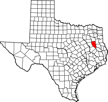 | |
| Towns | ||
| CDP | ||
| Other unincorporated communities | ||
| Ghost towns | ||
| Footnotes | ‡This populated place also has portions in an adjacent county or counties | |