Amalia, New Mexico
Amalia is a unincorporated community in Taos County, New Mexico, United States. Amalia is located at latitude 36.942 and longitude -105.454. It is located near the Colorado border on New Mexico State Route 196. The elevation is 8,146 feet.
Amalia has a post office, with the ZIP code 87512. The 87512 ZIP Code Tabulation Area had a population of 230 at the 2000 census.
References
Municipalities and communities of Taos County, New Mexico, United States | ||
|---|---|---|
| Towns | 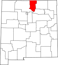 | |
| Villages | ||
| CDPs | ||
| Other unincorporated communities | ||
| Indian reservation | ||
Coordinates: 36°56′31″N 105°27′16″W / 36.94194°N 105.45444°W
This article is issued from Wikipedia - version of the 5/5/2014. The text is available under the Creative Commons Attribution/Share Alike but additional terms may apply for the media files.