Ban Dan Lan Hoi District
| Ban Dan Lan Hoi บ้านด่านลานหอย | |
|---|---|
| Amphoe | |
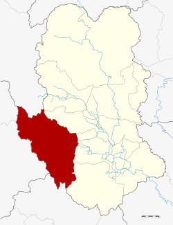 Amphoe location in Sukhothai Province | |
| Coordinates: 17°0′22″N 99°34′29″E / 17.00611°N 99.57472°ECoordinates: 17°0′22″N 99°34′29″E / 17.00611°N 99.57472°E | |
| Country |
|
| Province | Sukhothai |
| Area | |
| • Total | 1,018.11 km2 (393.09 sq mi) |
| Population (2005) | |
| • Total | 42,074 |
| • Density | 41.3/km2 (107/sq mi) |
| Time zone | THA (UTC+7) |
| Postal code | 64140 |
| Geocode | 6402 |
Ban Dan Lan Hoi (Thai: บ้านด่านลานหอย) is a district (Amphoe) in the western part of Sukhothai Province, in the lower north of Thailand.[1][2]
History
In the Sukhothai era, the district area was the western camp of Patrol soldiers. The village located nearby the camp was called Ban Lan Khoi (บ้านลานคอย). The pronunciation changed with time to the present-day Ban Lan Hoi.
In the Rattanakosin era, the Interior ministry created a new subdistrict (Tambon) named Ban Dan. It was upgraded to a minor district (King Amphoe) under Mueang Sukhothai district in 1909. The district office was moved to Tambon Lan Hoi in 1916. When the Charot Withi Thong road, connecting Sukhothai with Tak was finished, they moved the office to Tambon Ban Dan again. In 1939 the district was renamed from Lan Hoi to Ban Dan Lan Hoi.[3] In 1973 the government upgraded the minor district to a full district.
Geography
Neighboring districts are (from the north clockwise) Thung Saliam, Si Samrong, Mueang Sukhothai, Khiri Mat of Sukhothai Province, Phran Kratai of Kamphaeng Phet Province, Mueang Tak, Ban Tak, of Tak Province and Thoen of Lampang Province.
Administration
The district is subdivided into 7 subdistricts (tambon), which are further subdivided into 70 villages (muban). The township (thesaban tambon) Lan Hoi covers parts of the tambon Lan Hoi. There are further 7 Tambon administrative organizations (TAO).
| No. | Name | Thai name | Villages | Inh. | |
|---|---|---|---|---|---|
| 1. | Lan Hoi | ลานหอย | 10 | 7,559 | |
| 2. | Ban Dan | บ้านด่าน | 14 | 5,791 | |
| 3. | Wang Takhro | วังตะคร้อ | 9 | 5,307 | |
| 4. | Wang Nam Khao | วังน้ำขาว | 17 | 8,934 | |
| 5. | Taling Chan | ตลิ่งชัน | 10 | 9,337 | |
| 6. | Nong Ya Plong | หนองหญ้าปล้อง | 10 | 5,146 | |
| 7. | Wang Luek | วังลึก | 8 | 3,957 |
Sources
References
- ↑ http://www.sukhothai.go.th/3584/data/data_01.htm
- ↑ http://tourisminvest.tat.or.th/en/component/content/article?id=62
- ↑ พระราชกฤษฎีกาเปลี่ยนนามอำเภอ กิ่งอำเภอ และตำบลบางแห่ง พุทธศักราช ๒๔๘๒ (PDF). Royal Gazette (in Thai). 56 (0 ก): 354–364. April 17, 1939.