Kong Krailat District
| Kong Krailat กงไกรลาศ | |
|---|---|
| Amphoe | |
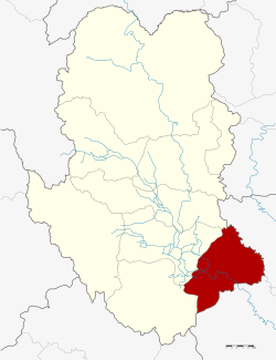 Amphoe location in Sukhothai Province | |
| Coordinates: 16°57′9″N 99°58′34″E / 16.95250°N 99.97611°ECoordinates: 16°57′9″N 99°58′34″E / 16.95250°N 99.97611°E | |
| Country |
|
| Province | Sukhothai |
| Seat | Ban Krang |
| Area | |
| • Total | 502.382 km2 (193.971 sq mi) |
| Population (2005) | |
| • Total | 64,521 |
| • Density | 128.4/km2 (333/sq mi) |
| Time zone | THA (UTC+7) |
| Postal code | 64170 |
| Geocode | 6404 |
Kong Krailat (Thai: กงไกรลาศ) is a district (Amphoe) in the southeastern part of Sukhothai Province, in the lower northern region of Thailand.[1][2]
Geography
Neighboring districts are (from the southwest clockwise): Khiri Mat and Mueang Sukhothai of Sukhothai Province, Phrom Phiram and Bang Rakam of Phitsanulok Province.
History
The district was renamed from Ban Krai to Kong Krailat in 1939.[3]
Administration
The district is subdivided into 11 subdistricts (tambon), which are further subdivided into 126 villages (muban). The township (thesaban tambon) Kong Krailat covers parts of tambon Kong, Ban Krang and Pa Faek. There are further 10 Tambon administrative organizations (TAO).
| No. | Name | Thai name | Villages | Inh. | |
|---|---|---|---|---|---|
| 1. | Kong | กง | 13 | 5,947 | |
| 2. | Ban Krang | บ้านกร่าง | 12 | 4,175 | |
| 3. | Krai Nok | ไกรนอก | 15 | 4,501 | |
| 4. | Krai Klang | ไกรกลาง | 8 | 3,924 | |
| 5. | Krai Nai | ไกรใน | 15 | 7,973 | |
| 6. | Dong Dueai | ดงเดือย | 11 | 6,478 | |
| 7. | Pa Faek | ป่าแฝก | 13 | 6,102 | |
| 8. | Kok Raet | กกแรต | 12 | 5,252 | |
| 9. | Tha Chanuan | ท่าฉนวน | 12 | 9,888 | |
| 10. | Nong Tum | หนองตูม | 7 | 5,400 | |
| 11. | Ban Mai Suk Kasem | บ้านใหม่สุขเกษม | 8 | 4,881 |
References
- ↑ http://www.sukhothai.go.th/3584/data/data_01.htm
- ↑ http://tourisminvest.tat.or.th/en/component/content/article?id=62
- ↑ พระราชกฤษฎีกาเปลี่ยนนามอำเภอ กิ่งอำเภอ และตำบลบางแห่ง พุทธศักราช ๒๔๘๒ (PDF). Royal Gazette (in Thai). 56 (0 ก): 354–364. April 17, 1939.
External links
This article is issued from Wikipedia - version of the 11/3/2016. The text is available under the Creative Commons Attribution/Share Alike but additional terms may apply for the media files.