Chiang Khwan District
| Chiang Khwan เชียงขวัญ | |
|---|---|
| Amphoe | |
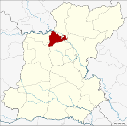 Amphoe location in Roi Et Province | |
| Coordinates: 16°9′56″N 103°45′7″E / 16.16556°N 103.75194°ECoordinates: 16°9′56″N 103°45′7″E / 16.16556°N 103.75194°E | |
| Country | Thailand |
| Province | Roi Et |
| Seat | Phra That |
| Area | |
| • Total | 127.2 km2 (49.1 sq mi) |
| Population (2005) | |
| • Total | 27,859 |
| • Density | 219.0/km2 (567/sq mi) |
| Time zone | ICT (UTC+7) |
| Postal code | 45000[1] |
| Geocode | 4518 |
Chiang Khwan (Thai: เชียงขวัญ) is a district (amphoe) of Roi Et Province, Thailand.
Geography
Neighboring districts are (from the north clockwise) Pho Chai, Selaphum, Thawat Buri, Mueang Roi Et and Changhan of Roi Et Province, and Rong Kham of Kalasin Province.
History
The minor district (king amphoe) was created on 30 April 1994, when six tambon were split off from Thawat Buri District.[2]
The Thai government on 15 May 2007 upgraded all 81 minor districts to full districts.[3] With publication in the Royal Gazette on 24 August, the upgrade became official.[4]
Administration
The district is divided into six sub-districts (tambon), which are further subdivided into 66 villages (muban). There are no municipal (thesaban) areas, and six tambon administrative organization (TAO).
| No. | Name | Thai name | Villages | Pop. | |
|---|---|---|---|---|---|
| 1. | Chiang Khwan | เชียงขวัญ | 12 | 4,666 | |
| 2. | Phlapphla | พลับพลา | 11 | 4,807 | |
| 3. | Phra That | พระธาตุ | 8 | 2,495 | |
| 4. | Phra Chao | พระเจ้า | 12 | 4,714 | |
| 5. | Mu Mon | หมูม้น | 10 | 4,727 | |
| 6. | Ban Khueang | บ้านเขือง | 13 | 6,450 |
References
- ↑ Phlapphla and Mu Mon have postcode 45170 (Thawat Buri)
- ↑ ประกาศกระทรวงมหาดไทย เรื่อง แบ่งเขตท้องที่อำเภอธวัชบุรี จังหวัดร้อยเอ็ด ตั้งเป็นกิ่งอำเภอเชียงขวัญ (PDF). Royal Gazette (in Thai). 111 (42 ก): 11. May 26, 1994.
- ↑ แถลงผลการประชุม ครม. ประจำวันที่ 15 พ.ค. 2550 (in Thai). Manager Online.
- ↑ พระราชกฤษฎีกาตั้งอำเภอฆ้องชัย...และอำเภอเหล่าเสือโก้ก พ.ศ. ๒๕๕๐ (PDF). Royal Gazette (in Thai). 124 (46 ก): 14–21. August 24, 2007.
External links
This article is issued from Wikipedia - version of the 7/17/2016. The text is available under the Creative Commons Attribution/Share Alike but additional terms may apply for the media files.