Nong Hi District
| Nong Hi หนองฮี | |
|---|---|
| Amphoe | |
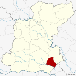 Amphoe location in Roi Et Province | |
| Coordinates: 15°36′37″N 103°59′26″E / 15.61028°N 103.99056°ECoordinates: 15°36′37″N 103°59′26″E / 15.61028°N 103.99056°E | |
| Country | Thailand |
| Province | Roi Et |
| Seat | Nong Hi |
| Area | |
| • Total | 132.0 km2 (51.0 sq mi) |
| Population (2005) | |
| • Total | 25,696 |
| • Density | 5.14/km2 (13.3/sq mi) |
| Time zone | ICT (UTC+7) |
| Postal code | 45140 |
| Geocode | 4519 |
Nong Hi (Thai: หนองฮี) is a district (amphoe) of Roi Et Province, Thailand.
Geography
Neighboring districts are (from the south clockwise) Phon Sai, Suwannaphum and Phanom Phrai of Roi Et Province, and Sila Lat of Sisaket Province.
History
The minor district (king amphoe) was created on 1 April 1995, when the three tambon Nong Hi, Sao Hae, and Duk Ueng were split off from Phanom Phrai.[1]
The Thai government on 15 May 2007, upgraded all 81 minor districts to full districts.[2] With publication in the Royal Gazette on 24 August, the upgrade became official.[3]
Administration
The district is divided into four sub-districts (tambon), which are further subdivided into 54 villages (muban). There are no municipal (thesaban) areas, and four tambon administrative organization (TAO).
| No. | Name | Thai name | Villages | Pop. | |
|---|---|---|---|---|---|
| 1. | Nong Hi | หนองฮี | 17 | 6,477 | |
| 2. | Sao Hae | สาวแห | 7 | 3,156 | |
| 3. | Duk Ueng | ดูกอึ่ง | 17 | 8,688 | |
| 4. | Den Rat | เด่นราษฎร์ | 13 | 7,375 |
References
- ↑ ประกาศกระทรวงมหาดไทย เรื่อง แบ่งเขตท้องที่อำเภอพนมไพร จังหวัดร้อยเอ็ด ตั้งเป็นกิ่งอำเภอหนองฮี (PDF). Royal Gazette (in Thai). 112 (Special 9 ง): 56. March 22, 1995.
- ↑ แถลงผลการประชุม ครม. ประจำวันที่ 15 พ.ค. 2550 (in Thai). Manager Online.
- ↑ พระราชกฤษฎีกาตั้งอำเภอฆ้องชัย...และอำเภอเหล่าเสือโก้ก พ.ศ. ๒๕๕๐ (PDF). Royal Gazette (in Thai). 124 (46 ก): 14–21. August 24, 2007.
External links
This article is issued from Wikipedia - version of the 7/17/2016. The text is available under the Creative Commons Attribution/Share Alike but additional terms may apply for the media files.