Roi Et Province
| Roi Et ร้อยเอ็ด | ||
|---|---|---|
| Province | ||
|
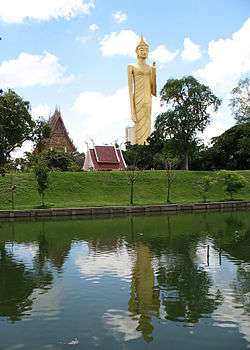
Phra Phuttharattanamongkhon Maha Muni or Luang Pho Yai, Wat Burapha Phiram (Wat Hua Ro) | ||
| ||
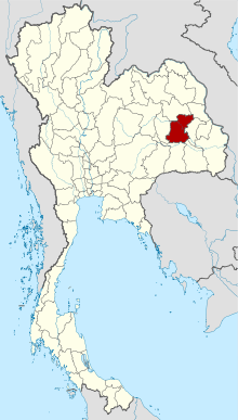 Map of Thailand highlighting Roi Et Province | ||
| Country | Thailand | |
| Capital | Roi Et | |
| Government | ||
| • Governor | Sarit Withun (since October 2016) | |
| Area | ||
| • Total | 8,299.4 km2 (3,204.4 sq mi) | |
| Area rank | Ranked 23rd | |
| Elevation | 150 m (490 ft) | |
| Population (2014) | ||
| • Total | 1,308,318 | |
| • Rank | Ranked 11th | |
| • Density | 160/km2 (410/sq mi) | |
| • Density rank | Ranked 23rd | |
| Time zone | ICT (UTC+7) | |
| ISO 3166 code | TH-45 | |
| Website | http://www.roiet.go.th/2013/ | |

Roi Et (Thai: ร้อยเอ็ด, pronounced [rɔ́ːj ʔèt]) is one of the provinces (changwat) of Thailand, in the northeast of Thailand. Neighboring provinces are (from north clockwise) Kalasin, Mukdahan, Yasothon, Sisaket, Surin, and Maha Sarakham.
Name
The name of the province literally means "one hundred and one" (ร้อยเอ็ด roi et). Correctly, the number should be "eleven" (สิบเอ็ด sip et), as the province was named after its eleven ancient gates built for its eleven vassal states. In olden times, the number "eleven" was written "๑๐๑" (101) and the province name was so written. Later, people misunderstood that "๑๐๑" was "one hundred and one" and have since incorrectly called it Roi Et.[1]
Geography
Most of the province is covered by plains about 130–160 meters above sea level, drained by the Chi River. In the north are the hills of the Phu Phan mountain range. The Yang River is the major watercourse. In the south is the Mun River, which also forms the boundary with Surin. At the mouth of the Chi River, where it enters the Mun River, a floodplain provides a good rice farming area.

History
The area was already settled at the time of the Khmer empire, as several ruins show. However, the main history of the province began when Lao people from Champasak settled near Suwannaphum during the Ayutthaya Kingdom. In the late 18th century, King Taksin moved the city to its present site, then called Saket Nakhon.[2]
Symbols
The provincial seal shows the shrine of the city pillar, which is in the artificial lake Bueng Phalan Chai. The spirit of the shrine, Mahesak, is revered by local people.
The provincial tree is Lagerstroemia macrocarpa.
Administrative divisions
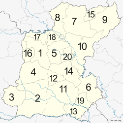

The province is subdivided into 20 districts (amphoe). The districts are further subdivided into 193 subdistricts (tambon) and 2,311 villages (muban).
References
- ↑ Royal Institute of Thailand (2010). Kotmai Tra Sam Duang Phra Thamnun (Chabap Ratchabandittayasathan) กฎหมายตราสามดวง พระทำนูน (ฉบับราชบัณฑิตยสถาน) [The Code of the Three Great Seals: The Judicial Statute (Royal Institute Version)] (in Thai). Bangkok: Royal Institute of Thailand. pp. 39–40. ISBN 9786167073118.
- ↑ "Roi Et". Tourism Authority of Thailand (TAT). Retrieved 21 June 2015.
External links
 Roi Et travel guide from Wikivoyage
- Province page from the Tourist Authority of Thailand
- Website of Province (Thai only)
 |
Kalasin Province | Mukdahan Province | | |
| Maha Sarakham Province | |
Yasothon Province | ||
| ||||
| | ||||
| Surin Province | Sisaket Province |
Coordinates: 16°3′12″N 103°39′9″E / 16.05333°N 103.65250°E