Amroth, Pembrokeshire
| Amroth | |
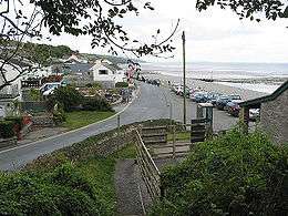 Amroth village and beach |
|
 Amroth |
|
| Population | 1,232 (2011)[1] |
|---|---|
| OS grid reference | SN1607 |
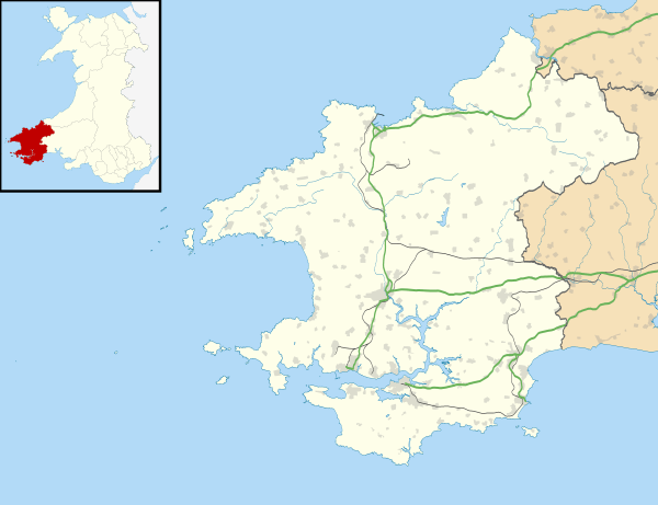
| Principal area | Pembrokeshire |
| Country | Wales |
| Sovereign state | United Kingdom |
| Post town | NARBERTH |
| Postcode district | SA67 |
| Dialling code | 01834 |
| Police | Dyfed-Powys |
| Fire | Mid and West Wales |
| Ambulance | Welsh |
| EU Parliament | Wales |
|
|
Coordinates: 51°44′N 4°40′W / 51.73°N 04.66°W
Amroth is a community and holiday resort village, 7 miles (11 km) east of Tenby, Pembrokeshire, in West Wales, noted for its long sandy beach.
History
The name is Welsh, and probably means "On (the brook called) Rhath".[2]
The beach stretches the whole length of the village and at extreme low tide one can still see the petrified forest, destroyed when sea levels rose 7000 years ago, while fossilised antlers, nuts, animal bones and Neolithic flints have been discovered.[3] The parish was an important anthracite coal mining area until the end of the 19th century. Slight remains of mines and tramways are still visible. Ruins of Amroth Castle still remain, and one mile inland is the Anglican parish church of St Elidyr, which is a grade II* listed building.[4]
Amroth Castle
.jpg)
Amroth Castle stands on the north side of the unclassified coast road east of the village of Amroth. It is surrounded by a high wall with an entrance archway at the south-western corner. The present building is a 19th-century country house built in the style of a mock castle which possibly replaced a small stone castle dating from the 12th century. The gatehouse is much restored. The ruinous remains of the house are a grade I listed building.[5]
After passing through several hands the castle was used as a lunatic asylum in the 1850s. Converted back to a private house in the 1880s it was later owned and occupied by Owen Colby Philipps, the shipping magnate who bought the White Star Line and was created Baron Kylsant of Carmarthen and Amroth in 1923.[6] It passed to his daughter Nesta, who had married George Coventry, grandson of the 9th Earl of Coventry. They moved out in 1930 when George inherited the Coventry title and estates.
Present
Amroth lies in the Pembrokeshire Coast National Park and is the southern start of the Pembrokeshire Coast Path, part of the national Cistercian Way.[7]
Local authority
Amroth is an electoral ward of Pembrokeshire, and a community with its own community council, which covers the settlements of Summerhill, Stepaside, Pleasant Valley, Wiseman's Bridge and Amroth as well as the hamlets at Llanteg and Llanteglos.[8]
References
- ↑ "Ward and community population 2011". Retrieved 17 April 2015.
- ↑ Charles, B. G., The Placenames of Pembrokeshire, National Library of Wales, Aberystwyth, 1992, ISBN 0-907158-58-7, pp464-5
- ↑ "Amroth beach". BBC Wales. Retrieved 2010-06-05.
- ↑ "St Elidyr's Church, Amroth". British Listed Buildings. Retrieved 28 December 2013.
- ↑ "Amroth Castle, Amroth". British Listed Buildings. Retrieved 28 December 2013.
- ↑ "Amroth Castle". Retrieved 28 December 2013.
- ↑ "Cistercian Way: Penally to Amroth". BBC Wales. Retrieved 2010-06-05.
- ↑ Pembrokeshire County Council Community review
External links
| Wikimedia Commons has media related to Amroth. |
| Wikivoyage has a travel guide for Amroth. |
- Amroth Castle
- Pictures of Amroth Area on Geograph
- Amroth: historical and genealogical information at GENUKI.
- The Amroth War Memorial