Carew, Pembrokeshire
| Carew | |
 The French Mill |
|
 Carew |
|
| Population | 1,532 (2011)[1] |
|---|---|
| OS grid reference | SN045038 |
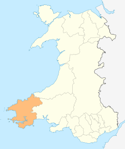
| Principal area | Pembrokeshire |
| Country | Wales |
| Sovereign state | United Kingdom |
| Post town | Kilgetty |
| Postcode district | SA68 0 |
| Dialling code | 01646 |
| Police | Dyfed-Powys |
| Fire | Mid and West Wales |
| Ambulance | Welsh |
| EU Parliament | Wales |
| UK Parliament | Preseli |
| Welsh Assembly | Preseli |
|
|
Coordinates: 51°42′N 4°50′W / 51.70°N 4.83°W
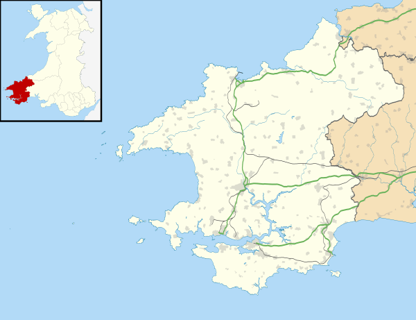
Carew (Welsh: Caeriw) is a village and community on an inlet of Milford Haven in the former Hundred of Narberth, Pembrokeshire, West Wales, 7 km east of Pembroke. The eastern part of the parish is included in the Pembrokeshire Coast National Park.
Description
The meaning of the name is disputed.[2] It is Welsh and could mean "fort on a hill" (Caer-rhiw), "fort by yews" (Caer-yw) or simply "forts" (Caerau). It is pronounced /'kε:ru/, or more traditionally /'kε:ri/. The village grew up to serve the nearby Norman castle. The parish includes several other villages and hamlets, including Carew Cheriton (around the parish church), Milton, Newton, West Williamston, Sageston and Whitehill.

Textile mills gave Milton its name. In the 19th century there was a carding mill downstream, a weaving mill by the bridge, and a fulling mill upstream.
West Williamston has an almost-disappeared industrial history. Limestone was quarried in the area for centuries. The stone was cut from slot-shaped flooded quarries communicating with the haven, known locally as "docks". See examples at 51°42′29″N 4°50′35″W / 51.70806°N 4.84306°W. These allowed stone to be dropped from the quarry faces directly into barges at the bottom. From there, stone was shipped to lime kilns all around the coast of North Pembrokeshire and Cardiganshire.[3] A small inland quarry still operates just north of Carew village. Besides limestone, anthracite was mined on a small scale for local consumption at Minnis Pit on the northeastern edge of the parish.
Typical of South Pembrokeshire, the parish has been predominantly English-speaking since the 12th century.
Features
- The 13th century Norman castle is 170 m west of the village. Main article: Carew Castle
- The French Mill is a rare example of a tidal flour mill on a dam across the Carew inlet. The present building dates from the 18th century, but the French Mill was mentioned in 1476. The mill has not functioned since the 1930s, but its equipment is all still in place. It has two large undershot water wheels, driving seven sets of mill stones.
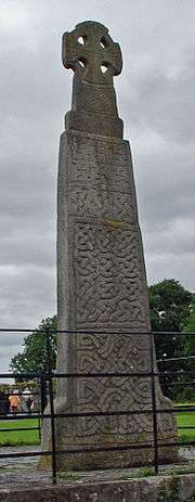
- The Carew Cross, Main article: Carew Crosscurrently located on the road side in the village, is an important example of an 11th-century memorial Celtic cross, commemorating King Maredudd ab Edwin of Deheubarth (died 1035). The cross, 4 m in height, is made from the local limestone. Similar to the Nevern cross, it consists of two parts, connected with a tenon joint. It is inscribed, on the west face:
MARGIT
EUT.RE
X.ETG.FILIUS
- St Mary's, the parish church, is a Grade I listed building, dating from the 14th century. In the churchyard is the Old Mortuary Chapel, also Grade I listed.[4]
Local Government
The village has its own elected community council and gives its name to an electoral ward of Pembrokeshire County Council.
References
- ↑ "Ward and community population 2011". Retrieved 17 April 2015.
- ↑ Charles, B. G, The Placenames of Pembrokeshire, National Library of Wales, Aberystwyth, 1992, ISBN 0-907158-58-7, Vol II, p 476
- ↑ Lewis, Topological Dictionary of Wales,1833
- ↑ "British Listed Buildings: Church Of St. Mary, Carew". Retrieved 10 May 2016.
Further reading
- Nield, Ted. A legacy of tidal Power: Carew Tidal mill. Country Quest June 1986: 36
External links
| Wikimedia Commons has media related to Carew, Pembrokeshire. |
- Carew Castle
- Pembrokeshire Coast National Park: Carew Castle and Mill
- Historical information and sources on GENUKI
- Photographs of Carew and surrounding area on Geograph
- A Vision of Britain through Time: Carew
- Dyfed Archaeological Trust; Carew, Milton and Nash - Historic background