Anderson Regional Airport
| Anderson Regional Airport Anderson Auxiliary Field | |||||||||||||||
|---|---|---|---|---|---|---|---|---|---|---|---|---|---|---|---|
|
2006 USGS airphoto | |||||||||||||||
| IATA: AND – ICAO: KAND | |||||||||||||||
| Summary | |||||||||||||||
| Airport type | Public | ||||||||||||||
| Operator | County of Anderson | ||||||||||||||
| Serves | Anderson, South Carolina | ||||||||||||||
| Elevation AMSL | 782 ft / 238.4 m | ||||||||||||||
| Coordinates | 34°29′41″N 082°42′32″W / 34.49472°N 82.70889°WCoordinates: 34°29′41″N 082°42′32″W / 34.49472°N 82.70889°W | ||||||||||||||
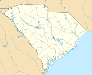
| Map | |||||||||||||||
 KAND Location | |||||||||||||||
| Runways | |||||||||||||||
| |||||||||||||||
| Helipads | |||||||||||||||
| |||||||||||||||
Anderson Regional Airport (IATA: AND, ICAO: KAND) is a public airport 3 miles southwest of Anderson, in Anderson County, South Carolina. Anderson has no scheduled airline service or concourses for gates, and no control tower, but in 2007 one runway was paved an extra 1,000 ft (300 m) to handle larger aircraft. It is one of the busiest airports in upstate South Carolina.
Facilities
Anderson Regional Airport covers 704 acres (2.85 km2) and has two runways and two helipads:
- 5/23: 6002 x 150 ft (1,524 x 46 m) Asphalt
- 17/35: 4,996 x 150 ft (1,523 x 46 m) Asphalt
- H1: 50 x 50 ft (15 x 15 m) Concrete
- H2: 50 x 50 ft (15 x 15 m) Concrete
Inflight Catering and support services- FBO Foods, Anderson SC. www.fbofoods.com
New Prospect Elementary School is across from the airport; the school mascot is the Jets. It is the headquarters of the Anderson County Civil Air Patrol.
History
The airport opened in September 1937. During World War II the airport was an auxiliary airfield for the United States Army Air Forces supporting the combat flight training at Greenville Army Airbase. Control of the airport was returned to local authorities in the fall of 1945. The Civilian Pilot Training for the Army Air Force was conducted there at the Anderson Airport and students from Clemson College participated in the flight training program.
Eastern Airlines stopped at AND from 1947 until 1964; Southern left in 1971-75.
See also
External links
| Wikimedia Commons has media related to Anderson Regional Airport. |
- Resources for this airport:
- FAA airport information for AND
- AirNav airport information for KAND
- ASN accident history for AND
- FlightAware airport information and live flight tracker
- NOAA/NWS latest weather observations
- SkyVector aeronautical chart, Terminal Procedures

.jpg)
.svg.png)