Moontown Airport
| Moontown Airport | |||||||||||
|---|---|---|---|---|---|---|---|---|---|---|---|
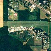 NAIP aerial image, 15 June 2006 | |||||||||||
| IATA: none – ICAO: none – FAA LID: 3M5 | |||||||||||
| Summary | |||||||||||
| Airport type | Public | ||||||||||
| Owner/Operator | Jerry Barnett | ||||||||||
| Location | Moontown, Alabama | ||||||||||
| Elevation AMSL | 650 ft / 198 m | ||||||||||
| Coordinates | 34°44′50″N 086°27′41″W / 34.74722°N 86.46139°W | ||||||||||
| Website | Moontown-Airport.com | ||||||||||
| Runways | |||||||||||
| |||||||||||
| Statistics (2009) | |||||||||||
| |||||||||||
Moontown Airport (FAA LID: 3M5) is a privately owned public-use airport located seven nautical miles (13 km) east of the central business district of Huntsville, a city in Madison County, Alabama, United States.[1] It is 16 miles (26 km) miles east of Huntsville International Airport (HSV).
Facilities and aircraft
Moontown Airport covers an area of 17 acres (6.9 ha) at an elevation of 650 feet (198 m) above mean sea level. It has one runway designated 9/27 with a turf surface measuring 2,180 by 160 feet (664 x 49 m).[1]
For the 12-month period ending April 22, 2009, the airport had 15,784 general aviation aircraft operations, an average of 43 per day. At that time there were 96 aircraft based at this airport: 86% single-engine, 2% multi-engine, 10% glider and 1% ultralight.[1]
Moontown Airport is the home base for the Huntsville Chapter of the EAA (Experimental Aircraft Association) and the Huntsville Soaring Club.
References
External links
- Moontown Airport, official website
- Airfield photos for 3M5 from Civil Air Patrol
- Huntsville Chapter EAA - Chapter 190, official website
- Resources for this airport:
- FAA airport information for 3M5
- AirNav airport information for 3M5
- FlightAware airport information and live flight tracker
- SkyVector aeronautical chart for 3M5