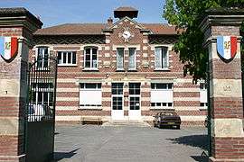
Angicourt
| Angicourt | |
|---|---|
 | |
 Angicourt | |
|
Location within Hauts-de-France region  Angicourt | |
| Coordinates: 49°18′45″N 2°30′16″E / 49.3125°N 2.5044°ECoordinates: 49°18′45″N 2°30′16″E / 49.3125°N 2.5044°E | |
| Country | France |
| Region | Hauts-de-France |
| Department | Oise |
| Arrondissement | Clermont |
| Canton | Liancourt |
| Intercommunality | Pays d’Oise et d’Halatte |
| Government | |
| • Mayor (2008–2014) | Christian Gressier |
| Area1 | 4.96 km2 (1.92 sq mi) |
| Population (2009)2 | 1,603 |
| • Density | 320/km2 (840/sq mi) |
| Time zone | CET (UTC+1) |
| • Summer (DST) | CEST (UTC+2) |
| INSEE/Postal code | 60013 / 60940 |
| Elevation | 38–120 m (125–394 ft) |
|
1 French Land Register data, which excludes lakes, ponds, glaciers > 1 km² (0.386 sq mi or 247 acres) and river estuaries. 2 Population without double counting: residents of multiple communes (e.g., students and military personnel) only counted once. | |
Angicourt is a commune in the Oise department in northern France.
Population
| Historical population | ||
|---|---|---|
| Year | Pop. | ±% |
| 1793 | 270 | — |
| 1800 | 268 | −0.7% |
| 1806 | 279 | +4.1% |
| 1821 | 256 | −8.2% |
| 1831 | 261 | +2.0% |
| 1836 | 272 | +4.2% |
| 1841 | 260 | −4.4% |
| 1846 | 260 | +0.0% |
| 1851 | 241 | −7.3% |
| 1856 | 231 | −4.1% |
| 1861 | 223 | −3.5% |
| 1866 | 260 | +16.6% |
| 1872 | 238 | −8.5% |
| 1876 | 239 | +0.4% |
| 1881 | 240 | +0.4% |
| 1886 | 216 | −10.0% |
| 1891 | 197 | −8.8% |
| 1896 | 198 | +0.5% |
| 1901 | 295 | +49.0% |
| 1906 | 249 | −15.6% |
| 1911 | 258 | +3.6% |
| 1921 | 395 | +53.1% |
| 1926 | 290 | −26.6% |
| 1931 | 620 | +113.8% |
| 1936 | 632 | +1.9% |
| 1946 | 724 | +14.6% |
| 1954 | 749 | +3.5% |
| 1962 | 571 | −23.8% |
| 1968 | 969 | +69.7% |
| 1975 | 1,363 | +40.7% |
| 1982 | 1,495 | +9.7% |
| 1990 | 1,538 | +2.9% |
| 1999 | 1,523 | −1.0% |
| 2006 | 1,653 | +8.5% |
| 2009 | 1,603 | −3.0% |
See also
References
| Wikimedia Commons has media related to Angicourt. |
This article is issued from Wikipedia - version of the 3/18/2013. The text is available under the Creative Commons Attribution/Share Alike but additional terms may apply for the media files.