Hénonville
| Hénonville | |
|---|---|
|
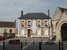
Town hall | |
 Hénonville | |
|
Location within Hauts-de-France region  Hénonville | |
| Coordinates: 49°12′28″N 2°03′14″E / 49.2078°N 2.0539°ECoordinates: 49°12′28″N 2°03′14″E / 49.2078°N 2.0539°E | |
| Country | France |
| Region | Hauts-de-France |
| Department | Oise |
| Arrondissement | Beauvais |
| Canton | Méru |
| Intercommunality | Sablons |
| Government | |
| • Mayor (2008–2014) | Pascal Van Themsche |
| Area1 | 6.84 km2 (2.64 sq mi) |
| Population (2012)2 | 788 |
| • Density | 120/km2 (300/sq mi) |
| Time zone | CET (UTC+1) |
| • Summer (DST) | CEST (UTC+2) |
| INSEE/Postal code | 60309 / 60119 |
| Elevation |
80–151 m (262–495 ft) (avg. 96 m or 315 ft) |
|
1 French Land Register data, which excludes lakes, ponds, glaciers > 1 km² (0.386 sq mi or 247 acres) and river estuaries. 2 Population without double counting: residents of multiple communes (e.g., students and military personnel) only counted once. | |
Hénonville is a commune in the Oise department in northern France.
See also
References
| Wikimedia Commons has media related to Hénonville. |
This article is issued from Wikipedia - version of the 7/21/2016. The text is available under the Creative Commons Attribution/Share Alike but additional terms may apply for the media files.