Rethondes
| Rethondes | ||
|---|---|---|
| ||
 Rethondes | ||
|
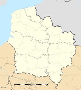
Location within Hauts-de-France region  Rethondes | ||
| Coordinates: 49°24′58″N 2°56′24″E / 49.416°N 2.94°ECoordinates: 49°24′58″N 2°56′24″E / 49.416°N 2.94°E | ||
| Country | France | |
| Region | Hauts-de-France | |
| Department | Oise | |
| Arrondissement | Compiègne | |
| Canton | Attichy | |
| Intercommunality | Canton d'Attichy | |
| Government | ||
| • Mayor (2014–2020) | Gérard Desmarest | |
| Area1 | 9.48 km2 (3.66 sq mi) | |
| Population (2013)2 | 745 | |
| • Density | 79/km2 (200/sq mi) | |
| Time zone | CET (UTC+1) | |
| • Summer (DST) | CEST (UTC+2) | |
| INSEE/Postal code | 60534 / 60153 | |
| Elevation |
33–110 m (108–361 ft) (avg. 38 m or 125 ft) | |
|
1 French Land Register data, which excludes lakes, ponds, glaciers > 1 km² (0.386 sq mi or 247 acres) and river estuaries. 2 Population without double counting: residents of multiple communes (e.g., students and military personnel) only counted once. | ||
Rethondes is a commune in the Oise department in northern France. It is associated with the signing of the armistice that ended World War I, although the actual location of the signing was on the other side of the Aisne in the commune of Compiègne. Rethondes was also where the armistice of World War II was signed by the Vichy government on June 22, 1940.[1]
Population
| Historical population | ||
|---|---|---|
| Year | Pop. | ±% |
| 1793 | 451 | — |
| 1806 | 539 | +19.5% |
| 1821 | 488 | −9.5% |
| 1831 | 629 | +28.9% |
| 1841 | 551 | −12.4% |
| 1851 | 529 | −4.0% |
| 1861 | 471 | −11.0% |
| 1872 | 421 | −10.6% |
| 1881 | 385 | −8.6% |
| 1891 | 379 | −1.6% |
| 1901 | 380 | +0.3% |
| 1911 | 389 | +2.4% |
| 1921 | 312 | −19.8% |
| 1931 | 318 | +1.9% |
| 1946 | 414 | +30.2% |
| 1954 | 353 | −14.7% |
| 1962 | 388 | +9.9% |
| 1968 | 451 | +16.2% |
| 1975 | 458 | +1.6% |
| 1982 | 504 | +10.0% |
| 1990 | 591 | +17.3% |
| 1999 | 668 | +13.0% |
| 2008 | 705 | +5.5% |
| 2013 | 745 | +5.7% |
See also
References
- ↑ Blay, Michel (2012). Les ordres du Chef: Culte de l'autorité et ambitions technocratiques : le CNRS sous Vichy. Paris: Armand Colin. pp. 1–26. ISBN 9782200277284 – via Cairn.info. (registration required (help)).
| Wikimedia Commons has media related to Rethondes. |
This article is issued from Wikipedia - version of the 4/10/2016. The text is available under the Creative Commons Attribution/Share Alike but additional terms may apply for the media files.
