Anvik, Alaska
| Anvik Gitr’ingithchagg | |
|---|---|
| City | |
 Anvik Location in Alaska | |
| Coordinates: 62°39′20″N 160°12′33″W / 62.65556°N 160.20917°WCoordinates: 62°39′20″N 160°12′33″W / 62.65556°N 160.20917°W | |
| Country | United States |
| State | Alaska |
| Census Area | Yukon-Koyukuk |
| Incorporated | October 6, 1969[1] |
| Government | |
| • Mayor | Jason Jones[2] |
| • State senator | Lyman Hoffman (D) |
| • State rep. | Bryce Edgmon (D) |
| Area | |
| • Total | 11.9 sq mi (30.9 km2) |
| • Land | 9.5 sq mi (24.6 km2) |
| • Water | 2.4 sq mi (6.3 km2) |
| Elevation | 52 ft (16 m) |
| Population (2010) | |
| • Total | 85 |
| Time zone | Alaska (AKST) (UTC-9) |
| • Summer (DST) | AKDT (UTC-8) |
| Zip code | 99558 |
| Area code | 907 |
| FIPS code | 02-03880 |
Anvik (Gitr’ingithchagg[3] in Deg Xinag) is a city, home to the Deg Hit'an people, in the Yukon-Koyukuk Census Area, Alaska, United States. The name Anvik, meaning "exit" in the Central Alaskan Yup'ik language, became the common usage despite multiple names at the time, and may have come from early Russian explorers. The native name in the Deg Xinag language is Deloy Ges. The population was 85 at the 2010 census.
Geography
Anvik is located at 62°39′20″N 160°12′33″W / 62.65556°N 160.20917°W (62.655659, -160.209237),[4] west of the Yukon River at the mouth of the Anvik River. It is 34 miles (55 km) to the north of Holy Cross. There is a public Anvik Airport (ANV) with a 2,960-foot (902 m) gravel runway located one mile (1.6 km) southeast of downtown Anvik. The students of Blackwell School have created a clickable interactive map of Anvik.
The Anvik Connector is a trail, designated a national side trail, which links the community to the Iditarod Trail 86 miles (138 km) to the east.
According to the United States Census Bureau, the city has a total area of 11.9 square miles (31 km2), of which 9.5 square miles (25 km2) is land and 2.4 square miles (6.2 km2) (20.44%) is water. It is considered an incorporated place (FIPS 55-3 Class C6).
Demographics
| Historical population | |||
|---|---|---|---|
| Census | Pop. | %± | |
| 1890 | 191 | — | |
| 1900 | 166 | −13.1% | |
| 1910 | 151 | −9.0% | |
| 1920 | 140 | −7.3% | |
| 1930 | 79 | −43.6% | |
| 1940 | 110 | 39.2% | |
| 1950 | 99 | −10.0% | |
| 1960 | 120 | 21.2% | |
| 1970 | 83 | −30.8% | |
| 1980 | 114 | 37.3% | |
| 1990 | 82 | −28.1% | |
| 2000 | 104 | 26.8% | |
| 2010 | 85 | −18.3% | |
| Est. 2015 | 84 | [5] | −1.2% |
At the 2000 census,[7] there were 104 people, 39 households and 23 families residing in the city. The population density was 10.9 per square mile (4.2/km²). There were 49 housing units at an average density of 5.2 per square mile (2.0/km²). The racial makeup of the city was 94 Native American, nine White, and one from other races. One also reported Hispanic or Latino ethnicity.
There were 39 households of which 41.0% had children under the age of 18 living with them, 30.8% were married couples living together, 25.6% had a female householder with no husband present, and 41.0% were non-families. 33.3% of all households were made up of individuals and 7.7% had someone living alone who was 65 years of age or older. The average household size was 2.67 and the average family size was 3.43.
Age distribution was 34 under the age of 15, 6 from 16 to 18, 9 from 18 to 24, 28 from 25 to 44, 19 from 45 to 64, and 8 who were 65 years of age or older. The average age was 30.14 and the median age was 28.5 years, compared to 32.4 for the entire state. There were 57 males (35 over 18) and 47 females (29 over 18).
The annual median household income was $21,250, and the median family income was $18,125. Males had a median income of $0 versus $18,750 for females. The per capita income for the city was $8,081 (compare $21,587 nationally). Median rent was $263 and monthly housing and mortgage costs were $833. There were 40.0% of families and 44.2% of the population living below the poverty line, including 45.5% of under eighteens and 50.0% of those over 64.
References
- ↑ "Directory of Borough and City Officials 1974". Alaska Local Government. Juneau: Alaska Department of Community and Regional Affairs. XIII (2): 19. January 1974.
- ↑ 2015 Alaska Municipal Officials Directory. Juneau: Alaska Municipal League. 2015. p. 33.
- ↑ ankn.uaf.edu: Deg Xinag Ałixi Ni’elyoy / Deg Xinag Learners' Dictionary (2007)
- ↑ "US Gazetteer files: 2010, 2000, and 1990". United States Census Bureau. 2011-02-12. Retrieved 2011-04-23.
- ↑ "Annual Estimates of the Resident Population for Incorporated Places: April 1, 2010 to July 1, 2015". Retrieved July 2, 2016.
- ↑ "Census of Population and Housing". Census.gov. Archived from the original on May 11, 2015. Retrieved June 4, 2015.
- ↑ "American FactFinder". United States Census Bureau. Archived from the original on 2013-09-11. Retrieved 2008-01-31.
Further reading
- Ekada, Patricia J. "Athabascan Culture-From the Lower Yukon Area".
External links
- Anvik at the Community Database Online from the Alaska Division of Community and Regional Affairs
- Maps from the Alaska Department of Labor and Workforce Development: 2000, 2010
- Anvik Tribal Council
- Anvik Historical Society
- Blackwell School in Anvik
- Alaska Department of Community and Economic Development. "The History of Anvik". ExploreNorth. Retrieved 2008-03-22.
- "Anvik, AK Community Profile" (.cfm). AK HomeTownLocator. HTL, Inc. 2008. Retrieved 2008-03-22.
- "Anvik, Alaska Detailed Profile". On Board LLC. 2008. Retrieved 2008-03-22.
- "Anvik, Alaska city profile". ePodunk Inc. 2007. Retrieved 2008-03-22.
Municipalities and communities of Yukon–Koyukuk Census Area, Alaska, United States | ||
|---|---|---|
| Cities | 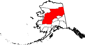 | |
| CDPs | ||
| Unincorporated communities | ||
| Ghost towns | ||