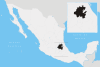
Apan
For other uses, see Apan (disambiguation).
| Apan | ||
|---|---|---|
| Municipality and city | ||
 | ||
| ||
|
Apan Location in Mexico | ||
| Coordinates: 19°42′N 98°26′W / 19.700°N 98.433°WCoordinates: 19°42′N 98°26′W / 19.700°N 98.433°W | ||
| Country |
| |
| State | Hidalgo | |
| Municipal seat | Apan | |
| Area | ||
| • Total | 346.9 km2 (133.9 sq mi) | |
| Elevation | 2,468 m (8,097 ft) | |
| Population (2005) | ||
| • Total | 39,247 | |
| Time zone | CST (UTC-6) | |
| • Summer (DST) | CDT (UTC-5) | |
| Website | Apan.blogia.com | |

Apan is a city and one of the 84 municipalities of Hidalgo, in central-eastern Mexico. The municipality covers an area of 346.9 km².
Overview
As of 2005, the municipality had a total population of 39,247.[1]
It was an important site in the War of Independence (1810-1821). It is a center for the production of pulque and for the sport of charrería, or Mexican rodeo. But the town historians has denied that since there are material evidence that this happened on this town .
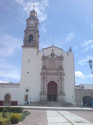
Gallery
-
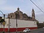
Church
-
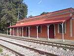
Railway station
References
- ↑ "Apan". Enciclopedia de los Municipios de México. Instituto Nacional para el Federalismo y el Desarrollo Municipal. Retrieved December 27, 2008.
External links
![]() Media related to Apan at Wikimedia Commons
Media related to Apan at Wikimedia Commons
This article is issued from Wikipedia - version of the 8/4/2016. The text is available under the Creative Commons Attribution/Share Alike but additional terms may apply for the media files.