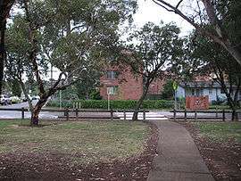
Ashcroft, New South Wales
| Ashcroft Sydney, New South Wales | |||||||||||||
|---|---|---|---|---|---|---|---|---|---|---|---|---|---|
 | |||||||||||||
| Population | 3,308 (2011 census)[1] | ||||||||||||
| Established | 1972 | ||||||||||||
| Postcode(s) | 2168 | ||||||||||||
| Location | 35 km (22 mi) south-west of Sydney CBD | ||||||||||||
| LGA(s) | City of Liverpool | ||||||||||||
| State electorate(s) | Liverpool | ||||||||||||
| Federal Division(s) | Werriwa | ||||||||||||
| |||||||||||||
Ashcroft is a suburb of Sydney, in the state of New South Wales, Australia 35 kilometres south-west of the Sydney central business district, in the local government area of the City of Liverpool.
History
The suburb was formed as part of the Housing Commission's Green Valley development. It was named Ashcroft after the pioneering family in the district that gave the land for the site of this development. The Ashcroft family was active in establishing meat wholesaling and retailing activities at the Homebush abattoir. E.J. Ashcroft was a butcher at Liverpool in the 1890s. Although named earlier, Ashcroft was officially gazetted on 7 April 1972. Ashcroft Post Office opened on 3 May 1965 and closed in 1985.[2]
Demographics
According to the 2011 census of Population, there were 3,308 residents in Ashcroft. 57.7% of residents were born in Australia. The most common other countries of birth were Lebanon 6.0%, Vietnam 5.6% and Iraq 2.6%. 45.2% of residents spoke only English at home. Other languages spoken at home included Arabic 19.4%, Vietnamese 8.8% and Samoan 2.3%. The most common responses for religious affiliation were Catholic 26.9%, Islam 19.3% and Anglican 15.1%.[3]
Notable residents
- Childhood home of Mark Latham, former leader of the Australian Labor Party.[4]
- Joseph Gatehau, finalist on the 2006 series of Australian Idol.
- X-Factor finalists Mahogany (9th contestants eliminated) attended Ashcroft High School.
- Brad Fittler - a Rugby league great, a former Ashcroft resident and also attended Ashcroft High School.
- Jason Taylor - former Rugby league player and former coach of the South Sydney Rabbitohs, a former Ashcroft resident and also attended Ashcroft High School.
- Ben Te'o - Rugby league player with South Sydney Rabbitohs attended Ashcroft High School.
Notable events
Ashcroft High School were the first co-educational school to win the Amco Shield (now called the Arrive Alive Cup). They won the Amco Shield in 1977 and again in 1985. In 1976, Ashcroft became the first City school to win the University Shield for 31 years and went on to win it again in 1977, 1984 and 1985.
References
- ↑ http://www.censusdata.abs.gov.au/census_services/getproduct/census/2011/quickstat/SSC10062?opendocument&navpos=220
- ↑ Premier Postal History. "Post Office List". Premier Postal Auctions. Retrieved 16 June 2012.
- ↑ Australian Bureau of Statistics (31 October 2012). "Ashcroft (State Suburb)". 2011 Census QuickStats. Retrieved 28 April 2013.
- ↑ Lagan, Bernard (2005). Loner: inside a Labor tragedy. Crows Nest, NSW: Allen & Unwin. pp. 41–42. ISBN 1-74114-515-5.
- The Book of Sydney Suburbs, Compiled by Frances Pollen, Angus & Robertson Publishers, 1990, Published in Australia ISBN 0-207-14495-8
Coordinates: 33°55′18″S 150°53′43″E / 33.92165°S 150.89541°E
| Wikimedia Commons has media related to Ashcroft, New South Wales. |