Ate District
| Ate | |
|---|---|
| District | |
 | |
|
Location of Ate in Lima | |
| Coordinates: 12°00′37″S 76°52′12″W / 12.01028°S 76.87000°WCoordinates: 12°00′37″S 76°52′12″W / 12.01028°S 76.87000°W | |
| Country |
|
| Region | Lima |
| Province | Lima |
| Capital | Vitarte |
| Government | |
| • Mayor | Oscar Benavides |
| Area | |
| • Total | 77.72 km2 (30.01 sq mi) |
| Elevation | 355 m (1,165 ft) |
| Population (2005 census) | |
| • Total | 478,278 |
| • Density | 6,200/km2 (16,000/sq mi) |
| Time zone | PET (UTC-5) |
| UBIGEO | 150103 |
| Website | muniate.gob.pe |
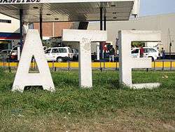
Ate, also known as Ate-Vitarte, is a district of the Lima Province in Peru. Located in the eastern part of the province, it is one of the districts that comprise the city of Lima.
Geography
The district has a total land area of 77.72 km². Its administrative center is located 355 meters above sea level.
Boundaries
- North: Lurigancho
- East: Santa Anita, Chaclacayo, Cieneguilla
- South: Santiago de Surco, La Molina
- West: San Borja, San Luis
Demographics
According to the 2007 census by the INEI, the district has 478,278 inhabitants and a population density of 6,154 persons/km². In 2005, there were 105,190 households in the district. It is the 13th most populated district in Lima.
Points of interest
- Stadium "Estadio Monumental de Universitario de Deportes", home of one of the most popular football teams in Perú.
- Puruchuco Archeological Site
- Huaycan Archeological Site
External links
This article is issued from Wikipedia - version of the 10/20/2016. The text is available under the Creative Commons Attribution/Share Alike but additional terms may apply for the media files.