List of districts of Lima
The province of Lima is divided into forty-three districts of Lima (Spanish: distritos) which are administered by the Metropolitan Municipality of Lima[1] The urban area of Lima is generally considered to be formed by thirty of these districts. The remaining thirteen districts consist of mostly rural and sparsely populated desert and mountainous areas. Of these peripheral districts, many of the coastal ones serve as beach resorts and their population, which is considerably smaller than that of the urban districts, increases during the summer months.
Districts of Lima
Area and population information on the following list has been retrieved from official data by the Peruvian National Institute of Statistics and Informatics (Spanish: Instituto Nacional de Estadística e Informática, INEI).[2] Demographic data is based on the 2005 Census carried out from 18 July through 20 August 2005. Population density is given to one decimal place in persons per square kilometer. UBIGEO numbers are codes used by INEI to identify national administrative subdivisions. Foundation dates have been retrieved from a compilation by the Peruvian Congress published in 2000.[3]
| Districts |
UBIGEO |
Area (km²) |
Population |
Population density (/km²) |
Created |
Postal code |
Location |
|---|---|---|---|---|---|---|---|
| Ancón | 150102 | 299.22 | 29,419 | 98.3 | 29 October 1874 | 02 |  |
| Ate | 150103 | 77.72 | 419,663 | 5,399.7 | 2 January 1857 | 03 |  |
| Barranco | 150104 | 3.33 | 45,922 | 13,790.4 | 26 October 1874 | 04 |  |
| Breña | 150105 | 3.22 | 94,808 | 29,443.5 | 15 July 1949 | 05 |  |
| Carabayllo | 150106 | 346.88 | 188,764 | 544.2 | 4 August 1821 | 06 | 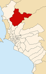 |
| Chaclacayo | 150107 | 39.5 | 39,686 | 1,004.7 | 24 April 1940 | 08 |  |
| Chorrillos | 150108 | 38.94 | 262,595 | 6,743.6 | 2 January 1857 | 09 | 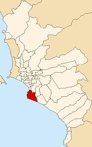 |
| Cieneguilla | 150109 | 240.33 | 15,784 | 65.7 | 3 March 1970 | 40 |  |
| Comas | 150110 | 48.75 | 464,745 | 9,533.2 | 12 December 1961 | 07 | 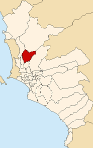 |
| El Agustino | 150111 | 12.54 | 165,425 | 13,191.8 | 6 January 1965 | 10 |  |
| Independencia | 150112 | 14.56 | 197,308 | 13,551.4 | 16 March 1964 | 28 |  |
| Jesús María | 150113 | 4.57 | 58,588 | 12,820.1 | 13 December 1963 | 11 | 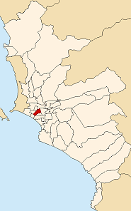 |
| La Molina | 150114 | 65.75 | 124,468 | 1,893.0 | 6 February 1962 | 12 | 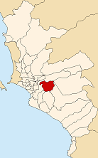 |
| La Victoria | 150115 | 8.74 | 190,218 | 21,764.1 | 16 August 1921 | 13 |  |
| Lima | 150101 | 21.88 | 278,804 | 13,187.2 | 2 January 1857 | 01 |  |
| Lince | 150116 | 3.03 | 52,123 | 17,202.3 | 20 May 1936 | 14 |  |
| Los Olivos | 150117 | 18.25 | 286,549 | 15,701.3 | 7 April 1989 | 39 |  |
| Lurigancho | 150118 | 236.47 | 90,594 | 383.1 | 2 January 1857 | 15 | 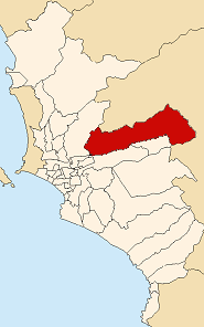 |
| Lurín | 150119 | 181.12 | 55,953 | 308.9 | 2 January 1857 | 16 |  |
| Magdalena del Mar | 150120 | 3.61 | 48,445 | 13,419.7 | 10 May 1920 | 17 |  |
| Miraflores | 150122 | 9.62 | 92,815 | 9,648.1 | 2 January 1857 | 18 | .png) |
| Pachacamac | 150123 | 160.23 | 54,763 | 341.8 | 2 January 1857 | 19 |  |
| Pucusana | 150124 | 37.83 | 9,231 | 244.0 | 22 January 1943 | 20 |  |
| Pueblo Libre | 150121 | 4.38 | 71,892 | 16,413.7 | 2 January 1857 | 21 |  |
| Puente Piedra | 150125 | 71.18 | 203,473 | 2,858.6 | 14 February 1927 | 22 |  |
| Punta Hermosa | 150126 | 119.5 | 4,676 | 39.1 | 7 April 1954 | 24 |  |
| Punta Negra | 150127 | 130.5 | 4,473 | 34.3 | 7 April 1954 | 23 |  |
| Rímac | 150128 | 11.87 | 175,793 | 14,809.9 | 16 August 1921 | 25 |  |
| San Bartolo | 150129 | 45.01 | 5,733 | 127.4 | 5 May 1946 | 26 | 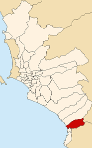 |
| San Borja | 150130 | 9.96 | 102,762 | 10,317.5 | 1 June 1983 | 41 |  |
| San Isidro | 150131 | 11.1 | 55,309 | 6,165.6 | 24 April 1931 | 27 | 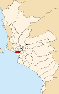 |
| San Juan de Lurigancho | 150132 | 131.25 | 812,656 | 6,191.7 | 13 January 1967 | 36 |  |
| San Juan de Miraflores | 150133 | 23.98 | 335,237 | 13,979.9 | 12 January 1965 | 29 |  |
| San Luis | 150134 | 3.49 | 46,258 | 13,254.4 | 30 May 1968 | 30 |  |
| San Martín de Porres | 150135 | 36.91 | 525,155 | 14,228.0 | 22 May 1950 | 31 | 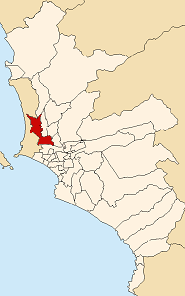 |
| San Miguel | 150136 | 10.72 | 124,904 | 11,651.5 | 10 May 1920 | 32 |  |
| Santa Anita | 150137 | 10.69 | 160,777 | 15,039.9 | 26 October 1989 | 43 |  |
| Santa María del Mar District | 150138 | 9.81 | 88 | 9.0 | 16 January 1962 | 37 |  |
| Santa Rosa | 150139 | 21.5 | 9,379 | 436.2 | 7 February 1962 | 38 | 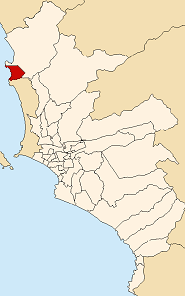 |
| Santiago de Surco | 150140 | 34.75 | 272,690 | 7,847.2 | 16 December 1929 | 33 | 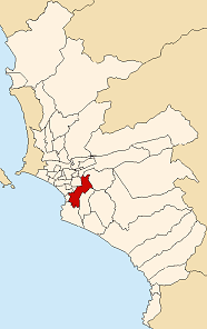 |
| Surquillo | 150141 | 3.46 | 84,202 | 24,335.8 | 15 July 1949 | 34 |  |
| Villa El Salvador | 150142 | 35.46 | 367,436 | 10,362.0 | 1 June 1983 | 42 | 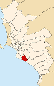 |
| Villa María del Triunfo | 150143 | 70.57 | 355,761 | 5,041.2 | 28 December 1961 | 35 |  |
See also
References
- ↑ Municipalidad Lima. Municipalidad Lima. Retrieved 24 March 2008.
- ↑ Instituto Nacional de Estadística e Informática. Banco de Información Distrital. Retrieved on 24 March 2008.
- ↑ Carmen Lozada de Gamboa, Perú: demarcación territorial, vol. II, pp. 405–414.