Lurín District
| Lurín | ||
|---|---|---|
| District | ||
| ||
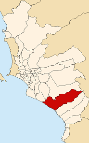 Location of Lurín in the Lima province | ||
| Country |
| |
| Region | Lima | |
| Province | Lima | |
| Founded | January 2, 1857 | |
| Capital | Lurín | |
| Government | ||
| • Mayor | Juan Jorge Marticorena Cuba | |
| Area | ||
| • Total | 181.12 km2 (69.93 sq mi) | |
| Elevation | 9 m (30 ft) | |
| Population (2005 census) | ||
| • Total | 55,953 | |
| • Density | 310/km2 (800/sq mi) | |
| Time zone | PET (UTC-5) | |
| UBIGEO | 150119 | |
| Website | munilurin.gob.pe | |

The valley of Lurín is a district of the Lima Province in Peru. Known for its archaeological temple of Pachacamac, the Pachacamac Island or "La Ballena", countryside areas, villages, fincas, rural restaurants, nightlife and beaches, it is one of the three valleys of the city of Lima.
Boundaries
It borders on the north with the districts of Pachacamac, Villa María del Triunfo, and Villa el Salvador, to the east also with the Pachacamac District, to the south with Punta Hermosa, and to the west with the Pacific Ocean.
General information
It was created on January 2, 1857, and since then it has been an agricultural district as it is located in the center of the Lurín River valley. It has a few beaches which receive tourists during the summer months (December-March) principally from the city of Lima which it is gradually being incorporated into. Important Peruvian social clubs are located in this district, mainly one of the two most popular football clubs in Peru: Alianza Lima and Universitario de Deportes.This southern suburb of Lima benefits from industrial activities along the Panamericana highway like Unique -Yanbal factory and an industrial park "Las Praderas" where important companies like Owens Illinois operate
See also
Coordinates: 12°16′45″S 76°52′30″W / 12.27917°S 76.87500°W