Au Gres, Michigan
| Au Gres, Michigan | |
|---|---|
| City | |
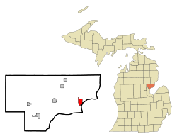 Location of Au Gres, Michigan | |
| Coordinates: 44°2′37″N 83°41′20″W / 44.04361°N 83.68889°W | |
| Country | United States |
| State | Michigan |
| County | Arenac |
| Area[1] | |
| • Total | 2.33 sq mi (6.03 km2) |
| • Land | 2.23 sq mi (5.78 km2) |
| • Water | 0.10 sq mi (0.26 km2) |
| Elevation | 587 ft (179 m) |
| Population (2010)[2] | |
| • Total | 889 |
| • Estimate (2012[3]) | 868 |
| • Density | 398.7/sq mi (153.9/km2) |
| Time zone | Eastern (EST) (UTC-5) |
| • Summer (DST) | EDT (UTC-4) |
| ZIP code | 48703 |
| Area code(s) | 989 |
| FIPS code | 26-04120[4] |
| GNIS feature ID | 0620321[5] |
| Website | City of Au Gres, Michigan |
Au Gres is a city in Arenac County in the U.S. state of Michigan. The population was 889 at the 2010 census. It was first settled in 1862.[6]
Geography
According to the United States Census Bureau, the city has a total area of 2.33 square miles (6.03 km2), of which 2.23 square miles (5.78 km2) is land and 0.10 square miles (0.26 km2) is water.[1]
Demographics
| Historical population | |||
|---|---|---|---|
| Census | Pop. | %± | |
| 1910 | 252 | — | |
| 1920 | 199 | −21.0% | |
| 1930 | 203 | 2.0% | |
| 1940 | 317 | 56.2% | |
| 1950 | 442 | 39.4% | |
| 1960 | 584 | 32.1% | |
| 1970 | 564 | −3.4% | |
| 1980 | 768 | 36.2% | |
| 1990 | 838 | 9.1% | |
| 2000 | 1,028 | 22.7% | |
| 2010 | 889 | −13.5% | |
| Est. 2015 | 859 | [7] | −3.4% |
2010 census
As of the census[2] of 2010, there were 889 people, 435 households, and 233 families residing in the city. The population density was 398.7 inhabitants per square mile (153.9/km2). There were 598 housing units at an average density of 268.2 per square mile (103.6/km2). The racial makeup of the city was 97.5% White, 0.4% Native American, 0.1% from other races, and 1.9% from two or more races. Hispanic or Latino of any race were 1.9% of the population.
There were 435 households of which 20.5% had children under the age of 18 living with them, 36.6% were married couples living together, 11.7% had a female householder with no husband present, 5.3% had a male householder with no wife present, and 46.4% were non-families. 41.1% of all households were made up of individuals and 17.7% had someone living alone who was 65 years of age or older. The average household size was 2.00 and the average family size was 2.65.
The median age in the city was 49.8 years. 17.9% of residents were under the age of 18; 6.8% were between the ages of 18 and 24; 19.4% were from 25 to 44; 30.3% were from 45 to 64; and 25.5% were 65 years of age or older. The gender makeup of the city was 52.1% male and 47.9% female.
2000 census
As of the census[4] of 2000, there were 1,028 people, 468 households, and 285 families residing in the city. The population density was 450.1 per square mile (174.1/km²). There were 733 housing units at an average density of 321.0 per square mile (124.1/km²). The racial makeup of the city was 95.43% White, 0.29% African American, 1.17% Native American, 0.29% Asian, 0.10% Pacific Islander, and 2.72% from two or more races. Hispanic or Latino of any race were 0.49% of the population.
There were 468 households out of which 24.6% had children under the age of 18 living with them, 47.2% were married couples living together, 9.8% had a female householder with no husband present, and 39.1% were non-families. 35.0% of all households were made up of individuals and 15.6% had someone living alone who was 65 years of age or older. The average household size was 2.15 and the average family size was 2.76.
In the city the population was spread out with 21.1% under the age of 18, 8.5% from 18 to 24, 23.6% from 25 to 44, 25.6% from 45 to 64, and 21.2% who were 65 years of age or older. The median age was 43 years. For every 100 females there were 98.8 males. For every 100 females age 18 and over, there were 92.2 males.
The median income for a household in the city was $24,511, and the median income for a family was $34,348. Males had a median income of $26,641 versus $18,295 for females. The per capita income for the city was $15,229. About 17.5% of families and 17.5% of the population were below the poverty line, including 29.0% of those under age 18 and 10.9% of those age 65 or over.
Transportation
Major highways
 US 23 serves Au Gres on its way along the Lake Huron shoreline. It has been designated the Sunrise Side Coastal Highway, and runs along (or parallels) the Lake Huron shore.
Bus
- Indian Trails provides daily intercity bus service between St. Ignace and Bay City, Michigan.[9]
Attractions
- A ferry service runs from mid-May to mid-October from Au Gres to Charity Island, which is ten miles (16 km) to the east in the middle of Saginaw Bay.[10]
- There are many recurring local events. A calendar is available.[11]
References
Notes
- 1 2 "US Gazetteer files 2010". United States Census Bureau. Archived from the original on January 24, 2012. Retrieved 2012-11-25.
- 1 2 "American FactFinder". United States Census Bureau. Retrieved 2012-11-25.
- ↑ "Population Estimates". United States Census Bureau. Archived from the original on June 17, 2013. Retrieved 2013-06-03.
- 1 2 "American FactFinder". United States Census Bureau. Archived from the original on September 11, 2013. Retrieved 2008-01-31.
- ↑ "US Board on Geographic Names". United States Geological Survey. 2007-10-25. Retrieved 2008-01-31.
- ↑ Romig 1986, p. 35.
- ↑ "Annual Estimates of the Resident Population for Incorporated Places: April 1, 2010 to July 1, 2015". Retrieved July 2, 2016.
- ↑ "Census of Population and Housing". Census.gov. Archived from the original on May 11, 2015. Retrieved June 4, 2015.
- ↑ "BAY CITY-ALPENA-CHEBOYGAN-ST. IGNACE" (PDF). Indian Trails. March 19, 2013. Archived from the original (PDF) on 2013-07-24. Retrieved 2013-04-03.
- ↑ Charity Island ferry service.
- ↑ Au Gres Chamber of Commerce.
Sources
- Romig, Walter (October 1, 1986) [1973]. Michigan Place Names: The History of the Founding and the Naming of More Than Five Thousand Past and Present Michigan Communities. Great Lakes Books Series (Paperback). Detroit, Michigan: Wayne State University Press. ISBN 081431838X. ISBN 978-0814318386.
External links
Municipalities and communities of Arenac County, Michigan, United States | ||
|---|---|---|
| Cities |  | |
| Villages | ||
| Townships | ||
| Unincorporated community | ||
Coordinates: 44°02′55″N 83°41′45″W / 44.04861°N 83.69583°W