Augusta, Wisconsin
| Augusta, Wisconsin | |
|---|---|
| City | |
 Location of Augusta within Wisconsin | |
| Coordinates: 44°40′47″N 91°7′22″W / 44.67972°N 91.12278°WCoordinates: 44°40′47″N 91°7′22″W / 44.67972°N 91.12278°W | |
| Country | United States |
| State | Wisconsin |
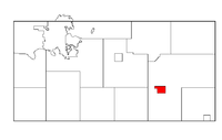
| County | Eau Claire |
| Area[1] | |
| • Total | 2.19 sq mi (5.67 km2) |
| • Land | 2.19 sq mi (5.67 km2) |
| • Water | 0 sq mi (0 km2) |
| Elevation[2] | 961 ft (293 m) |
| Population (2010)[3] | |
| • Total | 1,550 |
| • Estimate (2012[4]) | 1,558 |
| • Density | 707.8/sq mi (273.3/km2) |
| Time zone | Central (CST) (UTC-6) |
| • Summer (DST) | CDT (UTC-5) |
| ZIP Code | 54722 |
| Area code(s) | 715 & 534 |
| FIPS code | 55-03825[5] |
| GNIS feature ID | 1561013[2] |
| Website |
cityofaugusta |
Augusta is a city in Eau Claire County, Wisconsin, United States. The population was 1,550 at the 2010 census. The city is bordered by the Town of Bridge Creek.
History
A post office has been in operation in Augusta since 1858.[6] The city was named in 1856 after Augusta, Maine.[7]
Geography
Augusta is located at 44°40′47″N 91°7′22″W / 44.67972°N 91.12278°W (44.679656, -91.122664).[8]
According to the United States Census Bureau, the city has a total area of 2.19 square miles (5.67 km2), all of it land.[1] There are 2 class 2 trout fishing streams in Augusta, Bridge Creek and its tributary Diamond Valley Creek.[9]
Demographics
| Historical population | |||
|---|---|---|---|
| Census | Pop. | %± | |
| 1870 | 761 | — | |
| 1880 | 1,116 | 46.6% | |
| 1890 | 1,187 | 6.4% | |
| 1900 | 1,256 | 5.8% | |
| 1910 | 1,405 | 11.9% | |
| 1920 | 1,407 | 0.1% | |
| 1930 | 1,359 | −3.4% | |
| 1940 | 1,519 | 11.8% | |
| 1950 | 1,458 | −4.0% | |
| 1960 | 1,338 | −8.2% | |
| 1970 | 1,242 | −7.2% | |
| 1980 | 1,560 | 25.6% | |
| 1990 | 1,510 | −3.2% | |
| 2000 | 1,460 | −3.3% | |
| 2010 | 1,550 | 6.2% | |
| Est. 2015 | 1,532 | [10] | −1.2% |
2010 census
As of the census[3] of 2010, there were 1,550 people, 614 households, and 384 families residing in the city. The population density was 707.8 inhabitants per square mile (273.3/km2). There were 662 housing units at an average density of 302.3 per square mile (116.7/km2). The racial makeup of the city was 97.7% White, 0.3% African American, 0.4% Native American, 0.2% from other races, and 1.5% from two or more races. Hispanic or Latino of any race were 3.1% of the population.
There were 614 households of which 32.2% had children under the age of 18 living with them, 45.6% were married couples living together, 10.1% had a female householder with no husband present, 6.8% had a male householder with no wife present, and 37.5% were non-families. 31.6% of all households were made up of individuals and 14.5% had someone living alone who was 65 years of age or older. The average household size was 2.43 and the average family size was 3.05.
The median age in the city was 39.9 years. 25.2% of residents were under the age of 18; 6.7% were between the ages of 18 and 24; 24% were from 25 to 44; 24% were from 45 to 64; and 20% were 65 years of age or older. The gender makeup of the city was 48.9% male and 51.1% female.
2000 census
As of the census[5] of 2000, there were 1,460 people, 599 households, and 376 families residing in the city. The population density was 721.5 people per square mile (279.1/km²). There were 632 housing units at an average density of 312.3 per square mile (120.8/km²). The racial makeup of the city was 96.58% White, 0.41% African American, 2.05% Native American, 0.07% Asian, 0.21% from other races, and 0.68% from two or more races. Hispanic or Latino of any race were 1.30% of the population.
There were 599 households out of which 29.0% had children under the age of 18 living with them, 47.6% were married couples living together, 11.7% had a female householder with no husband present, and 37.2% were non-families. 32.9% of all households were made up of individuals and 21.5% had someone living alone who was 65 years of age or older. The average household size was 2.36 and the average family size was 3.01.
In the city the population was spread out with 25.0% under the age of 18, 7.5% from 18 to 24, 24.5% from 25 to 44, 20.1% from 45 to 64, and 22.9% who were 65 years of age or older. The median age was 40 years. For every 100 females there were 84.3 males. For every 100 females age 18 and over, there were 82.5 males.
The median income for a household in the city was $28,478, and the median income for a family was $37,500. Males had a median income of $31,023 versus $19,226 for females. The per capita income for the city was $15,469. About 10.1% of families and 11.0% of the population were below the poverty line, including 13.4% of those under age 18 and 7.3% of those age 65 or over.
Education
Augusta High School is the local public high school.
Events
Each year, Augusta celebrates Independence Day and the founding of the town with a Bean and Bacon Days celebration. The festival includes a parade and street fair. The celebration was first established with that name in 1977 by the August Business Association and the Lions Club. The annual sponsor of the celebration is Bush Brothers and Company[12]
Notable people
- Ira B. Bradford, Wisconsin State Assemblyman, lived in Augusta.
- George F. Caldwell, Wisconsin State Assemblyman, lived in Augusta.
- Dan Devine, former head coach of the Green Bay Packers and the Notre Dame Fighting Irish, was born in Augusta.
- Davis A. Donnelly, Wisconsin State Senator, was born in Augusta.
- Oscar Finch, Wisconsin State Assemblyman, was Mayor of Augusta.
- Charles F. Hanke, Wisconsin State Assemblyman, was a member of the Augusta city council.
- Lester Johnson, U.S. Representative, died in Augusta.
- Bernard H. Raether, Wisconsin State Assemblyman, was Chairman, Clerk and Assessor of Augusta.
References
- 1 2 "US Gazetteer files 2010". United States Census Bureau. Archived from the original on January 24, 2012. Retrieved 2012-11-18.
- 1 2 "US Board on Geographic Names". United States Geological Survey. 2007-10-25. Retrieved 2008-01-31.
- 1 2 "American FactFinder". United States Census Bureau. Retrieved 2012-11-18.
- ↑ "Population Estimates". United States Census Bureau. Archived from the original on June 17, 2013. Retrieved 2013-06-24.
- 1 2 "American FactFinder". United States Census Bureau. Archived from the original on September 11, 2013. Retrieved 2008-01-31.
- ↑ "Eau Claire County". Jim Forte Postal History. Retrieved 2 April 2015.
- ↑ Chicago and North Western Railway Company (1908). A History of the Origin of the Place Names Connected with the Chicago & North Western and Chicago, St. Paul, Minneapolis & Omaha Railways. p. 167.
- ↑ "US Gazetteer files: 2010, 2000, and 1990". United States Census Bureau. 2011-02-12. Retrieved 2011-04-23.
- ↑ name ="Wisconsin Department of Natural Resources">"Wisconsin Department of Natural Resources 2013". http://dnr.wi.gov/topic/fishing/documents/trout/trout_maps/EauClaire_color_landscape.pdf. External link in
|publisher=(help); - ↑ "Annual Estimates of the Resident Population for Incorporated Places: April 1, 2010 to July 1, 2015". Retrieved July 2, 2016.
- ↑ "Census of Population and Housing". Census.gov. Archived from the original on May 11, 2015. Retrieved June 4, 2015.
- ↑ Pearl, Emma (May 2003). "Last Testimony of Sister Emma". Wisconsin West Magazine. 16-17: 120.
External links
- City of Augusta
- Sanborn fire insurance maps: 1894 1903 1910
Municipalities and communities of Eau Claire County, Wisconsin, United States | ||
|---|---|---|
| Cities | 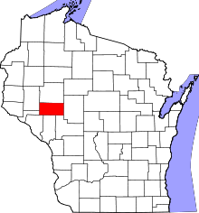 | |
| Villages | ||
| Towns | ||
| CDP | ||
| Unincorporated communities | ||
| Ghost towns | ||
| Footnotes | ‡This populated place also has portions in an adjacent county or counties | |