Ballintra
| Ballintra Baile an tSratha | |
|---|---|
| Town | |
|
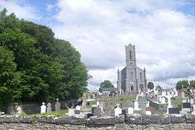
Ballintra Church of Ireland | |
 Ballintra Location in Ireland | |
| Coordinates: 54°34′30″N 8°07′24″W / 54.5749°N 8.1234°WCoordinates: 54°34′30″N 8°07′24″W / 54.5749°N 8.1234°W | |
| Country | Ireland |
| Province | Ulster |
| County | County Donegal |
| Population (2006) | |
| • Urban | 211 |
| Time zone | WET (UTC+0) |
| • Summer (DST) | IST (WEST) (UTC-1) |
| Irish Grid Reference | G917700 |

Ballintra (Irish: Baile an tSratha) is a village in the parish of Drumholm in the south of County Donegal, Ireland just off the N15 between Donegal town and Ballyshannon. The village is geographically situated in a limestone area and this natural resource is quarried locally for the building and civil engineering industries.
Ballintra lies on the northern bank of the Blackwater river. (The river is sometimes referred to as Ballintra River). The river rises in the hills that lie inland from the town, and flows through a number of small lakes before spilling over a small waterfall in a narrow gorge behind the village. The Blackwater runs low in summer, hence the name Baile an tSratha, town of the stream or dried-up river.
Ballintra has two public houses (Jamesie's and the Bay Bush), a grocery store, a takeaway, a hairdresser, two primary schools (St. Ernan's NS and The Robertson NS) and three churches (Methodist, Church of Ireland, and Roman Catholic). Ballintra is also situated close to Rossnowlagh and Murvagh beaches. Murvagh is also the home to the Donegal golf club.
Places of interest
- A minor road linking the hills with the coast at Rossnowlagh crosses the old N15 in Ballintra. Where these roads cross at the centre of the village stood a tree called the Bay Bush. In the 1980s, the tree was deemed unsafe and was felled. The pub at the crossroads bears its name.
Sport
- Ballintra is one of the greatest sporting towns in Donegal. Every August bank holiday, people are attracted to the Ballintra Races, in which horse races are held on in a field close to a nearby beach (Murvagh). Proceeds from this go to local amenities in the area.[1]

- The local G.A.A. club is called Naomh Bríd (club also includes Laghey).
- The local Soccer club is called Copany Rovers (club also includes Laghey).
People
- Thomas Morrow (Australian politician) was born in Ballintra.
- Canadian scholar Leonard Boyle was born in Ballintra.
- St Asacus is buried in Ballymagroarty, Ballintra. He was St Patrick's blacksmith and was travelling from Elphin, County Roscommon en route County Down. Famous Gaelic football players include Matt Gallagher, David Walsh, Darragh Brogan, John O'Brien and the late Pauric Gallagher.
Popular Music
Ballintra is the backdrop to a Gaelic Storm song entitled "Darcy's Donkey" (from the album What's the Rumpus?). The song includes references to the town, the August horse races, and Jamesie's bar.
Transport
- Ballintra railway station opened on 21 September 1905, but finally closed on 1 January 1960.[2] The station was on the County Donegal Railways Joint Committee network.
Social History
The people of Ballintra and the parish of Drumholm belong mainly to three religious denominations - Methodist, Church of Ireland, and Roman Catholic. The first of these are a minority and the later to make up the remainder in almost equal parts. The village itself is probably now majority Roman Catholic. There has always been very good relations between the everyone in the community. All make use of the Community Centre.
In the 1970s Donegal County Council built a small number of social housing units just off the Main Street on the Forge Road. A number of phases followed in which an additional twenty houses were added. A further change was the bypass of the village in the early 1980s.
The Decline of the Irish Language in Ballintra
The 1911 census records only a handful of people in Ballintra who were Irish speakers. Strangely enough, the language was stronger just to the north of Ballintra and Laghey and just to the south. For example, Irish seems to have survived longer on the northern outskirts of Donegal town, in particular around the Townawilly area at Lough Eske (see below), and to the South around Sligo. In his paper "Irish Speaking in the Pre-famine Period", Dr. Garret Fitzgerald remarks that "near Ballintra the language seems to have disappeared by the time of the Famine. Around Ballyshannon it also seems to have been almost extinct".
As late as 1960 up to a few dozen native Irish speakers remained in Tamhnach a' Mhullaigh (Grassy upland). The famous Irish scholar and campaigner Mairtín Ó Cadhain visited the area in 1957 to record folklore stores in Irish from a family in the area, possibly the McGinley's. In fact, one of the ladies he visited lived to be 100 and died in 2005.
See also
References
- ↑ Editor. "Ballintra / Laghey Notes", Donegal Democrat, July 23, 2009, accessed July 11, 2011.
- ↑ "Ballintra station" (PDF). Railscot - Irish Railways. Archived (PDF) from the original on 26 September 2007. Retrieved 2007-09-10.
- Drumhome by Bernard Egan
External links
Places in County Donegal | ||
|---|---|---|
| Towns |  | |
| Villages |
| |
| Townlands | ||
| Islands | ||
| Other regions | ||
| ||