Bandana, Kentucky
| Bandana, Kentucky | |
|---|---|
| CDP | |
 Bandana Location within the state of Kentucky | |
| Coordinates: 37°8′40″N 88°56′32″W / 37.14444°N 88.94222°WCoordinates: 37°8′40″N 88°56′32″W / 37.14444°N 88.94222°W | |
| Country | United States |
| State | Kentucky |
| County | Ballard |
| Area | |
| • Total | 1.9 sq mi (4.9 km2) |
| • Land | 1.9 sq mi (4.9 km2) |
| • Water | 0 sq mi (0 km2) |
| Elevation | 358 ft (109 m) |
| Population (2010) | |
| • Total | 203 |
| • Density | 107/sq mi (41.5/km2) |
| Time zone | Central (CST) (UTC-6) |
| • Summer (DST) | CDT (UTC-5) |
| ZIP code | 42022 |
| Area code(s) | 270 & 364 |
| FIPS code | 21-03412 |
| GNIS feature ID | 2629569[1] |
Bandana is a census-designated place (CDP) in Ballard County, Kentucky, United States. As of the 2010 census it had a population of 203.[2]
History
A post office has been in operation at Bandana since 1880.[3] Some say the community was so named for a traveling salesman who carried his goods in a bandana sack, while others believe the name marks an incident when a bandana was lost by a group of pioneers near the site.[4]
Geography
Bandana is located in northern Ballard County at the intersection of Kentucky Route 358 (Bandana Road) and Kentucky Route 473 (Needmore Road / Woodville Road). It is 5 miles (8 km) south of the Ohio River and 22 miles (35 km) west of Paducah.
Demographics
As of the census[5] of 2010, there were 203 people, 77 households, and 63 families residing in the CDP. The population density was 212.34 per square mile (81.98/km2). There were 101 housing units at an average density of 105.65 per square mile (40.79/km2). The racial makeup of the CDP was 97.0% White, 2.5% African American, and 0.5% from two or more races.
There were 77 households out of which 23.4% had children under the age of 18 living with them, 70.1% were married couples living together, 10.4% had a female householder with no husband present, and 18.2% were non-families. 11.7% of all households were made up of individuals living alone and 9.1% had someone living alone who was 65 years of age or older. The average household size was 2.64 and the average family size was 2.87.
In the CDP the population was spread out with 21.7% under 18, 3.9% from 20 to 24, 22.1% from 25 to 44, 30.6% from 45 to 64, and 19.3% who were 65 or older. The median age was 44.9 years. For every 100 females there were 95.2 males. For every 100 females age 18 and over, there were 91.6 males.
The median income for a household in the CDP was $88,906, and the median income for a family was $88,906. The per capita income for the CDP was $40,536.
Notable people
- Technical Sergeant Morris E. Crain, Medal of Honor recipient for his service during World War II
References
- ↑ U.S. Geological Survey Geographic Names Information System: Bandana, Kentucky
- ↑ "Geographic Identifiers: 2010 Demographic Profile Data (G001): Bandana CDP, Kentucky". U.S. Census Bureau, American Factfinder. Retrieved November 18, 2013.
- ↑ "Ballard County". Jim Forte Postal History. Retrieved 8 October 2015.
- ↑ Rennick, Robert M. (28 August 2013). Kentucky Place Names. University Press of Kentucky. p. 54. ISBN 0-8131-4401-9.
- ↑ "American FactFinder". United States Census Bureau. Archived from the original on 2013-09-11. Retrieved 2011-05-14.
Municipalities and communities of Ballard County, Kentucky, United States | ||
|---|---|---|
| Cities | 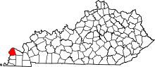 | |
| CDPs | ||
| Unincorporated communities | ||