Barry, Illinois
| Barry | |
| City | |
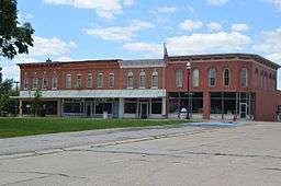 Downtown buildings | |
| Country | United States |
|---|---|
| State | Illinois |
| County | Pike |
| Township | Barry |
| Elevation | 730 ft (223 m) |
| Coordinates | 39°41′41″N 91°02′27″W / 39.69472°N 91.04083°WCoordinates: 39°41′41″N 91°02′27″W / 39.69472°N 91.04083°W |
| Area | 1.41 sq mi (4 km2) |
| - land | 1.41 sq mi (4 km2) |
| - water | 0.00 sq mi (0 km2) |
| Population | 1,318 (2010) |
| Mayor | Shawn Rennecker |
| Timezone | CST (UTC-6) |
| - summer (DST) | CDT (UTC-5) |
| Postal code | 62312 |
| Area code | 217 |
  Location of Barry within Illinois
| |
| Wikimedia Commons: Barry, Illinois | |
| Website: http://www.barryil.org | |
Barry (formerly Worcester) is a city in Pike County, Illinois, United States. The population was 1,318 at the 2010 census, down from 1,368 in 2000.
Geography
Barry is located at 39°41′41″N 91°2′27″W / 39.69472°N 91.04083°W (39.694756, -91.040957).[1]
According to the 2010 census, Barry has a total area of 1.41 square miles (3.65 km2), all land.[2]
Demographics
| Historical population | |||
|---|---|---|---|
| Census | Pop. | %± | |
| 1880 | 1,392 | — | |
| 1890 | 1,354 | −2.7% | |
| 1900 | 1,643 | 21.3% | |
| 1910 | 1,647 | 0.2% | |
| 1920 | 1,490 | −9.5% | |
| 1930 | 1,506 | 1.1% | |
| 1940 | 1,545 | 2.6% | |
| 1950 | 1,529 | −1.0% | |
| 1960 | 1,422 | −7.0% | |
| 1970 | 1,444 | 1.5% | |
| 1980 | 1,487 | 3.0% | |
| 1990 | 1,391 | −6.5% | |
| 2000 | 1,368 | −1.7% | |
| 2010 | 1,318 | −3.7% | |
| Est. 2015 | 1,274 | [3] | −3.3% |
2010 census
As of the census[5] of 2010, there were 1,318 people, 545 households, and 341 families residing in the city.
2000 census
As of the census[6] of 2000, there were 1,368 people, 552 households, and 363 families residing in the city. The population density was 1,198.0 people per square mile (463.3/km²). There were 623 housing units at an average density of 545.6/sq mi (211.0/km²). The racial makeup of the city was 99.42% White, 0.44% Asian, and 0.15% from two or more races. Hispanic or Latino of any race were 0.80% of the population.
There were 552 households out of which 29.5% had children under the age of 18 living with them, 52.5% were married couples living together, 10.3% had a female householder with no husband present, and 34.2% were non-families. 32.4% of all households were made up of individuals and 20.3% had someone living alone who was 65 years of age or older. The average household size was 2.32 and the average family size was 2.91.
In the city the population was spread out with 23.2% under the age of 18, 7.4% from 18 to 24, 24.3% from 25 to 44, 21.4% from 45 to 64, and 23.8% who were 65 years of age or older. The median age was 41 years. For every 100 females there were 84.6 males. For every 100 females age 18 and over, there were 79.4 males.
The median income for a household in the city was $27,635, and the median income for a family was $37,143. Males had a median income of $26,607 versus $18,050 for females. The per capita income for the city was $18,097. About 9.2% of families and 11.5% of the population were below the poverty line, including 13.4% of those under age 18 and 14.0% of those age 65 or over.
Notable people
- Floyd Dell, novelist, playwright, poet and literary critic; managing editor (The Masses); born in Barry.
- George Nicol, pitcher and outfielder for the St. Louis Browns, Chicago Colts, Pittsburgh Pirates and Louisville Colonels; born in Barry.
- Lottie Holman O'Neill, state representative; first female member of the General Assembly.[7]
- Scott Wike, politician, U.S. Representative, Assistant Secretary of the Treasury to Grover Cleveland; died in Barry
See also
References
- ↑ "US Gazetteer files: 2010, 2000, and 1990". United States Census Bureau. 2011-02-12. Retrieved 2011-04-23.
- ↑ "G001 - Geographic Identifiers - 2010 Census Summary File 1". United States Census Bureau. Retrieved 2015-12-25.
- ↑ "Annual Estimates of the Resident Population for Incorporated Places: April 1, 2010 to July 1, 2015". Retrieved July 2, 2016.
- ↑ "Census of Population and Housing". Census.gov. Archived from the original on May 11, 2015. Retrieved June 4, 2015.
- ↑ "American FactFinder". U.S. Census Bureau. Archived from the original on 5 March 2014. Retrieved 24 December 2011.
- ↑ "American FactFinder". United States Census Bureau. Archived from the original on 2013-09-11. Retrieved 2008-01-31.
- ↑ "Lottie Holman O'Neill (1878-1967)". National Women's History Museum. Retrieved December 2015. Check date values in:
|access-date=(help)
External links
Municipalities and communities of Pike County, Illinois, United States | ||
|---|---|---|
| Cities | ||
| Town | ||
| Villages | ||
| Townships | ||
| Unincorporated communities | ||
| Ghost towns | ||