Bazoches-les-Gallerandes
| Bazoches-les-Gallerandes | ||
|---|---|---|
|
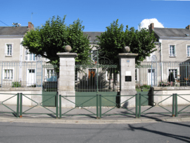
The town hall in Bazoches-les-Gallerandes | ||
| ||
 Bazoches-les-Gallerandes | ||
|
Location within Centre-Val de Loire region  Bazoches-les-Gallerandes | ||
| Coordinates: 48°09′47″N 2°02′38″E / 48.1631°N 2.0439°ECoordinates: 48°09′47″N 2°02′38″E / 48.1631°N 2.0439°E | ||
| Country | France | |
| Region | Centre-Val de Loire | |
| Department | Loiret | |
| Arrondissement | Pithiviers | |
| Canton | Outarville | |
| Intercommunality | Plaine du Nord Loiret | |
| Government | ||
| • Mayor (2008–2014) | Dominique Villette | |
| Area1 | 36.73 km2 (14.18 sq mi) | |
| Population (2009)2 | 1,443 | |
| • Density | 39/km2 (100/sq mi) | |
| Time zone | CET (UTC+1) | |
| • Summer (DST) | CEST (UTC+2) | |
| INSEE/Postal code | 45025 / 45480 | |
| Elevation | 120–137 m (394–449 ft) | |
|
1 French Land Register data, which excludes lakes, ponds, glaciers > 1 km² (0.386 sq mi or 247 acres) and river estuaries. 2 Population without double counting: residents of multiple communes (e.g., students and military personnel) only counted once. | ||

Bazoches-les-Gallerandes is a commune in the Loiret department in north-central France.
Population
| Historical population | ||
|---|---|---|
| Year | Pop. | ±% |
| 1793 | 1,006 | — |
| 1800 | 1,046 | +4.0% |
| 1806 | 1,059 | +1.2% |
| 1821 | 1,061 | +0.2% |
| 1831 | 1,107 | +4.3% |
| 1836 | 1,101 | −0.5% |
| 1841 | 1,135 | +3.1% |
| 1846 | 1,153 | +1.6% |
| 1851 | 1,178 | +2.2% |
| 1856 | 1,239 | +5.2% |
| 1861 | 1,245 | +0.5% |
| 1866 | 1,238 | −0.6% |
| 1872 | 1,244 | +0.5% |
| 1876 | 1,227 | −1.4% |
| 1881 | 1,176 | −4.2% |
| 1886 | 1,163 | −1.1% |
| 1891 | 1,192 | +2.5% |
| 1896 | 1,123 | −5.8% |
| 1901 | 1,108 | −1.3% |
| 1906 | 1,077 | −2.8% |
| 1911 | 1,008 | −6.4% |
| 1921 | 944 | −6.3% |
| 1926 | 934 | −1.1% |
| 1931 | 961 | +2.9% |
| 1936 | 909 | −5.4% |
| 1946 | 946 | +4.1% |
| 1954 | 807 | −14.7% |
| 1962 | 768 | −4.8% |
| 1968 | 829 | +7.9% |
| 1975 | 1,216 | +46.7% |
| 1982 | 1,325 | +9.0% |
| 1990 | 1,326 | +0.1% |
| 1999 | 1,348 | +1.7% |
| 2006 | 1,446 | +7.3% |
| 2009 | 1,443 | −0.2% |
See also
References
| Wikimedia Commons has media related to Bazoches-les-Gallerandes. |
This article is issued from Wikipedia - version of the 9/16/2015. The text is available under the Creative Commons Attribution/Share Alike but additional terms may apply for the media files.