Mézières-lez-Cléry
| Mézières-lez-Cléry | |
|---|---|
|
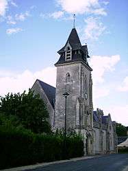
The church in Mézières-lez-Cléry | |
 Mézières-lez-Cléry | |
|
Location within Centre-Val de Loire region  Mézières-lez-Cléry | |
| Coordinates: 47°49′06″N 1°48′16″E / 47.8182°N 1.8044°ECoordinates: 47°49′06″N 1°48′16″E / 47.8182°N 1.8044°E | |
| Country | France |
| Region | Centre-Val de Loire |
| Department | Loiret |
| Arrondissement | Orléans |
| Canton | Cléry-Saint-André |
| Intercommunality | Communauté de communes du Val d'Ardoux |
| Government | |
| • Mayor (2001–2007) | Francis Crochet |
| Area1 | 27.01 km2 (10.43 sq mi) |
| Population (2006)2 | 703 |
| • Density | 26/km2 (67/sq mi) |
| Time zone | CET (UTC+1) |
| • Summer (DST) | CEST (UTC+2) |
| INSEE/Postal code | 45204 / 45370 |
| Elevation | 91–108 m (299–354 ft) |
|
1 French Land Register data, which excludes lakes, ponds, glaciers > 1 km² (0.386 sq mi or 247 acres) and river estuaries. 2 Population without double counting: residents of multiple communes (e.g., students and military personnel) only counted once. | |
Mézières-lez-Cléry is a commune in the Loiret department in north-central France.
See also
| Wikimedia Commons has media related to Mézières-lez-Cléry. |
This article is issued from Wikipedia - version of the 3/15/2016. The text is available under the Creative Commons Attribution/Share Alike but additional terms may apply for the media files.