Olivet, Loiret
| Olivet | ||
|---|---|---|
|
Banks of the Loiret at Olivet | ||
| ||
 Olivet | ||
|
Location within Centre-Val de Loire region  Olivet | ||
| Coordinates: 47°51′50″N 1°54′02″E / 47.8639°N 1.9006°ECoordinates: 47°51′50″N 1°54′02″E / 47.8639°N 1.9006°E | ||
| Country | France | |
| Region | Centre-Val de Loire | |
| Department | Loiret | |
| Arrondissement | Orléans | |
| Canton | Olivet | |
| Area1 | 23.39 km2 (9.03 sq mi) | |
| Population (2012)2 | 19,807 | |
| • Density | 850/km2 (2,200/sq mi) | |
| Time zone | CET (UTC+1) | |
| • Summer (DST) | CEST (UTC+2) | |
| INSEE/Postal code | 45232 / 45160 | |
| Elevation | 89–109 m (292–358 ft) | |
| Website | www.ville-olivet.fr | |
|
1 French Land Register data, which excludes lakes, ponds, glaciers > 1 km² (0.386 sq mi or 247 acres) and river estuaries. 2 Population without double counting: residents of multiple communes (e.g., students and military personnel) only counted once. | ||

.svg.png)
Olivet is a commune in the Loiret department in north-central France.
Geography
Olivet is located in the septentrional bend of the Loire, which crosses from east to west. Olivet belongs to the vallée de la Loire sector between Sully-sur-Loire and Chalonnes-sur-Loire, which was in 2000 inscribed by UNESCO as a World Heritage Site.
Olivet is 120 km south-south-west of Paris. Olivet is bordered to the north by Orléans and to the south by the Sologne.
Olivet is crossed by the Loiret, a 13 km long river which is both a tributary and a resurgence of the Loire.
History
The first traces of inhabitants belong to the Merovingian era. The water mills along the river were built by monks during the tenth century.
The first name of the village, during eleventh century, was Saint Martin du Loiret. The name Olivet comes probably from Mount of olives.
The village suffered severe destructions during the Hundred Years' War, especially during the Siege of Orléans.
During the nineteenth century the river sides became a resort. Most of the surface was still devoted to agriculture, specialised in flowers, vegetable and fruits.
Nowadays Olivet is a growing city of more than 20.000 inhabitants.
Places of interest
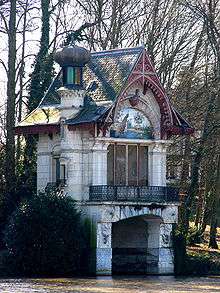
The peaceful river Loiret, surroundered by trees and home of numerous swans, offers pleasant public walks. They show glimpses of water mills, old castles, guinguettes and boat garages.
On the north side of the main bridge, the Horloge fleurie is a giant clock on a flowery slope.
The Eglise Saint Martin is a historical monument whose building began in the thirteenth century.
Gastronomy
- Olivet, a cheese often covered with ashes, hay or plane leaves
- poire d'Olivet, a pear liquor with a whole pear inside the bottle
People
- Gentien Hervet (1499–1584), writer and translator
- Gaston d'Illiers (1876–1932), sculptor
- Louis d'Illiers (1880–1953), writer
Lorsque finissait le siècle, roman de Louis d'Illiers, présenté par Julie Bertrand-Sabiani, Orléans Corsaire éditions 2010.
- Jules-Marie Simon (1871–1970), writer
- Isidore Bernhart (1898–1976), pataphysician
- Pierre Michon (1945- ), writer
See also
External links
| Wikimedia Commons has media related to Olivet (Loiret). |
- (French) Official city website