Beacon Rock State Park
| Beacon Rock State Park | |
| Washington State Park | |
| Beacon Rock viewed from the west | |
| Country | United States |
|---|---|
| State | Washington |
| County | Skamania |
| Landmark | Beacon Rock [1] |
| Elevation | 1,968 ft (600 m) [2] |
| Prominence | 848 ft (258 m) Beacon Rock [1] |
| Coordinates | 45°39′42″N 122°00′56″W / 45.66167°N 122.01556°WCoordinates: 45°39′42″N 122°00′56″W / 45.66167°N 122.01556°W [2] |
| Highest point | Hamilton Mountain |
| - elevation | 2,392 ft (729 m) |
| - coordinates | 45°39′03″N 122°00′19″W / 45.65083°N 122.00528°W [3] |
| Area | 5,100 acres (2,064 ha) |
| Established | 1935 |
| Management | Washington State Parks and Recreation Commission |
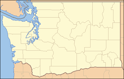 Location in State of Washington
| |
| Website: Beacon Rock State Park | |
Beacon Rock State Park is a publicly owned recreation area and natural history site on Route 14 in the Columbia River Gorge National Scenic Area about 35 miles (56 km) east of Vancouver, Washington, United States. The state park covers 5,100 acres (2,100 ha), which includes 9,500 feet (2,900 m) of Columbia River shoreline and 4,482 acres (1,814 ha) of forested uplands.[4]
The park takes its name from Beacon Rock,[1] an 848-foot (258 m) basalt volcanic plug next to the Columbia River.[5] On October 31, 1805, the Lewis and Clark Expedition arrived here and first measured tides on the river, indicating that they were nearing the ocean.[4]
Beacon Rock
Beacon Rock is a monolith on the north bank of the Columbia River. It was named by Lewis and Clark in 1805; they originally referred to it as Beaten Rock, later as Beacon Rock. They noted that the rock marked the eastern extent of the tidal influence in the Columbia. The rock was later known as Castle Rock, until 1915 when its name was changed back to Beacon Rock.[6] [7]
Beacon Rock is 848 feet (258 m) tall and is composed of basalt. Henry Biddle purchased the rock in 1915 for $1 and during the next three years constructed a trail with 51 switchbacks, handrails and bridges. The three-quarter mile trail to the top, completed in April 1918,[6] leads to views in all directions. It is a popular hiking destination.
The United States Army Corps of Engineers planned to destroy the rock, to supply material for the jetty at the mouth of the Columbia (see Columbia River Bar), and dug three caves on the rock's south side. During this time, Biddle's family tried to make it a state park. At first Washington refused the gift, but changed its position when Oregon offered to accept. The park was established in 1935.
It has been variously claimed to be the second largest free standing monolith in the northern hemisphere, or in the world, just behind the Rock of Gibraltar, Stone Mountain, or Mount Augustus, the latter two being very much larger than either of the first two. The assertion depends on how one defines the term "monolith." For example, Devils Tower National Monument in Wyoming is larger than Beacon Rock, but is considered an igneous intrusion rather than necessarily a "single rock."
Activities and amenities
Beacon Rock is known for quality, challenging, technical rock climbing. The park has over 20 miles (32 km) of hiking, mountain biking, and equestrian trails. Trails go to the top of Beacon Rock and Little Beacon Rock. Hardy Falls and Rodney Falls are scenic highlights along the trail to the summit of 2,445-foot (745 m) Hamilton Mountain,[3] which has a view of Bonneville Dam and points east. In addition, the park has a dock and boat launch plus group and individual site campgrounds.[4]
Sources
- Mueller, Marge & Ted (2004). Washington State Parks: A Complete Recreation Guide. Seattle: Mountaineers Books. ISBN 0-89886-893-9.
References
- 1 2 3 "Beacon Rock". Geographic Names Information System. United States Geological Survey.
- 1 2 "Beacon Rock State Park". Geographic Names Information System. United States Geological Survey.
- 1 2 "Hamilton Mountain". Geographic Names Information System. United States Geological Survey.
- 1 2 3 "Beacon Rock State Park". Washington State Parks and Recreation Commission. Retrieved February 14, 2016.
- ↑ "Beacon Rock, Washington". The Columbia River: A Photographic Journey. Lyn Topinka. Retrieved February 14, 2016.
- 1 2 "Henry J. Biddle photographs, c.1860s-1925". Historic Photograph Collections. University of Oregon. Retrieved January 5, 2015.
- ↑ GNIS says its decision to rename was in 1915: "GNIS entry detail for Beacon Rock". 1979-09-10. Retrieved 2006-10-09.
External links
| Wikimedia Commons has media related to Beacon Rock. |
- Beacon Rock State Park Washington State Parks and Recreation Commission
- Beacon Rock State Park Map Washington State Parks and Recreation Commission