Belmont, Sutton
| Belmont | |
%2C_Queens_Road%2C_Belmont_-_geograph.org.uk_-_478223.jpg) St. John's Church (C of E), Queens Road, Belmont, Sutton |
|
 Belmont |
|
| Population | 10,048 (2011 Census. Ward)[1] |
|---|---|
| OS grid reference | TQ253620 |
| London borough | Sutton |
| Ceremonial county | Greater London |
| Region | London |
| Country | England |
| Sovereign state | United Kingdom |
| Post town | SUTTON |
| Postcode district | SM2 |
| Dialling code | 020 |
| Police | Metropolitan |
| Fire | London |
| Ambulance | London |
| EU Parliament | London |
| UK Parliament | Sutton and Cheam |
| London Assembly | Croydon and Sutton |
Coordinates: 51°20′36″N 0°12′09″W / 51.34328°N 0.20239°W
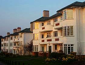
Belmont is a village at the southern end of the town of Sutton in the southwest London Borough of Sutton, England. It is located off the A217 road and near to Banstead Downs in Surrey. It is a suburban development situated 10.8 miles (17.4 km) south-southwest of Charing Cross.
History
Belmont did not exist until the late 19th-century.[2] Belmont railway station opened in May 1865 and was originally called 'California Station', named after the California Arms public house on the opposite side of Brighton Road which was built by John Gibbons in approximately 1858. The station was renamed 'Belmont' in 1875, and the name was attached to the village that emerged subsequently.[2] The original pub was heavily damaged by German bombing in the Second World War. The new building, built on the site in 1955, was known as 'The Belmont', but in 2014, under new management, reverted to its original name of The 'California'.[2] St. John's Church (C of E) stands in Queens Road, near the end of the small High Street ("Station Road").
Banstead Hospital and the emergence of Belmont
The village of Belmont strongly owed its development to the presence of Banstead Asylum.[2] Although located in the parish of Banstead, the asylum was much closer to the village and railway station of Belmont than those of Banstead. Originally known as Banstead Asylum, the hospital opened in 1877 as the third county lunatic asylum for Middlesex. Around 1890 it came under the auspices of London County Council.[2] Later a psychiatric hospital under the name Banstead Mental Hospital, then Banstead Hospital, it closed in 1986 and was largely demolished in 1989. The site is now occupied by the prison High Down.
Belmont Hospital and the South Metropolitan District School
Belmont Hospital was a psychiatric hospital. It closed and was demolished in the 1980s. The site is now occupied by the 'Belmont Heights' housing development, which is situated to the west of Brighton Road, to the north of Belmont village. Belmont Hospital opened after the Second World War. The premises had previously fulfilled a number of different institutional purposes.[2] For example, during World War II it was used as an emergency hospital for military and civilian casualties, including psychiatric cases. The oldest buildings on the site, built in the early 1850s, had originally been a large Poor Law residential 'district' school belonging to the South Metropolitan Schools District. This institution catered for pauper children from several parishes in south-east London. Along with its nearby annex site, built in 1884 in Cotswold Road (formerly Banstead Road), this establishment closed in 1902. The premises at both sites were then acquired by the Metropolitan Asylums Board. Some of the buildings of the Cotswold Road site still exist.[2]
Public institutions
- The Royal Marsden Hospital is a specialist cancer treatment hospital. It is an NHS Foundation Trust, and operates facilities on two sites, including one in Belmont, Sutton. The original buildings on the site were first used as the Banstead Road branch of the South Metropolitan District School, which was a 'district' school for children of workhouse inmates in south London. In the 1890s, girls were kept at the Banstead Road site and boys were kept at a site on Brighton Road, which was built in 1851. The Brighton Road site later became Belmont workhouse and Belmont Psychiatric hospital, before being demolished in the 1980s. The Banstead Road site later became a sanatorium, before the southern half of the site was acquired by Royal Marsden in 1962.
- The Institute of Cancer Research is a public research institute and university located on two London sites and specialised in oncology.[3] It was founded in 1909 as a research department of the Royal Marsden Hospital. It established its Belmont, Sutton campus site in 1956. It joined the University of London in 2003.[4]
- Sutton Hospital
Green Space
.jpg)
In addition to Belmont Park, Belmont contains two Local Nature Reserves.[5]
- Cuddington Meadows is a Grade I Site of Borough Importance for Nature Conservation. The site was shown as two enclosures on the open Banstead Downs on an early nineteenth century map, and it was later part of Walnut Tree Farm, which became Cuddington Hospital in 1897. The hospital closed in 1984, and in the late 1990s the land was transferred to Sutton Council to be managed for nature conservation.[6] It is mainly chalk grassland with some scrub. Its most important feature is a variety of unusual flowering plants, including greater knapweed, lady's bedstraw and field scabious.
- Belmont Pastures is a Grade II Site of Borough Importance for Nature Conservation. It is a long narrow triangle north of Belmont railway station. It is an old meadow which formerly belonged to Belmont Hospital.
Just to the south of the village is Banstead Downs, which extends for around a mile further south towards neighbouring Banstead, Surrey. Banstead Downs is a large Site of Special Scientific Interest, covering 430 acres (170 ha). Banstead Golf Course is on the northern slopes.
Economy

Station Road is the main commercial street of Belmont Village, containing a range of mainly independent shops and restaurants. It runs for about half-a-mile from Belmont Station in the east to St John's Church in the west. One mile to the north lies the larger economic centre of Sutton.
Nearest places

- Sutton to the north
- Cheam to the west
- Ewell to the west
- Banstead, Surrey to the south
- Carshalton to the east
- Wallington to the east
Transport
Belmont railway station is on the Sutton to Epsom Downs branchline and the London Victoria to Epsom Downs line. It is part of the Sutton & Mole Valley Line services of the Southern rail operating company, and is in London Travelcard Zone 5.
Former Residents
- James Hunt (1947–93), World Formula One motor-racing champion 1976.
- Lord Judd (born 1935) former director of Oxfam. As Frank Judd he was MP for constituencies in Portsmouth from 1966 to 1979.
- Don Lusher (1923–2006), trombonist and jazz band leader
- Lord Ritchie-Calder (1906–82), journalist and environment expert
- Lionel Tertis (1876–1975), viola-player
- Barry Wordsworth (born in Cheam 1948), orchestral conductor – music director.
- David Bellamy Botanist, author and academic.
References
- ↑ "Sutton Ward population 2011". Neighbourhood Statistics. Office for National Statistics. Retrieved 9 October 2016.
- 1 2 3 4 5 6 7 Sparkes, Roland (2009) Belmont: A Century Ago.
- ↑ "University of London: Colleges/Institutes". Lon.ac.uk. 29 March 2010. Retrieved 29 April 2010.
- ↑ "Annual Review 2009" (PDF). Institute of Cancer Research. Retrieved 21 October 2010.
- ↑ "Local Nature Reserves: Search results for Greater London". Natural England. Archived from the original on 27 September 2013.
- ↑ "Cuddington Meadows LNR". London Borough of Sutton. Archived from the original on 23 December 2014. Retrieved 3 April 2014.
Further reading (local history)
- Belmont: A Century Ago by Roland Sparkes, published December 2009. Paperback. ISBN 978-0-9563424-0-9. . This is first book dedicated to the history of the village. The introductory chapter provides a resume of Belmont's history and development in the Victorian era and the early 20th century.
- Articles by local historian Roland Sparkes for the Belmont Local History group (established 2009). E.g. Belmont: 1865 – A description of the Belmont area as it existed in 1865 , and Dr Carl Warburg, his Belmont laboratory, and his famous fever drug.
- Sutton Guardian newspaper – heritage page articles and features.
- Sutton Scene (London Borough of Sutton's official newsletter), Oct/Nov 2009 edition. Feature on Belmont.
- Two booklets have been produced about the history of Belmont's churches, both now out of print: (i) Splendid the Heritage: the story of Belmont and its Methodist Church (Craig, 1965); and (ii) A Village Church: the story of the first 75 years of St John’s with Belmont Methodists (Reed, 1992).
External links
| Districts |
|  |
|---|---|---|
| Attractions | ||
| Parks and open spaces | ||
| Constituencies | ||
| Rail and tram stations | ||
| Other topics | ||