Belnahua
| Gaelic name | Beul na h-Uamha |
|---|---|
| Meaning of name | The mouth of the cave |
| Location | |
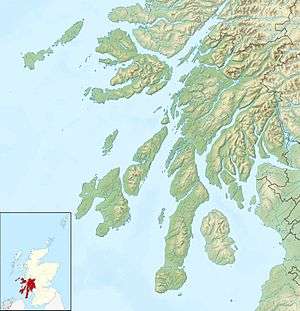 Belnahua Belnahua shown within Argyll and Bute | |
| OS grid reference | NM713127 |
| Physical geography | |
| Island group | Slate Islands |
| Highest elevation | 22 metres (72 ft) |
| Administration | |
| Sovereign state | United Kingdom |
| Country | Scotland |
| Council area | Argyll and Bute |
| Demographics | |
| Population | 0 |
| References | [1][2][3][4] |
Belnahua is one of the Slate Islands, in the Firth of Lorn in Scotland, known for its slate quarries
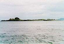
It lies 1.5 miles (2.4 km) north west of Luing west of Argyll, and east of the Garvellachs. Although it once had a population of nearly 200 people, it has been uninhabited since World War I. Famed for its slate, the island has been considerably denuded by its quarrying. Deep water-filled cuttings and the ruined slate workers cottages remain as a testament of this industry.[5]
There was a jetty to the east of the island, but it has been worn away within the last quarter of the twentieth century, and an extensive drying reef to the north west.[3] The Latvian vessel Helena Faulbaums foundered on the reef in 1936, with the loss of 16 lives.[2]
A quiet home for local wildlife, the island is occasionally a stop off for local fisher folk and tourists. It is currently owned by the Carling family.[2]
Footnotes
- ↑ 2001 UK Census per List of islands of Scotland
- 1 2 3 Haswell-Smith, Hamish (2004). The Scottish Islands. Edinburgh: Canongate.
- 1 2 Ordnance Survey
- ↑ Iain Mac an Tailleir. "Placenames" (PDF). Pàrlamaid na h-Alba. Archived from the original (PDF) on 23 September 2011. Retrieved 28 July 2007.
- ↑ "Overview of Belnahua". Gazetteer for Scotland. Retrieved 28 July 2007.
External links
| Wikimedia Commons has media related to Belnahua. |
Inhabited islands of the Hebrides | ||
|---|---|---|
| Inner Hebrides | 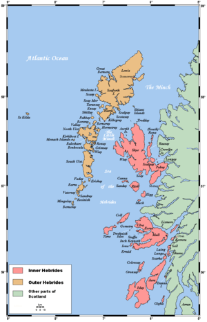 | |
| Outer Hebrides | ||
Coordinates: 56°15′N 5°41.3′W / 56.250°N 5.6883°W