Bharathappuzha
| Bharathappuzha (ഭാരതപ്പുഴ) | |
| River | |
| Country | |
|---|---|
| States | Kerala, Tamil Nadu |
| Tributaries | |
| - left | Thuthapuzha, Gayathripuzha, Kalpathipuzha, Kannadipuzha, Tirur River |
| Source | Anamalai Hills |
| - location | Tamil Nadu, India |
| - elevation | 2,461 m (8,074 ft) |
| - coordinates | 10°36′N 77°07′E / 10.600°N 77.117°E |
| Mouth | Lakshadweep Sea [1] |
| - location | Ponnani, KERALA, INDIA |
| - elevation | 0 m (0 ft) |
| - coordinates | 10°47′23.89″N 75°55′17.42″E / 10.7899694°N 75.9215056°ECoordinates: 10°47′23.89″N 75°55′17.42″E / 10.7899694°N 75.9215056°E |
| Length | 209 km (130 mi) |
| Basin | 6,186 km2 (2,388 sq mi) |
| Discharge | mouth |
| - average | 161 m3/s (5,686 cu ft/s) |
 Labelled map of Bharathappuzha
| |
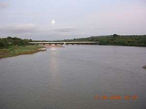
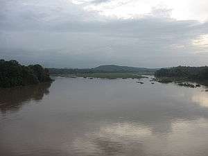
Bharathappuzha ("River of Bhārata"), also known as the River Nila, is a river in India in the state of Kerala. With a length of 209 km, it is the second-longest river in Kerala, after the Periyar River. The word "Nila" indicates the culture more than just a river. Nila has groomed the culture and life of south Malabar part of Kerala. We see the name "Peraar" indicating the same river in ancient scripts and documents.
Course
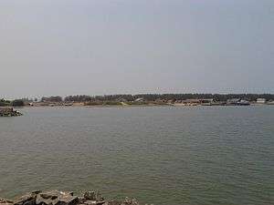
The headwaters of the main tributary of Bharathapuzha originates in the Anaimalai Hills in the Western Ghats, and flows westward through Palakkad Gap, (also known as Palghat gap) across Palakkad, Thrissur and Malappuram districts of Kerala, with many tributaries joining it, including the Tirur River. For the first 40 km or so, the Bharathappuzha follows an almost northerly course till Pollachi near Coimbatore. At Parli, the Kannadipuzha and Kalpathippuza merge and flow as Bharathappuzha, following a westerly course until it empties into the Lakshadweep Sea at Ponnani.[1] At Mayannur, Gayathripuzha merges with the river. The Thootha River merges with the Nila at Pallippuram. As the Thootha River is rich in water, after its merger, the Nila becomes thicker in flow.

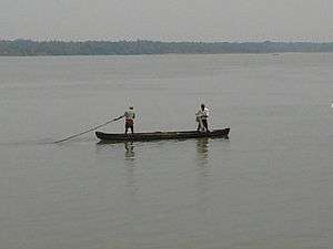
The river is not navigable along most of its course except the small stretch where it joins the sea. With a watershed of 6,186 km², the Bharathapuzha basin is the largest among all the river basins in Kerala. A little more than two-thirds of this area (4400 km²) is within Kerala and the remaining area (1786 km²) is in Tamil Nadu. Though Bharathapuzha has a large basin, the water flow is relatively less compared to other long rivers in Kerala because a large portion of the basin is located in the comparatively drier regions (Tamil Nadu and Palakkad Gap). The construction of a number of dams after independence has also reduced the river flow. In fact in the summer months, there is almost no flow in most parts of the river. The river is the "Nile" of Kerala and has the name Nila also. The Bharathapuzha is the lifeline of many cities and villages: Chittur-Thathamangalam (in Chittur, Bharathappuzha is known as "Sokanasini"; this name was given by Thunjathu Ramanujan Ezhuthachan), Kodumbu-Thiruvalathur, Palakkad, Parli-Kottayi, Mankara-Perigottukurissi, Lakkidi-Thiruvilwamala, Killikkurussimangalam, Ottappalam, Shoranur, Cheruthuruthy, Chelakkara, Pattambi, Thrithala, Thiruvegappura, Kudallur, Pallipuram and Kumbidi. The village of Parudur, including the town of Pallipuram, stand near the confluence of this river and the River Thootha or, simply, Thuthapuzha.
Irrigation projects
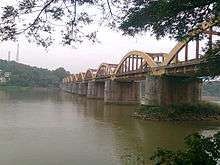
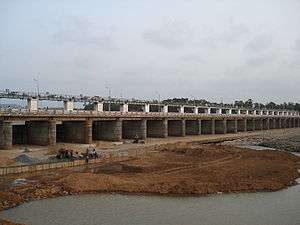
The Bharathappuzha is extensively dammed. There are 11 reservoirs along the course of the river, and two more are under construction. Malampuzha dam is the largest among the reservoirs built across Bharathapuzha and its tributaries. Other dams in the Bharathapuzha basin are Walayar Dam, Mangalam Dam, Pothundi Dam, Meenkara Dam, Chulliyar Dam, Thirumoorthy, Aliyar, Upper Aliyar, Chitturpuzha regulator and Kanhirappuzha Dam. Most of these reservoirs serve the purpose of irrigation only. A total area of 773 km² is irrigated by these irrigation projects. One irrigation dam at Chittur in Attappadi Hills is under construction. The construction of these two dams will increase the area irrigated by another 542 km². Another major project is the Regulator cum bridge at Thrithala built on the Velliyankallu bridge. The bridge connects the two villages Pallippuram and Thrithala. The main objective of the regulator is drinking water supply. The water supply projects towards Thrissur district has already started. The shutter height of the regulator is 5 meters, and it can contain a huge quantity of water. Also the new bridge reduces the distance from Thrissur to Kozhikode by 11 km. This project is the largest in Bharathappuzha in last many decades. Fish species once thought to be almost extinct have come back remarkably due to the increased water level during summer. Special note is to be made on the species called 'Vaala' considered to be the king of fresh water fishes. Individual 'Vaala' weighing 5 to 10 kg are now common.
Cultural significance
Bharathappuzha is the lifeline of Kerala's cultural map. Kerala Kalamandalam, which is a major center for learning Indian performing arts like Kathakali, Koodiyattam and Ottamthullal, is situated at Cheruthuruty on the banks of this river—in Thrissur district. The birthplace of famous Malayalam satire poet and founder of the Ottamthullal art form, Kunchan Nambiar, is located at Killikkurissimangalam near Lakkidi, again on the banks of the Nila.Tholpavakoothu (around 65 temples are situated in the banks of river Nila) is a unique shadow puppet play mainly performed in the Bhadar Kali temple in the malabar region Leading Malayalam writers who were born along its banks include M. T. Vasudevan Nair, M. Govindan, V. K. N., O. V. Vijayan and M. Sukumaran. Late poet P. Kunhiraman Nair, a native of north Malabar, drew literary inspiration from the scenic beauty of the landscape along the Bharatapuzha. There are a number of famous Hindu temples like Thiruvilwamala Temple, Thirunavaya Navamukunda Temple, [[Chamravattam Ayyappa Temple]] and Panniyur Sree Varahamurthy Temple on the bank of Nila.
Legend says that those cremated on the banks of the Bharathappuzha achieve salvation. It is also one of the important places in the state where the sons pay homage to their late fathers by conducting a Pithru Tharpanam ritual on the Karkidaka Vavu day. Some of the famous persons cremated here include literary personalities like O V Vijayan and VKN.
Degradation
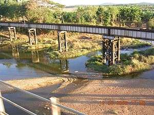
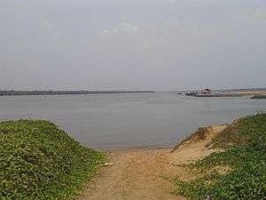
The river went through a series of challenges which saw its degradation that has reached a point of no return. People started making the river dirty and left it in the mouth of death. Bharathapuzha is now dirty because of the actions of we human beings. The river gets lifeless due to we human beings. The river water got dirty and it is currently not potable. Until a few decades back the river used to flow effortlessly during even intense summer. However, due to the sand mining in the last 30 years, the thick sand bed has been completely vanished and has been replaced with grasses and bushes which has become an environmental catastrophe. At the peak of the sand mining period of the mid 1990s at least 40-50 lorries carrying tons of pristine sand was a common sight at each 'kadavu' (entrance to the river) of the river every day. Considering the hundreds of the 'kadavu' throughout its length, the amount of sand mined in these years is unimaginable. Today, with almost no sand in many parts of the river, people have started mining sand from underwater which has become a profitable business for many.
Challenges
The river now faces significant challenges for its survival. It is predicted that the river may change its course due to the obstruction of the tall grasses and bushes that has grown in the river. Illegal sand mining mafias are very active and the nexus between the politicians, bureaucrats and these mafias make it extremely difficult to stop this. Organisations which were once very active have now gone on hibernation due to the threat posed by them. Environmentalists have predicted dire consequences and the untimely death of the river within the near future.
Social networking sites like Facebook have active groups with a purpose of saving the river named as Bharathappuzha Samrakhshana Samithi.[2]
Actions required for saving the river
Environmentalists suggest the followings actions for saving the river.
- Controlled mining of the sand if not completely stopping it. Sand beds which got created in millions of years were completely removed within a few years of human greed and mismanagement. Creation of sand is a very slow process and is considered as the veins of the river. Although a total ban is impossible and impracticable, strict regulations needs to be put in place for sustainable mining of sand. Experts suggest that a portion of the revenue from sand mining has to be allocated for river management.
- Strict regulations for hotels, hospitals and households on managing their waste. Regulation has to be put in place and enforced for managing waste generated by hospitals and hotels.
- Planting trees like Banyan, Jackfruit, Teak, or Mango can enhance the water table and the water quality as these trees can hold large amount of water in its roots and will slowly discharge it during summer. This method has found to be successful in many parts of the world in reviving rivers.
- Planting and growing mangroves wherever possible: Mangroves acts a barrier protecting the river banks from soil erosion. The ecosystem within the mangroves are varied and complex and help aquatic species to thrive in rivers.
- Constructing check dams: Check dams slow down the flow of the river where by recharging the ground water and increasing the water table.
Tributaries
Sorted in order from the mouth heading upstream.
- Thuthapuzha
- Kunthippuzha
- Kanjirappuzha
- Ambankadavu
- Thuppanadupuzha
- Gayathripuzha
- Kalpathipuzha
- Kannadipuzha
See also
Notes
|
External links
| Wikimedia Commons has media related to Bharathappuzha. |
- Kudallur Village
- Nila Foundation Organization
- A Frontline article about the problems faced by Bharathapuzha
- An Indiatogether article on Sand Mining in Bharathapuzha
- Bharata, To Kill a River
- night in bharathappuzha
References
- https://www.youtube.com/watch?feature=endscreen&NR=1&v=DGdKcAbPZ_c
- https://www.youtube.com/watch?v=gEoV4xhJHBM
- https://www.youtube.com/watch?v=R6eA7wahVDY&feature=related
- https://www.youtube.com/watch?feature=endscreen&v=07Dxuhs1zLU&NR=1
- https://www.youtube.com/watch?v=Tb-O2XpGTTE&feature=relmfu
- Abraham, Vinu (2004), "The way to the Maker", The Week, archived from the original on February 24, 2005, retrieved February 10, 2006 .
- Newindpress (2005), "Thousands offer Pithru Tharpanam", The New Indian Express, retrieved February 10, 2006.
- "Infobox facts". All Kerala River Protection Council. Retrieved January 30, 2006.