Big Rapids, Michigan
| Big Rapids, Michigan | |
|---|---|
| City | |
 Location of Big Rapids, Michigan | |
| Coordinates: 43°41′56″N 85°28′52″W / 43.69889°N 85.48111°W | |
| Country | United States |
| State | Michigan |
| County | Mecosta |
| Area[1] | |
| • Total | 4.48 sq mi (11.60 km2) |
| • Land | 4.36 sq mi (11.29 km2) |
| • Water | 0.12 sq mi (0.31 km2) |
| Elevation | 925 ft (282 m) |
| Population (2010)[2] | |
| • Total | 10,601 |
| • Estimate (2012[3]) | 10,702 |
| • Density | 2,431.4/sq mi (938.8/km2) |
| Time zone | Eastern (EST) (UTC-5) |
| • Summer (DST) | EDT (UTC-4) |
| ZIP code | 49307 |
| Area code(s) | 231 |
| FIPS code | 26-08300[4] |
| GNIS feature ID | 1619197[5] |
| Website | Big Rapids official website |
Big Rapids is a city in the U.S. state of Michigan. The population was 10,601 at the 2010 census. It is the county seat of Mecosta County.[6] The city is located within Big Rapids Township, but is politically independent. Big Rapids is home of the main campus of Ferris State University, a four-year public university, well known for its College of Pharmacy and the Michigan College of Optometry, as well as its NCAA Division I hockey team, the Bulldogs.
History
Big Rapids was settled in 1855 by George French and his brother Zera. It became the seat of Mecosta County in 1859. The village was platted in 1859. It was incorporated as a city in 1869.[7]
Geography
According to the United States Census Bureau, the city has a total area of 4.48 square miles (11.60 km2), of which 4.36 square miles (11.29 km2) is land and 0.12 square miles (0.31 km2) is water.[1] Like most of the central Michigan area, it lies on the ancient sea bed and has a sandy subsoil which lies above an iron ore base. The Muskegon River runs through Big Rapids, passing both Ferris State University and the local middle school on its way to Lake Michigan. Numerous small lakes are within a few miles of the city.
Transportation
Major Highways
Bus
- Indian Trails provides daily intercity bus service between Grand Rapids and Petoskey, Michigan. The southbound bus stops in Big Rapids at 2:35 pm; and the northbound bus stops in Big Rapids at 6:03 pm.[8] Effective Friday, August 1, 2014 Indian Trails no longer provides service through the Ferris State Racquet & Fitness Center. Temporarily, buses stop in the Save-A-Lot parking lot across the street from the Racquet & Fitness Center. The buses stop on the east end of the parking lot near the road. This is a temporary location as Indian Trails continues to work toward a more permanent location. The Save-A-Lot store will be a pick-up and drop-off location only. Call Indian Trails (800) 292-3831 for ticket information.
- Public dial-a-ride bus service is provided by the Big Rapids Dial-A-Ride.
Airports
- Roben-Hood Airport Located two miles north of the Big Rapids business district provides services to businesses and general aviation throughout the Midwest.
- Gerald R. Ford International Airport is the nearest international airport, located roughly one hour south of Big Rapids.
Cycling, Hiking
The Fred Meijer White Pine Trail, a 92-mile multi-use trail from Grand Rapids to Cadillac, MI, passes through Big Rapids.
Demographics
| Historical population | |||
|---|---|---|---|
| Census | Pop. | %± | |
| 1870 | 1,237 | — | |
| 1880 | 3,552 | 187.1% | |
| 1890 | 5,303 | 49.3% | |
| 1900 | 4,686 | −11.6% | |
| 1910 | 4,519 | −3.6% | |
| 1920 | 4,558 | 0.9% | |
| 1930 | 4,671 | 2.5% | |
| 1940 | 4,987 | 6.8% | |
| 1950 | 6,736 | 35.1% | |
| 1960 | 8,686 | 28.9% | |
| 1970 | 11,995 | 38.1% | |
| 1980 | 14,361 | 19.7% | |
| 1990 | 12,603 | −12.2% | |
| 2000 | 10,849 | −13.9% | |
| 2010 | 10,601 | −2.3% | |
| Est. 2015 | 10,397 | [9] | −1.9% |
2010 census
As of the census[2] of 2010, there were 10,601 people, 3,330 households, and 1,323 families residing in the city. The population density was 2,431.4 inhabitants per square mile (938.8/km2). There were 3,623 housing units at an average density of 831.0 per square mile (320.9/km2). The racial makeup of the city was 88.0% White, 6.8% African American, 0.7% Native American, 1.5% Asian, 0.6% from other races, and 2.5% from two or more races. Hispanic or Latino of any race were 2.4% of the population.
There were 3,330 households of which 22.2% had children under the age of 18 living with them, 22.9% were married couples living together, 12.7% had a female householder with no husband present, 4.2% had a male householder with no wife present, and 60.3% were non-families. 36.5% of all households were made up of individuals and 9.8% had someone living alone who was 65 years of age or older. The average household size was 2.22 and the average family size was 2.88.
The median age in the city was 21.8 years. 12.5% of residents were under the age of 18; 54% were between the ages of 18 and 24; 15.9% were from 25 to 44; 11.2% were from 45 to 64; and 6.5% were 65 years of age or older. The gender makeup of the city was 51.0% male and 49.0% female.
2000 census
As of the census[4] of 2000, there were 10,849 people, 3,388 households, and 1,473 families residing in the city. The population density was 2,555.5 per square mile (985.6/km²). There were 3,654 housing units at an average density of 860.7 per square mile (332.0/km²). The racial makeup of the city was 83.57% White, 10.63% Black, 0.73% Native American, 2.24% Asian, 0.04% Pacific Islander, 0.50% from other races, and 2.30% from two or more races. Hispanic or Latino of any race were 1.83% of the population.
There were 3,388 households out of which 25.5% had children under the age of 18 living with them, 26.5% were married couples living together, 14.3% had a female householder with no husband present, and 56.5% were non-families. 35.7% of all households were made up of individuals and 9.8% had someone living alone who was 65 years of age or older. The average household size was 2.26 and the average family size was 2.93.
In the city the population was spread out with 15.2% under the age of 18, 51.0% from 18 to 24, 17.3% from 25 to 44, 9.1% from 45 to 64, and 7.4% who were 65 years of age or older. The median age was 22 years. For every 100 females there were 109.4 males. For every 100 females age 18 and over, there were 110.4 males. Ferris State University has a high number of male students, accounting for this anomaly.
The median income for a household in the city was $20,192, and the median income for a family was $28,629. Males had a median income of $30,341 versus $19,770 for females. The per capita income for the city was $10,719. About 19.2% of families and 35.0% of the population were below the poverty line, including 29.3% of those under age 18 and 11.6% of those age 65 or over.
Climate
This climatic region has large seasonal temperature differences, with warm to hot (and often humid) summers and cold (sometimes severely cold) winters. According to the Köppen Climate Classification system, Big Rapids has a humid continental climate, abbreviated "Dfb" on climate maps.[11]
| Climate data for Big Rapids, Michigan | |||||||||||||
|---|---|---|---|---|---|---|---|---|---|---|---|---|---|
| Month | Jan | Feb | Mar | Apr | May | Jun | Jul | Aug | Sep | Oct | Nov | Dec | Year |
| Average high °C (°F) | −3 (26) |
−3 (27) |
2 (36) |
11 (52) |
18 (65) |
24 (75) |
27 (80) |
26 (78) |
21 (69) |
14 (57) |
5 (41) |
−1 (30) |
12 (53) |
| Average low °C (°F) | −12 (11) |
−13 (9) |
−8 (18) |
−1 (30) |
5 (41) |
11 (52) |
13 (56) |
12 (54) |
9 (48) |
3 (38) |
−3 (27) |
−8 (17) |
1 (33) |
| Average precipitation mm (inches) | 43 (1.7) |
41 (1.6) |
48 (1.9) |
69 (2.7) |
80 (3) |
79 (3.1) |
74 (2.9) |
74 (2.9) |
89 (3.5) |
71 (2.8) |
69 (2.7) |
43 (1.7) |
772 (30.4) |
| Source: Weatherbase [12] | |||||||||||||
Notable people
- Stephen Thomas Erlewine, music critic
- Ben Hebard Fuller, Major General and Commandant of the Marine Corps; born in Big Rapids
- Clint Hurdle, outfielder with four MLB teams; manager of the Colorado Rockies and Pittsburgh Pirates; born in Big Rapids
- James Hynes, novelist; grew up in Big Rapids
- Anna Howard Shaw, a leader of the women's suffrage movement in the nineteenth century; lived in Big Rapids as a young woman
Education
- Big Rapids Public Schools
- Crossroads Charter Academy
- Ferris State University
- St. Peter's Lutheran Church and School
- St. Mary's Catholic School
Music
- Tuba Bach
References
- 1 2 "US Gazetteer files 2010". United States Census Bureau. Archived from the original on January 24, 2012. Retrieved 2012-11-25.
- 1 2 "American FactFinder". United States Census Bureau. Retrieved 2012-11-25.
- ↑ "Population Estimates". United States Census Bureau. Archived from the original on June 17, 2013. Retrieved 2013-06-03.
- 1 2 "American FactFinder". United States Census Bureau. Archived from the original on 2013-09-11. Retrieved 2008-01-31.
- ↑ "US Board on Geographic Names". United States Geological Survey. 2007-10-25. Retrieved 2008-01-31.
- ↑ "Find a County". National Association of Counties. Archived from the original on May 31, 2011. Retrieved 2011-06-07.
- ↑ Walter Romig, Michigan Place Names, p. 61
- ↑ "GRAND RAPIDS-CADILLAC-TRAVERSE CITY-PETOSKEY" (PDF). Indian Trails. January 15, 2013. Retrieved 2013-03-09.
- ↑ "Annual Estimates of the Resident Population for Incorporated Places: April 1, 2010 to July 1, 2015". Retrieved July 2, 2016.
- ↑ "Census of Population and Housing". Census.gov. Archived from the original on May 11, 2015. Retrieved June 4, 2015.
- ↑ Climate Summary for Big Rapids, Michigan
- ↑ "Weatherbase.com". Weatherbase. 2013. Retrieved on September 22, 2013.
External links
| Wikimedia Commons has media related to Big Rapids, Michigan. |
- Big Rapids official website
- Big Rapids Convention & Visitors Bureau
 "Big Rapids". Encyclopædia Britannica (11th ed.). 1911.
Municipalities and communities of Mecosta County, Michigan, United States | ||
|---|---|---|
| City | 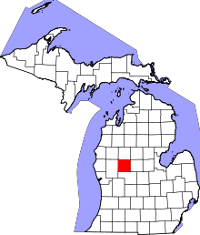 | |
| Villages | ||
| Charter townships | ||
| General law townships | ||
| CDP | ||
| Other unincorporated communities | ||
Coordinates: 43°41′53″N 85°29′01″W / 43.69806°N 85.48361°W