Black Rock Mountain State Park
| Black Rock Mountain State Park | |
|---|---|
|
View from Black Rock Mountain State Park | |
 Location of Black Rock Mountain State Park in Georgia | |
| Location | Rabun County, Georgia, USA |
| Nearest city | Clayton, Georgia |
| Coordinates | 34°54′34″N 83°24′55″W / 34.90944°N 83.41528°WCoordinates: 34°54′34″N 83°24′55″W / 34.90944°N 83.41528°W |
| Area | 1,743 acres (7.05 km2; 2.72 sq mi) |
| Governing body | Georgia State Park |

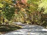
Black Rock Mountain State Park is a 1,743 acre (7.03 km²) Georgia state park located west of Mountain City in Rabun County, Georgia. It is named after its sheer cliffs of dark-colored biotite gneiss in Georgia's Blue Ridge Mountains. Located astride the Eastern Continental Divide at an elevation of 3,640 feet (1,109 m), the park provides many scenic overlooks and 80 mile (130 km) vistas of the southern Appalachian Mountains. On a clear day, four states are visible: Georgia, North Carolina, South Carolina, and Tennessee. In addition to Black Rock Mountain itself, the park includes four other peaks over 3,000 feet (910 m) in elevation, making it the highest state park in Georgia.
The park is closed during the late fall and winter (December 1 until March 15).
History
Most of the rock outcrops found throughout the park are made of biotite gneiss, a metamorphic rock that underlies a large portion of the Georgia Blue Ridge. Black Rock Mountain State Park was established in 1952 and originally consisted of 1,000 acres (4 km²). Long before the Park was established, Rabun County native John V. Arrendale began assembling the area that would later become the Park, making his first 70-acre (280,000 m2) purchase in 1938. Numerous purchases have added to the Park's area since it was established in 1952, including 301 acres (1.2 km²) added in 1995 with funding received from then-Governor Zell Miller's Preservation 2000 land acquisition program. Several smaller acquisitions have added acreage to the park's southwest corner since then.
Climate
| Climate data for Mountain City 2 SW, Georgia (3464 feet) | |||||||||||||
|---|---|---|---|---|---|---|---|---|---|---|---|---|---|
| Month | Jan | Feb | Mar | Apr | May | Jun | Jul | Aug | Sep | Oct | Nov | Dec | Year |
| Average high °F (°C) | 44.4 (6.9) |
47.5 (8.6) |
55.3 (12.9) |
63.5 (17.5) |
69.7 (20.9) |
73.9 (23.3) |
76.8 (24.9) |
76.3 (24.6) |
71.7 (22.1) |
63.7 (17.6) |
57.1 (13.9) |
46.8 (8.2) |
62.2 (16.8) |
| Daily mean °F (°C) | 34.8 (1.6) |
37.5 (3.1) |
44.6 (7) |
53.1 (11.7) |
60.2 (15.7) |
66.2 (19) |
69.2 (20.7) |
68.5 (20.3) |
63.5 (17.5) |
54.2 (12.3) |
47.6 (8.7) |
37.6 (3.1) |
53.1 (11.7) |
| Average low °F (°C) | 25.1 (−3.8) |
27.4 (−2.6) |
33.8 (1) |
42.7 (5.9) |
50.7 (10.4) |
58.5 (14.7) |
61.6 (16.4) |
60.7 (15.9) |
55.2 (12.9) |
44.6 (7) |
38.0 (3.3) |
28.3 (−2.1) |
43.9 (6.6) |
| Average precipitation inches (mm) | 5.86 (148.8) |
5.93 (150.6) |
6.28 (159.5) |
4.69 (119.1) |
5.34 (135.6) |
5.87 (149.1) |
5.27 (133.9) |
5.56 (141.2) |
6.14 (156) |
4.93 (125.2) |
6.41 (162.8) |
6.33 (160.8) |
68.61 (1,742.7) |
| Source: NOAA (normals 1981−2010)[1] | |||||||||||||
Hiking and camping

There are five hiking trails through lush forests, alongside cascading mountain streams and around 17 acre (69,000 m²) Black Rock Lake. The 2.2-mile (3.5 km) Tennessee Rock Trail crosses Black Rock Mountain's cool north slope before climbing across the mountain's summit and following the Eastern Continental Divide.[2] From the trail's namesake feature - Tennessee Rock itself - hikers enjoy vistas that extend northward into the Great Smoky Mountains National Park, including Clingman's Dome, the highest point in Tennessee.
The 7.2-mile (11.6 km) James E. Edmonds Trail is named for "Mr. Eddie" Edmonds, one of the park's earliest and longest-serving rangers. This rugged trail features four secluded campsites which allow backpackers with reservations to escape into the park's quiet backcountry. The campsites- Fern Cove, Lookoff Mountain, Laurel Ridge, and Creek Ridge- are completely undeveloped and offer no facilities. In places the Edmonds Trail weaves in and out of laurel-filled coves and follows cascading mountain streams with small waterfalls.[3] At the trail's northern end, hikers reach 3,162-foot (964 m) Lookoff Mountain and enjoy views of scenic Wolffork Valley, the source of the Little Tennessee River.
The Ada-Hi Falls Trail is named for the Cherokee word for "forest." The quarter-mile trail begins near the entrance of the park's popular RV camping area and leads hikers into a moist north-facing cove filled with rosebay rhododendron. The lower portion of the trail becomes very steep and utilizes a series of wooden steps before ending on the observation platform for Ada-hi Falls, a small cascade typical of falls found in the upper reaches of mountain coves. The trail is short but strenuous due to the 220-foot (67 m) elevation change.[2] Note: This trail is now reopened after having been closed following damage from a tornado strike on April 27, 2011.
The .85-mile (137 km) Black Rock Lake Trail was completed in August, 2007. This gently rolling path completely encircles Black Rock Lake and features several wooden bridges that span cascading streams, as well as trailside benches which afford scenic views of the lake. The trail is easy and can be enjoyed by hikers of most any fitness level.
The park's newest trail, the Norma Campbell Cove Trail, is short- only 200 yards- but nevertheless very scenic. It begins on the southern edge of the Eastern Continental Divide near the Marie Mellinger Center and descends into the upper reaches of a south-facing cove filled with ferns, mayapple and trillium. Hikers pass huge boulders and large rock outcrops, as well as small springs that flow into Stekoa Creek, one of the principal tributaries of the federally designated "wild and scenic" Chattooga River. The cove and trail are named for the late Norma Campbell, a popular park naturalist, who led the decade-long effort to acquire funding for the construction of the Marie Mellinger Center, the park's primary programming and special event facility.
The park offers a variety of camping experiences. It has a 44-site campground featuring water, electricity and cable TV hookups for recreational vehicles. There are also 12 isolated walk-in tent sites located in Hickory Cove on the mountain's southeastern slope. On the park's westernmost ridge are ten rental cottages and Camp Tsatu-gi, a primitive pioneer campsite designed for use by organized groups.
Marie Mellinger Center
The park's newest facility, the Marie Mellinger Center, was completed in July 2010. Named for one of the region's most noted botanists, the 1,484-square-foot (137.9 m2) facility is designed to accommodate a variety of uses including special events; country, bluegrass, and gospel music programs; nature arts and crafts; and other naturalist-led programs. A 1,150-square-foot (107 m2) deck overlooks densely forested Norma Campbell Cove. A separate construction project to add restroom facilities to the Mellinger Center was completed in March, 2011. The facility was formally dedicated during a public ceremony on October 8, 2011.
Black Rock Lake
In September, 2010, Black Rock Lake was officially opened for boating for the first time since its construction in 1974. Canoes, kayaks, and other small boats are authorized. No boat ramps exist, so all craft have to be carried a short distance. Electric trolling motors may be used, but gasoline motors are prohibited. U.S. Coast Guard-approved personal flotation devices are required for each occupant.
The Turtle Rock Fishing Pier, located near Taylors Chapel Road, is completely barrier-fee and offers easy lake access for fishermen with mobility challenges.
During the spring and early summer, Black Rock Lake is regularly stocked with rainbow trout. In addition, anglers fish for catfish, bream, yellow perch, and large-mouth bass (some weighing more than 10 pounds). Fishermen must have a Georgia fishing license, but are not required to have an additional trout stamp provided they remain on lake waters and do not venture up streams.
Facilities
- 44 Tent/RV/Trailer sites
- 4 Backcountry Campsites
- 12 Walk-In Campsites
- 10 Cottages
- 11-mile (18 km) hiking trail system
- 2 covered picnic shelters
- Multiple picnic areas
- Camp Tsatu-gi Pioneer Camping Area
- Summit Visitor Center
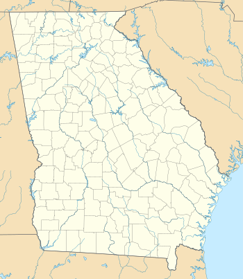
- 17-acre (69,000 m2) Black Rock Lake
- Turtle Rock Fishing Pier (wheelchair-accessible)
- Marie Mellinger Center
- Children's playground
Annual events
- Junior Fishing Rodeo (Saturday, May 5, 2012 tentative)
- Happy Birthday, America! (July, 2012 event date to be determined)
Tornado
On April 27, 2011, the park was directly hit by an EF-2 tornado spawned from the same supercell thunderstorm that had earlier in the evening tracked across central Alabama, heavily damaging Tuscaloosa. Thousands of trees were snapped or uprooted, and large parts of the park's camping areas and summit area were damaged. In the camping area, several cars and trucks were crushed by falling trees, however, no injuries were sustained. The park was re-opened to the public on May 6; however, large swaths of downed timber remain, especially on the mountain's westernmost flank above 3,200 feet. Most park trails were re-opened on May 13, with the exception of the Ada-hi Falls Trail. A large section of wooden steps was crushed by fallen trees and will have to be replaced before the trail is re-opened.
Gallery
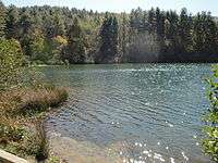
 Road on Black Rock Mountain
 Another view from Black Rock Mountain State Park
 Black Rock Overlook
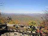 Tennessee Rock Overlook
References
- Molloy, Johnny (2007). The Best in Tent Camping: Georgia. Birmingham, AL: Menasga Ridge Press. ISBN 978-0-89732-724-4.
- Pfitzer, Donald W. (2006). Hiking Georgia (Third Edition). Helena, MT: Morris Book Publishing/Falcon. ISBN 0-7627-3642-9.
Notes
- ↑ "Normals Monthly Station Details". National Oceanic and Atmospheric Administration. Retrieved June 22, 2015.
- 1 2 Pfitzer (2006), p. 151
- ↑ Black Rock Mountain State Park Trail Map, published by the Georgia Department of Natural Resources (rev 02/2006)
External links
| Wikimedia Commons has media related to Black Rock Mountain State Park. |
- Georgia State Parks Website
- History of Georgia State Parks
- Ada Hi Falls Hiking Trail
- Tennessee Rock Hiking Trail
- James E. Edmonds
- Backcountry Hiking Trail