Blackburn, Oklahoma
| Blackburn, Oklahoma | |
|---|---|
| Town | |
|
Northern part of downtown Blackburn | |
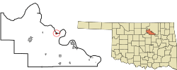 Location of Blackburn, Oklahoma | |
| Coordinates: 36°22′18″N 96°35′47″W / 36.37167°N 96.59639°WCoordinates: 36°22′18″N 96°35′47″W / 36.37167°N 96.59639°W | |
| Country | United States |
| State | Oklahoma |
| County | Pawnee |
| Area | |
| • Total | 0.3 sq mi (0.8 km2) |
| • Land | 0.3 sq mi (0.8 km2) |
| • Water | 0.0 sq mi (0.1 km2) |
| Elevation | 810 ft (247 m) |
| Population (2010) | |
| • Total | 108 |
| • Density | 360/sq mi (135/km2) |
| Time zone | Central (CST) (UTC-6) |
| • Summer (DST) | CDT (UTC-5) |
| FIPS code | 40-06450[1] |
| GNIS feature ID | 1090220[2] |

Blackburn is a town in Pawnee County, Oklahoma, United States. The population was 108 at the 2010 census, up 5.9 percent from 102 at the 2000 census.[3] It is 12 miles (19 km) east of the city of Pawnee.[4]
History
Located on the south side of the Arkansas River at a natural ford, the community of Blackburn developed after the opening of the Cherokee Outlet on September 16, 1893. It was named for Kentucky Senator Joseph C. S. Blackburn. A post office was established December 15, 1893. Because it was located in Oklahoma Territory, Blackburn was a "whiskey town" that bordered Indian Territory until statehood in 1907. The town was incorporated April 21, 1909.[4]
Geography
Blackburn is located at 36°22′18″N 96°35′47″W / 36.37167°N 96.59639°W (36.371655, −96.596497).[5] According to the United States Census Bureau, the town has a total area of 0.3 square miles (0.78 km2), of which, 0.3 square miles (0.78 km2) of it is land and 0.04 square miles (0.10 km2) of it (6.25%) is water.
Demographics
| Historical population | |||
|---|---|---|---|
| Census | Pop. | %± | |
| 1910 | 335 | — | |
| 1920 | 257 | −23.3% | |
| 1930 | 219 | −14.8% | |
| 1940 | 198 | −9.6% | |
| 1950 | 135 | −31.8% | |
| 1960 | 129 | −4.4% | |
| 1970 | 88 | −31.8% | |
| 1980 | 114 | 29.5% | |
| 1990 | 110 | −3.5% | |
| 2000 | 102 | −7.3% | |
| 2010 | 108 | 5.9% | |
| Est. 2015 | 108 | [6] | 0.0% |
As of the census[1] of 2000, there were 102 people, 41 households, and 25 families residing in the town. The population density was 342.2 people per square mile (131.3/km²). There were 59 housing units at an average density of 197.9 per square mile (75.9/km²). The racial makeup of the town was 88.24% White, 8.82% Native American, and 2.94% from two or more races.
There were 41 households out of which 29.3% had children under the age of 18 living with them, 58.5% were married couples living together, and 39.0% were non-families. 39.0% of all households were made up of individuals and 24.4% had someone living alone who was 65 years of age or older. The average household size was 2.49 and the average family size was 3.44.
In the town the population was spread out with 28.4% under the age of 18, 6.9% from 18 to 24, 26.5% from 25 to 44, 20.6% from 45 to 64, and 17.6% who were 65 years of age or older. The median age was 33 years. For every 100 females there were 85.5 males. For every 100 females age 18 and over, there were 97.3 males.
The median income for a household in the town was $12,000, and the median income for a family was $30,625. Males had a median income of $28,750 versus $5,000 for females. The per capita income for the town was $8,668. There were 28.6% of families and 34.7% of the population living below the poverty line, including 40.9% of under eighteens and 38.5% of those over 64.
References
- 1 2 "American FactFinder". United States Census Bureau. Archived from the original on 2013-09-11. Retrieved 2008-01-31.
- ↑ "US Board on Geographic Names". United States Geological Survey. 2007-10-25. Retrieved 2008-01-31.
- ↑ CensusViewer:Population of the City of Blackburn, Oklahoma
- 1 2 Wilson, Linda D. Encyclopedia of Oklahoma History and Culture. "Blackburn.""Archived copy". Archived from the original on 2009-01-05. Retrieved 2009-08-30.
- ↑ "US Gazetteer files: 2010, 2000, and 1990". United States Census Bureau. 2011-02-12. Retrieved 2011-04-23.
- ↑ "Annual Estimates of the Resident Population for Incorporated Places: April 1, 2010 to July 1, 2015". Retrieved July 2, 2016.
- ↑ "Census of Population and Housing". Census.gov. Archived from the original on May 11, 2015. Retrieved June 4, 2015.
External links
Municipalities and communities of Pawnee County, Oklahoma, United States | ||
|---|---|---|
| Cities | 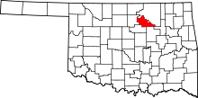 | |
| Towns | ||
| Unincorporated communities |
| |
| Footnotes | ‡This populated place also has portions in an adjacent county or counties | |