Blacksburg, South Carolina
| Blacksburg | |
|---|---|
| Town | |
|
Shelby Street in Uptown Blacksburg | |
| Nickname(s): Iron City | |
| Motto: Beginning the New Beginning | |
 Location of Blacksburg | |
| Coordinates: 35°7′14″N 81°30′59″W / 35.12056°N 81.51639°WCoordinates: 35°7′14″N 81°30′59″W / 35.12056°N 81.51639°W | |
| Country | United States |
| State | South Carolina |
| County | Cherokee |
| Incorporated | 1888 |
| Government | |
| • Mayor | David Hogue |
| Area | |
| • Town | 1.87 sq mi (4.85 km2) |
| • Land | 1.87 sq mi (4.85 km2) |
| • Water | 0.0 sq mi (0.0 km2) |
| Elevation | 774 ft (236 m) |
| Population (2010) | |
| • Town | 1,848 |
| • Density | 987/sq mi (381.2/km2) |
| • Metro | 9,655 |
| Time zone | Eastern (UTC5) |
| • Summer (DST) | EDT (UTC-4) |
| ZIP code | 29702 |
| Area code(s) | 864 |
| FIPS code | 45-06400[1] |
| GNIS feature ID | 1246907[2] |
| Website |
www |

Blacksburg is a small town in Cherokee County, South Carolina, United States. The population was 1,848 at the 2010 census.[3] The communities of Cherokee Falls, Kings Creek, Cashion Crossroads, Buffalo, and Mount Paran are located near the town.
Blacksburg is in Upstate South Carolina on the Interstate 85 corridor about 45 mi (72 km) southwest of Charlotte, North Carolina. It is part of the Greenville-Spartanburg-Anderson Combined Statistical Area (CSA) which has a population of 1,173,433 according to 2004 estimates by the U.S. Census Bureau.
History
Located near the northern border of the state, the present-day site of Blacksburg was first settled by a man named Stark. Mr. Stark, who had lived in Charleston, South Carolina prior to moving to the area, had gotten several people to come along with him on an agriculture venture, but this venture would fail. Those who stayed behind named the area "Stark's Folly".
In the late 19th century the Black family, headed by John G. Black, a Confederate veteran, was living in the area and persuaded the C.C. & C. Railroad Company to lay track through the town and build a depot. The town soon became known as "Black's Station" in honor of John G. Black and was renamed "Blacksburg" in 1888.
Major John F. Jones of Massachusetts came to live in Blacksburg when hired as superintendent of the C. C. & C. Railroad. He donated his own money to build a school, hotel (the Cherokee Inn), and several other buildings in Blacksburg. He lived in Blacksburg until 1922, when he was appointed the South Carolina Internal Revenue Collector by the President of the United States.
In the 1890s large amounts of iron ore were found in the area, and many people hoping to make a fortune from mining it flocked to the town. Blacksburg became a boom town, and hotels and saloons were built for the new visitors. The town went by the name "Iron City" for a short time. Because of the "iron rush" the town became quite wealthy. It installed the first electric street lights in Upstate South Carolina and perhaps in the entire state.[4][5] The city was incorporated in 1888 as "Blacksburg" but still holds the nickname of "Iron City".
The Kings Mountain State Park Historic District was listed on the National Register of Historic Places in 2008.[6]
Geography
Blacksburg is located in northeastern Cherokee County at 35°7′14″N 81°30′59″W / 35.12056°N 81.51639°W (35.120676, -81.516291).[7] It is 4 miles (6 km) south of the North Carolina border.
According to the United States Census Bureau, the town has a total area of 1.87 square miles (4.85 km2), all of it land.[3]
Whitaker Mountain is partially in the northern corner of the town, with a summit elevation outside the town limits of around 1,169 ft (356 m).
Major transportation routes
-
.svg.png) Interstate 85 runs northwest of the town, with access from Exits 100 and 102. There is a South Carolina Welcome Center at milemarker 103.
Interstate 85 runs northwest of the town, with access from Exits 100 and 102. There is a South Carolina Welcome Center at milemarker 103. -
 US 29 is a two-lane highway that runs through the downtown area and serves as the main street (Cherokee Street). It leads southwest 8 miles (13 km) to downtown Gaffney and northeast 6 miles (10 km) to Grover, North Carolina.
 -
 South Carolina Highway 5 is a four-lane road that passes east of the town center. SC 5 North ends at the south end of the bridge over I-85 at exit 102, 2 miles (3 km) north of the center of town. SC 5 South leads southeast 19 miles (31 km) to York and 34 miles (55 km) to Rock Hill.
 -
 South Carolina Highway 198 is a four-lane road that begins at the north end of the bridge over I-85 at exit 102 and leads north 14 miles (23 km) to Shelby, North Carolina.
Government
- Mayor: David Hogue
- Town Council members:
- Dennis Stroupe (District 1)
- Mike Patterson (District 2)
- Darren Janesky (District 3)
- S. L.Ford (District 4)
- Town Administrator: Charlene Carter
Other information
- The Ed Brown Championship Rodeo attracts an estimated 22,000 people to the town on the first Friday and Saturday of August each year. In the past, the town had "Rodeo Days" Festival with several events including, a parade, car show, and street dance. The rodeo, started in 1968, features bareback riding, saddle bronc riding, calf roping, steer wrestling, ladies barrel racing, bull riding and other events.
- The Blacksburg High School Marching Band has won the Class A state championship four times in the 21st century: 2002, 2003, 2004, and 2005.
- The Blacksburg High School football team won the state football championship in 1976
- Historic Downtown Blacksburg is home to the Upstate's first Contemporary Dance and Theatre training school, Carolina Modern Arts Collective (CMAC).
Nearby attractions
- Kings Mountain National Military Park and State Park, commemorating a battle of the Revolutionary War, are located about 8 miles (13 km) northeast of the town.
- The famous Peachoid, a 1,000,000 US gal (3,800,000 l; 830,000 imp gal) water tank shaped like a peach, is located 10 miles (16 km) west of the town, in Gaffney.
Annual events
- Iron City Ministries, a non-profit organization which helps people in Cherokee County with needs such as food and clothing, holds an annual fund raising event.
- The Iron City Festival was held for the first time in 2006. The festival commemorates the founding of the town and is sponsored by the Blacksburg Business Association, Inc. Iron City Festival is held the third weekend in April.
- The anniversary of the Battle of Kings Mountain is held annually on October 7-8th at the Kings Mountain National Military Park and honors those who fell at the Battle of Kings Mountain during the Revolutionary War.
Local media
- The Cherokee Chronicle, a newspaper serving Cherokee County, is published Tuesdays and Thursdays.
- The Gaffney Ledger, a newspaper of the city of Gaffney located 10 mi (16 km) southwest of Blacksburg, is published Monday, Wednesday, and Friday.
Schools
There are four public schools: Blacksburg Primary School, Blacksburg Elementary School, Blacksburg Middle School, and Blacksburg High School.
Demographics
| Historical population | |||
|---|---|---|---|
| Census | Pop. | %± | |
| 1880 | 145 | — | |
| 1890 | 1,245 | 758.6% | |
| 1900 | 1,285 | 3.2% | |
| 1910 | 1,110 | −13.6% | |
| 1920 | 1,512 | 36.2% | |
| 1930 | 1,747 | 15.5% | |
| 1940 | 1,917 | 9.7% | |
| 1950 | 2,056 | 7.3% | |
| 1960 | 2,174 | 5.7% | |
| 1970 | 1,977 | −9.1% | |
| 1980 | 1,873 | −5.3% | |
| 1990 | 1,907 | 1.8% | |
| 2000 | 1,880 | −1.4% | |
| 2010 | 1,848 | −1.7% | |
| Est. 2015 | 1,883 | [8] | 1.9% |
As of the census[1] of 2000, there were 1,880 people, 785 households, and 503 families residing in the town. The population density was 1,018.8 people per square mile (392.4/km²). There were 911 housing units at an average density of 493.7 per square mile (190.1/km²). The racial makeup of the town was 74.52% White, 23.56% African American, 0.21% Native American, 0.11% Asian, 0.05% Pacific Islander, and 1.54% from two or more races. Hispanic or Latino of any race were 0.53% of the population.
There were 785 households out of which 31.0% had children under the age of 18 living with them, 40.3% were married couples living together, 19.5% had a female householder with no husband present, and 35.8% were non-families. 32.6% of all households were made up of individuals and 16.3% had someone living alone who was 65 years of age or older. The average household size was 2.39 and the average family size was 3.04.
In the town the population was spread out with 28.2% under the age of 18, 7.8% from 18 to 24, 27.9% from 25 to 44, 21.8% from 45 to 64, and 14.3% who were 65 years of age or older. The median age was 34 years. For every 100 females there were 80.2 males. For every 100 females age 18 and over, there were 76.6 males.
The median income for a household in the town was $26,453, and the median income for a family was $35,208. Males had a median income of $27,384 versus $21,207 for females. The per capita income for the town was $16,833. About 13.7% of families and 17.4% of the population were below the poverty line, including 20.3% of those under age 18 and 29.4% of those age 65 or over.
Notable people
- James Rhyne Killian (1904–1988), 10th president of the Massachusetts Institute of Technology, from 1948 until 1959
- Mikki Moore, professional basketball player, graduated from Blacksburg High School in 1993
- Jason Gilfillan, professional baseball player, graduated from Blacksburg High School in 1994
- Judy Rose, director of athletics at UNC Charlotte
References
- 1 2 "American FactFinder". United States Census Bureau. Archived from the original on 2013-09-11. Retrieved 2008-01-31.
- ↑ "US Board on Geographic Names". United States Geological Survey. 2007-10-25. Retrieved 2008-01-31.
- 1 2 "Geographic Identifiers: 2010 Census Summary File 1 (G001): Blacksburg town, South Carolina". U.S. Census Bureau, American Factfinder. Retrieved June 30, 2015.
- ↑ SCIway.net. http://www.sciway.net/ccr/sc-city-nicknames.html
- ↑ Discoversouthcarolina.com. "Archived copy". Archived from the original on 2008-11-13. Retrieved 2008-08-10.
- ↑ National Park Service (2010-07-09). "National Register Information System". National Register of Historic Places. National Park Service.
- ↑ "US Gazetteer files: 2010, 2000, and 1990". United States Census Bureau. 2011-02-12. Retrieved 2011-04-23.
- ↑ "Annual Estimates of the Resident Population for Incorporated Places: April 1, 2010 to July 1, 2015". Retrieved July 2, 2016.
- ↑ "Census of Population and Housing". Census.gov. Archived from the original on May 11, 2015. Retrieved June 4, 2015.
External links
Municipalities and communities of Cherokee County, South Carolina, United States | ||
|---|---|---|
| Cities | 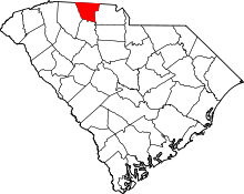 | |
| Towns | ||
| CDP | ||
| Unincorporated communities | ||
| Ghost town | ||
| Footnotes | ‡This populated place also has portions in an adjacent county or counties | |