Smyrna, South Carolina
| Smyrna, South Carolina | |
|---|---|
| Town | |
 | |
 Location of Smyrna, South Carolina | |
| Coordinates: 35°2′48″N 81°24′47″W / 35.04667°N 81.41306°WCoordinates: 35°2′48″N 81°24′47″W / 35.04667°N 81.41306°W | |
| Country | United States |
| State | South Carolina |
| Counties | York, Cherokee |
| Area | |
| • Total | 0.71 sq mi (1.83 km2) |
| • Land | 0.71 sq mi (1.83 km2) |
| • Water | 0.0 sq mi (0.0 km2) |
| Elevation | 761 ft (232 m) |
| Population (2010) | |
| • Total | 45 |
| • Density | 64/sq mi (24.6/km2) |
| Time zone | Eastern (EST) (UTC-5) |
| • Summer (DST) | EDT (UTC-4) |
| ZIP code | 29743 |
| Area code(s) | 803 |
| FIPS code | 45-67210[1] |
| GNIS feature ID | 1231809[2] |
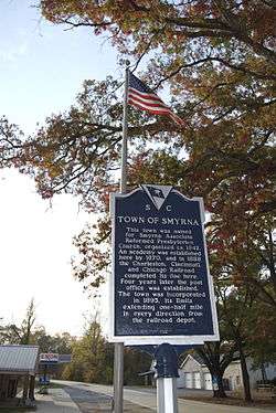
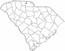
Smyrna is a small town in York and Cherokee counties in the U.S. state of South Carolina. The population was 45 at the 2010 United States Census,[3] making Smyrna the smallest town in South Carolina.[4]
History
The Jackson's Furnace Site (38YK217) was listed on the National Register of Historic Places in 1987.[5]
Geography and climate
Smyrna is located in western York County at 35°2′48″N 81°24′47″W / 35.04667°N 81.41306°W (35.046664, -81.413191).[6] A small portion extends northwest into Cherokee County.
According to the United States Census Bureau, the town has a total area of 0.69 square miles (1.8 km2), all land.[3]
Demographics
| Historical population | |||
|---|---|---|---|
| Census | Pop. | %± | |
| 1900 | 48 | — | |
| 1910 | 109 | 127.1% | |
| 1920 | 101 | −7.3% | |
| 1930 | 117 | 15.8% | |
| 1940 | 133 | 13.7% | |
| 1950 | 105 | −21.1% | |
| 1960 | 52 | −50.5% | |
| 1970 | 85 | 63.5% | |
| 1980 | 47 | −44.7% | |
| 1990 | 57 | 21.3% | |
| 2000 | 59 | 3.5% | |
| 2010 | 45 | −23.7% | |
| Est. 2015 | 46 | [7] | 2.2% |
As of the census[9] of 2010, there were 45 people, 22 households, and 14 families residing in the city. The population density was 67.2 per square mile. There were 29 housing units at an average density of 43.3 per square mile. The racial makeup of the city was 100.0% White, 0.0% African American, 0.0% Native American, 0.0% Asian, 0.0% from other races, and 0.0% from two or more races. Hispanic or Latino of any race were 0.0% of the population.
There were 22 households of which 18.2% had children under the age of 18 living with them, 40.9% were married couples living together, 9.1% had a female householder with no husband present, 13.6% had a male householder with no wife present, and 36.4% were non-families. 31.8% of all households were made up of individuals and 31.8% had someone living alone who was 65 years of age or older. The average household size was 2.05 and the average family size was 2.50.
The median age in the city was 48.5 years. 13.3% of residents were under the age of 18; 11.1% were between the ages of 18 and 24; 20.0% were from 25 to 44; 35.6% were from 45 to 64; and 20.0% were 65 years of age or older. The gender makeup of the city was 48.9% male and 51.1% female.
As of the 2008-2012 American Community Survey [9] the median income for a household in the city was $32,813, and the median income for a family was $33,438. The per capita income for the city was $16,621.

As of the census[1] of 2000, there were 59 people, 22 households, and 17 families residing in the town. The population density was 83.6 people per square mile (32.1/km²). There were 26 housing units at an average density of 36.8 per square mile (14.1/km²). The racial makeup of the town was 91.53% White and 8.47% African American.
There were 22 households out of which 40.9% had children under the age of 18 living with them, 72.7% were married couples living together, 4.5% had a female householder with no husband present, and 22.7% were non-families. 18.2% of all households were made up of individuals and 4.5% had someone living alone who was 65 years of age or older. The average household size was 2.68 and the average family size was 3.12.
In the town the population was spread out with 28.8% under the age of 18, 6.8% from 18 to 24, 28.8% from 25 to 44, 18.6% from 45 to 64, and 16.9% who were 65 years of age or older. The median age was 35 years. For every 100 females there were 84.4 males. For every 100 females age 18 and over, there were 75.0 males.
The median income for a household in the town was $32,500, and the median income for a family was $36,667. Males had a median income of $35,000 versus $46,250 for females. The per capita income for the town was $20,575. None of the population or the families were below the poverty line.
History
Incorporated in 1895, the town of Smyrna took its name from the Smyrna Associate Reformed Presbyterian Church that had been providing a place of worship to the local residents for fifty years.[10] A railroad depot was built in 1888 by the Charleston, Cincinnati and Chicago Railroad, a forerunner to the Southern Railway, and then F.D. Horn built a mercantile business nearby.
References
- 1 2 "American FactFinder". United States Census Bureau. Retrieved 2008-01-31.
- ↑ "US Board on Geographic Names". United States Geological Survey. 2007-10-25. Retrieved 2008-01-31.
- 1 2 "Geographic Identifiers: 2010 Census Summary File 1 (G001): Smyrna town, South Carolina". U.S. Census Bureau, American Factfinder. Retrieved June 30, 2015.
- ↑ "Geographic Identifiers: 2010 Census Summary File 1 (G001): All places within South Carolina". U.S. Census Bureau, American Factfinder. Retrieved June 30, 2015.
- ↑ National Park Service (2010-07-09). "National Register Information System". National Register of Historic Places. National Park Service.
- ↑ "US Gazetteer files: 2010, 2000, and 1990". United States Census Bureau. 2011-02-12. Retrieved 2011-04-23.
- ↑ "Annual Estimates of the Resident Population for Incorporated Places: April 1, 2010 to July 1, 2015". Retrieved June 25, 2016.
- ↑ "Census of Population and Housing". Census.gov. Retrieved June 4, 2015.
- 1 2 "American FactFinder". United States Census Bureau. Retrieved 2014-02-19.
- ↑ York County Regional Chamber Archived September 17, 2007, at the Wayback Machine.
Municipalities and communities of Cherokee County, South Carolina, United States | ||
|---|---|---|
| Cities | 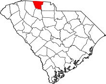 | |
| Towns | ||
| CDP | ||
| Unincorporated communities | ||
| Ghost town | ||
| Footnotes | ‡This populated place also has portions in an adjacent county or counties | |
Municipalities and communities of York County, South Carolina, United States | ||
|---|---|---|
| Cities | 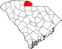 | |
| Towns | ||
| CDPs | ||
| Other unincorporated communities | ||
| Footnotes | ‡This populated place also has portions in an adjacent county or counties | |