Blankenfelde
| Blankenfelde | |
|---|---|
| Quarter of Berlin | |
|
Village church | |
 Blankenfelde | |
Location of Blankenfelde in Pankow and Berlin | |
| Coordinates: 52°37′07″N 13°23′24″E / 52.61861°N 13.39000°ECoordinates: 52°37′07″N 13°23′24″E / 52.61861°N 13.39000°E | |
| Country | Germany |
| State | Berlin |
| City | Berlin |
| Borough | Pankow |
| Founded | 1375 |
| Area | |
| • Total | 13.4 km2 (5.2 sq mi) |
| Population (2008-06-30) | |
| • Total | 1,917 |
| • Density | 140/km2 (370/sq mi) |
| Time zone | CET/CEST (UTC+1/+2) |
| Postal codes | (nr. 0308) 13159 |
| Vehicle registration | B |
Blankenfelde is a locality (Ortsteil) located within the Berlin bourugh (Bezirk) of Pankow. Of the city's 95 localities, it is the least densely populated.[1]
History
Blankenfelde was founded around 1375 and was integrated into Berlin in 1920 via the "Greater Berlin Act". After World War II, it was part of East Berlin from 1949 to 1990. From 1961 to 1989, its western borders were part of the Berlin Wall.[2]
Geography
Overview
Located in the northern outskirts of the city, Blankenfelde borders on the Brandenburg municipalities of Mühlenbecker Land in the Oberhavel district and Wandlitz in the district of Barnim. Within Berlin, its neighboring localities are Buch, Französisch Buchholz, and Rosenthal in the borough of Pankow and Lübars in the Reinickendorf borough. Blankenfelde's largest lake is the Badesee Arkenberge, located in a rural part of the Barnim Nature Park.[3]
Subdivision
Blankenfelde is divided into 2 zones (Ortslagen):
- Arkenberge
- Stadtrandsiedlung Blankenfelde
Transport
Though crossed by the S-Bahn line S8, it has no direct access to the railway. Formerly, it was served by the now defunct branch of a local suburban line, the Heidekrautbahn, to which an abandoned station bears witness. Plans to re-activate the former line as part of the Berlin public transport system have been hypothesized but not yet finalized. Bus line 107 serves the area.
Photogallery
-
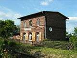
The former Berlin-Blankenfelde station
-
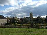
Northern view of Blankenfelde
References
- ↑ (German) Boroughs, Localities, and Statistical Tracts from Berlin's Statistical Office
- ↑ (German) Historical data about Blankenfelde in DDR (page 226)
- ↑ Infos on the NPB official website. Click on "Naturpark", then click on "Region"
External links
![]() Media related to Blankenfelde at Wikimedia Commons
Media related to Blankenfelde at Wikimedia Commons
| |