Blendon, London
| Blendon | |
 Blendon |
|
| Population | 10,910 (2011 Census. Blendon and Penhill Ward)[1] |
|---|---|
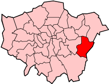
| London borough | Bexley |
| Ceremonial county | Greater London |
| Region | London |
| Country | England |
| Sovereign state | United Kingdom |
| Post town | LONDON |
| Postcode district | DA5 |
| Dialling code | 020 |
| Police | Metropolitan |
| Fire | London |
| Ambulance | London |
| EU Parliament | London |
| London Assembly | Bexley and Bromley |
Coordinates: 51°26′49″N 0°07′25″E / 51.447053°N 0.123575°E
Blendon is an area of South East London within the London Borough of Bexley, located between Bexleyheath and Sidcup.
It is probably named after the Bladindon family who owned land in the area.[2] Blendon Hall was built in 1763, but was sold to a local housing developer in 1929 and eventually demolished to make way for suburban housing.[3] Today the area is a middle-class residential district with a small row of shops along the western stretch of Blendon Road.
Transport
Blendon is served by several Transport for London bus services.
- 132 to Bexleyheath and to North Greenwich Via Eltham
- B13 to Bexleyheath and to New Eltham
- B14 to Bexleyheath and to Orpington Via Sidcup
The cloest National Rail Station is Albany Park Station.
- ↑ "Bexley Ward population 2011". Neighbourhood Statistics. Office for National Statistics. Retrieved 14 October 2016.
- ↑ Willey, Russ. Chambers London Gazetter, p 48.
- ↑ Willey, Russ. Chambers London Gazetter, p 48.
| Districts |
|  |
|---|---|---|
| Attractions |
| |
| Parks and open spaces |
| |
| Constituencies | ||
| Rail stations | ||
| Other topics | ||
This article is issued from Wikipedia - version of the 10/14/2016. The text is available under the Creative Commons Attribution/Share Alike but additional terms may apply for the media files.