Longlands
| Longlands | |
 Longlands |
|
| Population | 10,442 (2011 Census. Ward)[1] |
|---|---|
| OS grid reference | TQ449722 |
| London borough | Bexley |
| Bromley | |
| Greenwich | |
| Ceremonial county | Greater London |
| Region | London |
| Country | England |
| Sovereign state | United Kingdom |
| Post town | SIDCUP |
| Postcode district | DA14, DA15 |
| Post town | LONDON |
| Postcode district | SE9 |
| Post town | CHISLEHURST |
| Postcode district | BR7 |
| Dialling code | 020 |
| Police | Metropolitan |
| Fire | London |
| Ambulance | London |
| EU Parliament | London |
| UK Parliament | Old Bexley and Sidcup |
| Eltham | |
| Bromley and Chislehurst | |
| London Assembly | Bexley and Bromley |
| Bexley and Bromley | |
| Greenwich and Lewisham | |
Coordinates: 51°25′49″N 0°05′07″E / 51.4302°N 0.0854°E

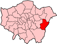
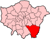
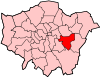
Longlands is an area of South East London within the London Boroughs of Bexley, Bromley and Greenwich. It lies north west of Sidcup
Some old maps and records have the name as two words "Long Lands", and show it was in the Foots Cray/Sidcup parish[2] in the Hundred of Ruxley.[3]
Found within Longlands
On Main Road there are a small number of shops including a Peugeot show room, an off license/convenience store, a fish and chip shop, a restaurant, a launderette and a small post office. Shops here seem to be somewhat over shadowed by nearby larger towns, New Eltham and especially Sidcup. Within Longlands the place gives it name to Longlands Recreation Ground, Longlands Primary School, Longlands Road and Longlands Park Crescent. Also things found within the ward of Longlands include Queen Mary's Hospital, Frognal Corner Roundabout, Sidcup Fire Station, Sidcup Place, two primary schools, Longlands primary school and Dulverton Primary School, one secondary school, St Mary and St Joseph's Catholic School, and a small college. These are all part of the Sidcup post town, with the exception of Dulverton Primary School which occupies the small westerly part of the ward that overlaps into the SE9postcode district, that is within the London post town.The small river Wyncham Stream also flows from Chislehurst northward through Longlands toward Lamorbey and finally into the River Shuttle.
Transport
Longlands is served by two Transport for London bus services, the 233 connecting the area with Eltham via New Eltham and to Swanley via Sidcup, as well as the 321 to New Cross Gate via Eltham and Lewisham and to Foots Cray via Sidcup. The closest rail links to Longlands are Sidcup station and New Eltham station.
Roads
Two A roads pass through Longlands, the A20 "Sidcup By-Pass Road", a dual carriageway, which runs from New Cross until it joins the M20 at Swanley in Kent, and the A211 called "Foots Cray Road" and "Main Road". They both run from northwest to southeast, the A20 being the southern most; on both these roads Longlands sits between New Eltham and Sidcup. An odd fact about the area is these A roads begin some distance apart, come closer together, they then run parallel for a short length at Longlands but move apart again without ever directly meeting; This makes the area recognizable on a map. A large concrete wall stands here separating the roads as they run parallel, stopping the faster traffic of Sidcup By Pass from swerving onto Main Road and possibly hitting on coming traffic. This wall is on the only bend of a relatively straight by-pass, and there have been several accidents involving cars crashing into this wall, that could have otherwise hit on coming traffic. around 2002 railings were put on the by-pass to prevent pedestrians attempting to cross the road, at least where the concrete wall is.
References
- ↑ "Bexley Ward population 2011". Neighbourhood Statistics. Office for National Statistics. Retrieved 14 October 2016.
- ↑ Map of Sidcup parish from Vision of Britain.org.uk
- ↑ Old map showing Long Lands (bottom right) in the Hundred of Ruxley. From British History Online
External links
- Longlands Ward on Bexley council website
- Map of Longlands Ward on Bexley council website. (Ordnance Survey map ©Crown 2006)
| Districts |
|  |
|---|---|---|
| Attractions |
| |
| Parks and open spaces |
| |
| Constituencies | ||
| Rail stations | ||
| Other topics | ||